Grange Park Community Centre
Grange Park Community Centre is located in Grange Park, Northampton (NN4), and offers Artificial Grass Pitch.
| Address | School Lane, Grange Park, Northampton, NN4 5FZ |
| Car Park | Yes |
| Car Park Capacity | 10 |
| Management Type | Local Authority (in house) |
| Management Group | Local Authority |
| Owner Type | Local Authority |
| Owner Group | Local Authority |
| Education Phase | Not applicable |
Facilities
| Accessibility | Pay and Play |
| Management Type | Local Authority (in house) |
| Year Built | 2003 |
| Changing Rooms | Yes |
| Date Record Checked | 26th May 2023 |
Opening times
| Access description | Pay and Play |
|---|
| Opening time | 18:00 |
| Closing time | 23:59 |
| Period open for | Monday-Friday |
| |
| Access description | Private Use |
|---|
| Opening time | 09:00 |
| Closing time | 18:00 |
| Period open for | Monday-Friday |
| |
| Access description | Pay and Play |
|---|
| Opening time | 09:00 |
| Closing time | 23:59 |
| Period open for | Weekend |
Facility specifics
| Area | 660m² |
| Floodlit | Yes |
| Indoor | No |
| Length | 20m |
| Width | 33m |
| WR22 Compliant Pitch | No |
Disabled access
| Disabled Access | Yes |
| Disabled Parking | Yes |
| Finding/Reaching Entrance | Yes |
| Reception Area | Yes |
| Doorways | Yes |
| Disabled Changing Facilities | Yes |
| Activity Areas | Yes |
| Disabled Toilets | Yes |
| Emergency Exits | Yes |
Contact
Disabled access
Disabled access for Grange Park Community Centre
| Disabled Access | Yes |
| Disabled Parking | Yes |
| Finding/Reaching Entrance | Yes |
| Reception Area | Yes |
| Doorways | Yes |
| Disabled Changing Facilities | Yes |
| Activity Areas | Yes |
| Disabled Toilets | Yes |
| Emergency Exits | Yes |
Where is Grange Park Community Centre?
| Sub Building Name | |
| Building Name | |
| Building Number | 0 |
| Dependent Thoroughfare | |
| Thoroughfare Name | SCHOOL LANE |
| Double Dependent Locality | |
| Dependent Locality | GRANGE PARK |
| PostTown | NORTHAMPTON |
| Postcode | NN4 5FZ |
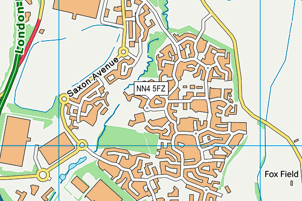
Grange Park Community Centre on a map

Grange Park Community Centre geodata
| Easting | 476414 |
| Northing | 255202 |
| Latitude | 52.189776 |
| Longitude | -0.883613 |
| Local Authority Name | West Northamptonshire |
| Local Authority Code | E06000062 |
| Parliamentary Constituency Name | South Northamptonshire |
| Parliamentary Constituency Code | E14000942 |
| Region Name | East Midlands |
| Region Code | E15000004 |
| Ward Name | Hackleton and Grange Park |
| Ward Code | E05013255 |
| Output Area Code | E00169298 |
About this data
This data is open data sourced from Active Places Power and licenced under the Active Places Open Data Licence.
| toid | osgb1000002113145133 |
| Created On | 22nd Nov 2011 |
| Audited On | 26th May 2023 |
| Checked On | 26th May 2023 |
