Glynde Recreation Ground
Glynde Recreation Ground is located in Glynde, Lewes (BN8), and offers Grass Pitches, and Swimming Pool.
| Address | GLYNDE CRICKET CLUB, Ranscombe Lane, Glynde, Lewes, BN8 6RS |
| Car Park | Yes |
| Car Park Capacity | 20 |
| Management Type | Local Authority (in house) |
| Management Group | Local Authority |
| Owner Type | Other |
| Owner Group | Others |
| Education Phase | Not applicable |
Facilities
| Status Notes | 2 grass pitch
Site has one grass pitch which includes an artificial practice wicket
|
| Accessibility | Sports Club / Community Association |
| Management Type | Local Authority (in house) |
| Changing Rooms | Yes |
| Date Record Checked | 12th Dec 2022 |
| Opening Times | Dawn To Dusk |
Facility specifics
Disabled access
| Disabled Access | Yes |
| Finding/Reaching Entrance | Yes |
| Activity Areas | Yes |
| Emergency Exits | Yes |
| Status Notes | Open from May till September.
http://glynde.info/attractions/swimming/membership.php, available for village member use only, not open to the general public. |
| Accessibility | Registered Membership use |
| Management Type | Local Authority (in house) |
| Year Built | 1937 |
| Year Refurbished | 2006 |
| Changing Rooms | Yes |
| Date Record Checked | 12th Dec 2022 |
| Opening Times | Dawn To Dusk |
Facility specifics
| Access to Pool Hoist | No |
| Area | 126m² |
| Diving Boards | No |
| Length | 18m |
| Maximum Depth | 1.8m |
| Minimum Depth | 1.2m |
| Movable Floor | No |
| Width | 7m |
Disabled access
| Disabled Access | Yes |
| Finding/Reaching Entrance | Yes |
| Activity Areas | Yes |
| Emergency Exits | Yes |
Contact
Disabled access
Disabled access for Glynde Recreation Ground
| Disabled Access | Yes |
| Finding/Reaching Entrance | Yes |
| Activity Areas | Yes |
| Emergency Exits | Yes |
Where is Glynde Recreation Ground?
| Sub Building Name | |
| Building Name | GLYNDE CRICKET CLUB |
| Building Number | 0 |
| Dependent Thoroughfare | |
| Thoroughfare Name | RANSCOMBE LANE |
| Double Dependent Locality | |
| Dependent Locality | GLYNDE |
| PostTown | LEWES |
| Postcode | BN8 6RS |
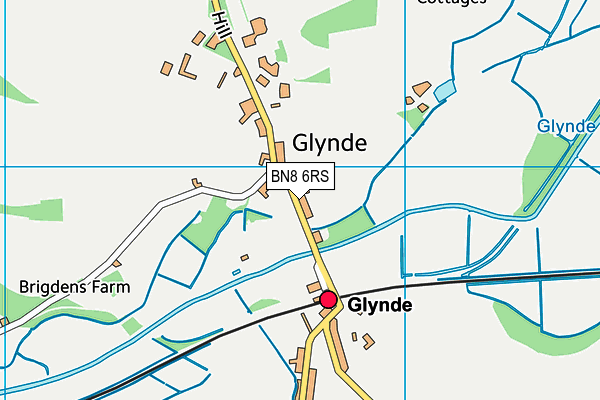
Glynde Recreation Ground on a map

Glynde Recreation Ground geodata
| Easting | 545597.88 |
| Northing | 108771.8 |
| Latitude | 50.860134 |
| Longitude | 0.06739 |
| Local Authority Name | Lewes |
| Local Authority Code | E07000063 |
| Parliamentary Constituency Name | Lewes |
| Parliamentary Constituency Code | E14000786 |
| Region Name | South East |
| Region Code | E15000008 |
| Ward Name | Ouse Valley & Ringmer |
| Ward Code | E05011593 |
| Output Area Code | E00106927 |
About this data
This data is open data sourced from Active Places Power and licenced under the Active Places Open Data Licence.
| Created On | 5th Jun 2009 |
| Audited On | 12th Dec 2022 |
| Checked On | 12th Dec 2022 |
