Gainsborough Playing Fields - London
Gainsborough Playing Fields is located in London (E15), and offers Artificial Grass Pitch.
| Address | GAINSBOROUGH PLAYING FIELDS, East Bay Lane, London, E15 2GW |
| Management Type | Trust |
| Management Group | Trust |
| Owner Type | Local Authority |
| Owner Group | Local Authority |
| Education Phase | Not applicable |
Facilities
| Status Notes | 5v5
Utilised by Gainsborough School and Mossbourne Riverside Academy during school hours. Outside of school hours it is managed by GLL. |
| Accessibility | Pay and Play |
| Management Type | Trust |
| Year Built | 2014 |
| Changing Rooms | Yes |
| Date Record Created | 28th Dec 2018 |
| Date Record Checked | 27th Jun 2023 |
Opening times
| Access description | Pay and Play |
|---|
| Opening time | 09:00 |
| Closing time | 17:00 |
| Period open for | Weekend |
| |
| Access description | Pay and Play |
|---|
| Opening time | 17:00 |
| Closing time | 22:00 |
| Period open for | Monday-Friday |
Facility specifics
| Area | 648m² |
| Fill | Yes - Rubber |
| Floodlit | Yes |
| Indoor | No |
| Length | 36m |
| Pile Length | 30mm |
| Width | 18m |
| WR22 Compliant Pitch | No |
Disabled access
| Disabled Access | Yes |
| Finding/Reaching Entrance | Yes |
| Disabled Changing Facilities | Yes |
| Activity Areas | Yes |
| Disabled Toilets | Yes |
| Spectator Areas | Yes |
Contact
Disabled access
Disabled access for Gainsborough Playing Fields
| Disabled Access | Yes |
| Finding/Reaching Entrance | Yes |
| Disabled Changing Facilities | Yes |
| Activity Areas | Yes |
| Disabled Toilets | Yes |
| Spectator Areas | Yes |
Where is Gainsborough Playing Fields?
| Sub Building Name | |
| Building Name | GAINSBOROUGH PLAYING FIELDS |
| Building Number | 0 |
| Dependent Thoroughfare | |
| Thoroughfare Name | EAST BAY LANE |
| Double Dependent Locality | |
| Dependent Locality | |
| PostTown | LONDON |
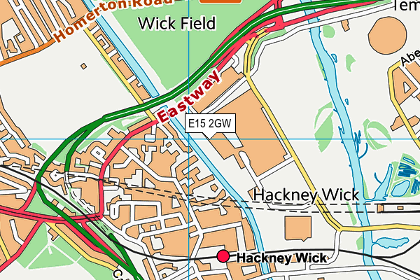
| Postcode | E15 2GW |
Gainsborough Playing Fields on a map

Gainsborough Playing Fields geodata
| Easting | 537177.45 |
| Northing | 184887 |
| Latitude | 51.546211 |
| Longitude | -0.023105 |
| Local Authority Name | Hackney |
| Local Authority Code | E09000012 |
| Parliamentary Constituency Name | Hackney South and Shoreditch |
| Parliamentary Constituency Code | E14000721 |
| Region Name | London |
| Region Code | E15000007 |
| Ward Name | Hackney Wick |
| Ward Code | E05009374 |
| Output Area Code | E00009197 |
About this data
This data is open data sourced from Active Places Power and licenced under the Active Places Open Data Licence.
| toid | osgb5000005192413840 |
| Created On | 28th Dec 2018 |
| Audited On | 27th Jun 2023 |
| Checked On | 27th Jun 2023 |
