Elvetham Heath - Fleet
Elvetham Heath is located in Fleet (GU51), and offers Outdoor Tennis Courts.
| Address | ELVETHAM HEATH SPORTS PAVILION, Turners Way, Fleet, GU51 1BU |
| Car Park | Yes |
| Car Park Capacity | 50 |
| Management Type | Local Authority (in house) |
| Management Group | Local Authority |
| Owner Type | Local Authority |
| Owner Group | Local Authority |
| Education Phase | Not applicable |
Aliases
Elvetham Heath is also known as:
- Elvetham Heath Football Pitch
Facilities
| Closure Date | 1st Jan 2009 |
| Closure Reason | Unclassified |
| Accessibility | Sports Club / Community Association |
| Management Type | Not Known |
| Changing Rooms | No |
| Date Record Checked | 29th Nov 2022 |
| Opening Times | Detailed Timings |
Facility specifics
| Status Notes | Used by Elvetham Heath Primary School in term time. |
| Accessibility | Sports Club / Community Association |
| Management Type | Local Authority (in house) |
| Year Built | 2012 |
| Changing Rooms | No |
| Date Record Checked | 29th Nov 2022 |
| Opening Times | Dawn To Dusk |
Facility specifics
Disabled access
| Disabled Access | Yes |
| Disabled Parking | Yes |
| Activity Areas | Yes |
| Status Notes | Tennis courts are over marked with 2 netball courts. |
| Accessibility | Sports Club / Community Association |
| Management Type | Local Authority (in house) |
| Year Built | 2001 |
| Changing Rooms | No |
| Date Record Created | 13th Mar 2018 |
| Date Record Checked | 29th Nov 2022 |
| Opening Times | Dawn To Dusk |
Facility specifics
| Floodlit | No |
| Overmarked | Yes |
| Surface Type | Macadam |
Disabled access
| Disabled Access | Yes |
| Disabled Parking | Yes |
| Finding/Reaching Entrance | Yes |
| Reception Area | Yes |
| Doorways | Yes |
| Activity Areas | Yes |
| Disabled Toilets | Yes |
| Emergency Exits | Yes |
Contact
Disabled access
Disabled access for Elvetham Heath
| Disabled Access | Yes |
| Disabled Parking | Yes |
| Activity Areas | Yes |
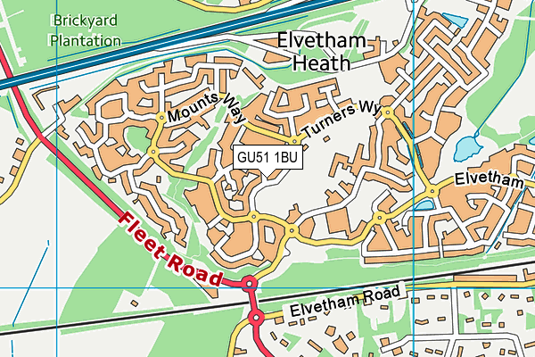
Where is Elvetham Heath ?
| Sub Building Name | |
| Building Name | ELVETHAM HEATH SPORTS PAVILION |
| Building Number | 0 |
| Dependent Thoroughfare | |
| Thoroughfare Name | TURNERS WAY |
| Double Dependent Locality | |
| Dependent Locality | |
| PostTown | FLEET |
| Postcode | GU51 1BU |
Elvetham Heath on a map

Elvetham Heath geodata
| Easting | 479698 |
| Northing | 155394 |
| Latitude | 51.29211 |
| Longitude | -0.858419 |
| Local Authority Name | Hart |
| Local Authority Code | E07000089 |
| Parliamentary Constituency Name | North East Hampshire |
| Parliamentary Constituency Code | E14000844 |
| Region Name | South East |
| Region Code | E15000008 |
| Ward Name | Fleet West |
| Ward Code | E05009357 |
| Output Area Code | E00167918 |
About this data
This data is open data sourced from Active Places Power and licenced under the Active Places Open Data Licence.
| toid | osgb1000002490071247 |
| Created On | 26th Oct 2007 |
| Audited On | 29th Nov 2022 |
| Checked On | 25th Jul 2023 |
