Elton Driving Range
Elton Driving Range is located in Elton, Sandbach (CW11), and offers Golf.
| Address | Hall Lane, Elton, Sandbach, CW11 3TT |
| Car Park | Yes |
| Car Park Capacity | 30 |
| Management Type | Commercial Management |
| Management Group | Commercial |
| Owner Type | Commercial |
| Owner Group | Commercial |
| Education Phase | Not applicable |
Facilities
| Accessibility | Pay and Play |
| Management Type | Commercial Management |
| Year Built | 1995 |
| Changing Rooms | Yes |
| Year Changing Rooms Refurbished | 2012 |
| Date Record Checked | 28th Sep 2022 |
Opening times
| Access description | Pay and Play |
|---|
| Opening time | 08:00 |
| Closing time | 21:00 |
| Period open for | Every day |
Facility specifics
Disabled access
| Disabled Access | Yes |
| Disabled Parking | Yes |
| Finding/Reaching Entrance | Yes |
| Reception Area | Yes |
| Doorways | Yes |
| Activity Areas | Yes |
| Disabled Toilets | Yes |
| Emergency Exits | Yes |
Contact
Disabled access
Disabled access for Elton Driving Range
| Disabled Access | Yes |
| Disabled Parking | Yes |
| Finding/Reaching Entrance | Yes |
| Reception Area | Yes |
| Doorways | Yes |
| Activity Areas | Yes |
| Disabled Toilets | Yes |
| Emergency Exits | Yes |
Where is Elton Driving Range?
| Sub Building Name | |
| Building Name | |
| Building Number | 0 |
| Dependent Thoroughfare | |
| Thoroughfare Name | HALL LANE |
| Double Dependent Locality | |
| Dependent Locality | ELTON |
| PostTown | SANDBACH |
| Postcode | CW11 3TT |
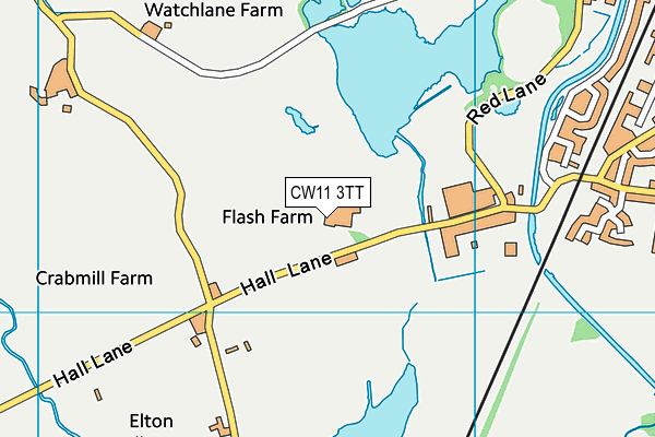
Elton Driving Range on a map

Elton Driving Range geodata
| Easting | 372708.28 |
| Northing | 360120.42 |
| Latitude | 53.137532 |
| Longitude | -2.40941 |
| Local Authority Name | Cheshire East |
| Local Authority Code | E06000049 |
| Parliamentary Constituency Name | Congleton |
| Parliamentary Constituency Code | E14000646 |
| Region Name | North West |
| Region Code | E15000002 |
| Ward Name | Brereton Rural |
| Ward Code | E05008614 |
| Output Area Code | E00092812 |
About this data
This data is open data sourced from Active Places Power and licenced under the Active Places Open Data Licence.
| Created On | 10th Jun 2004 |
| Audited On | 28th Sep 2022 |
| Checked On | 28th Sep 2022 |
