Croft Playing Field
Croft Playing Field is located in Croft, Warrington (WA3).
| Address | Smithy Lane, Croft, Warrington, WA3 7HQ |
| Car Park | Yes |
| Car Park Capacity | 25 |
| Management Type | Local Authority (in house) |
| Management Group | Local Authority |
| Owner Type | Local Authority |
| Owner Group | Local Authority |
| Education Phase | Not applicable |
Facilities
| Accessibility | Sports Club / Community Association |
| Management Type | Local Authority (in house) |
| Changing Rooms | No |
| Date Record Created | 25th Jan 2017 |
| Date Record Checked | 7th Jun 2023 |
| Opening Times | Dawn To Dusk |
Facility specifics
Disabled access
| Disabled Access | Yes |
| Activity Areas | Yes |
Contact
Disabled access
Disabled access for Croft Playing Field
| Disabled Access | Yes |
| Activity Areas | Yes |
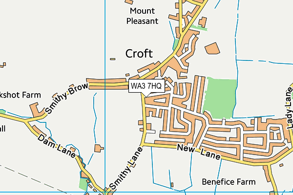
Where is Croft Playing Field?
| Sub Building Name | |
| Building Name | |
| Building Number | 0 |
| Dependent Thoroughfare | |
| Thoroughfare Name | SMITHY LANE |
| Double Dependent Locality | |
| Dependent Locality | CROFT |
| PostTown | WARRINGTON |
| Postcode | WA3 7HQ |
Croft Playing Field on a map

Croft Playing Field geodata
| Easting | 363180.2 |
| Northing | 393520.05 |
| Latitude | 53.437163 |
| Longitude | -2.555713 |
| Local Authority Name | Warrington |
| Local Authority Code | E06000007 |
| Parliamentary Constituency Name | Warrington North |
| Parliamentary Constituency Code | E14001017 |
| Region Name | North West |
| Region Code | E15000002 |
| Ward Name | Culcheth, Glazebury & Croft |
| Ward Code | E05011029 |
| Output Area Code | E00062898 |
About this data
This data is open data sourced from Active Places Power and licenced under the Active Places Open Data Licence.
| toid | osgb1000035996487 |
| Created On | 25th Jan 2017 |
| Audited On | 7th Jun 2023 |
| Checked On | 7th Jun 2023 |
