Cowley Park - St. Osyth
Cowley Park is located in St. Osyth, Clacton-on-sea (CO16), and offers Grass Pitches.
| Address | The Bury, St. Osyth, Clacton-on-sea, CO16 8EP |
| Management Type | Community Organisation |
| Management Group | Others |
| Owner Type | Community Organisation |
| Owner Group | Community Organisation |
| Education Phase | Not Known |
Aliases
Cowley Park is also known as:
Facilities
| Accessibility | Free Public Access |
| Management Type | Community Organisation |
| Year Built | 1922 |
| Year Refurbished | 2010 |
| Changing Rooms | Yes |
| Year Changing Rooms Refurbished | 2015 |
| Date Record Checked | 26th Jul 2022 |
| Opening Times | Dawn To Dusk |
Facility specifics
Disabled access
| Disabled Access | Yes |
| Finding/Reaching Entrance | Yes |
| Doorways | Yes |
| Activity Areas | Yes |
| Disabled Toilets | Yes |
| Social Areas | Yes |
| Emergency Exits | Yes |
| Status Notes | 1 grass square inc an artificial wicket
|
| Accessibility | Sports Club / Community Association |
| Management Type | Community Organisation |
| Year Built | 1923 |
| Year Refurbished | 2010 |
| Changing Rooms | Yes |
| Year Changing Rooms Refurbished | 2015 |
| Date Record Checked | 26th Jul 2022 |
| Opening Times | Dawn To Dusk |
Facility specifics
Disabled access
| Disabled Access | Yes |
| Finding/Reaching Entrance | Yes |
| Doorways | Yes |
| Social Areas | Yes |
| Emergency Exits | Yes |
Contact
Disabled access
Disabled access for Cowley Park
| Disabled Access | Yes |
| Finding/Reaching Entrance | Yes |
| Doorways | Yes |
| Disabled Changing Facilities | Yes |
| Activity Areas | Yes |
| Disabled Toilets | Yes |
| Social Areas | Yes |
| Emergency Exits | Yes |
Where is Cowley Park?
| Sub Building Name | |
| Building Name | |
| Building Number | 0 |
| Dependent Thoroughfare | |
| Thoroughfare Name | THE BURY |
| Double Dependent Locality | |
| Dependent Locality | ST. OSYTH |
| PostTown | CLACTON-ON-SEA |
| Postcode | CO16 8EP |
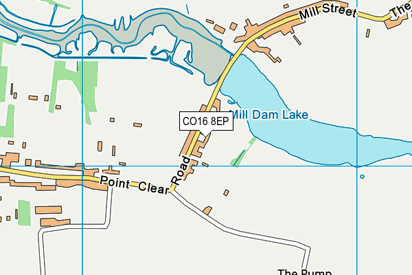
Cowley Park on a map

Cowley Park geodata
| Easting | 612041.17 |
| Northing | 215491.3 |
| Latitude | 51.797852 |
| Longitude | 1.073725 |
| Local Authority Name | Tendring |
| Local Authority Code | E07000076 |
| Parliamentary Constituency Name | Clacton |
| Parliamentary Constituency Code | E14000642 |
| Region Name | Eastern |
| Region Code | E15000006 |
| Ward Name | St. Osyth |
| Ward Code | E05011955 |
| Output Area Code | E00112008 |
About this data
This data is open data sourced from Active Places Power and licenced under the Active Places Open Data Licence.
| Created On | 16th Nov 2006 |
| Audited On | 26th Jul 2022 |
| Checked On | 26th Jul 2022 |
