Cowgate Leisure Centre (Closed) - Newcastle Upon Tyne
Cowgate Leisure Centre (Closed) is located in Newcastle Upon Tyne (NE5).
| Address | Harehills Avenue, Newcastle Upon Tyne, NE5 3HD |
| Management Type | Not Known |
| Management Group | Not Known |
| Owner Type | Local Authority |
| Owner Group | Local Authority |
| Education Phase | Not Known |
| Closure Date | 1st Sep 2008 |
| Closure Reason | Unclassified |
Facilities
| Closure Date | 1st Sep 2008 |
| Closure Reason | Unclassified |
| Accessibility | Pay and Play |
| Management Type | Not Known |
| Year Built | 1986 |
| Changing Rooms | Yes |
| Date Record Checked | 19th Dec 2008 |
| Opening Times | Detailed Timings |
Facility specifics
| Area | 810m² |
| Floor Matting | Don't Know |
| Gymnastics Trampoline Use | Don't Know |
| Length | 0m |
| Moveable Balance Apparatus | Don't Know |
| Moveable Large Apparatus | Don't Know |
| Moveable Rebound Apparatus | Don't Know |
| Moveable Trampolines | Don't Know |
| Small Apparatus | Don't Know |
| Swinging and Hanging Apparatus | Don't Know |
| Width | 0m |
| Closure Date | 1st Sep 2008 |
| Closure Reason | Unclassified |
| Accessibility | Pay and Play |
| Management Type | Not Known |
| Year Built | 1986 |
| Year Refurbished | 2006 |
| Changing Rooms | Yes |
| Date Record Checked | 19th Dec 2008 |
| Opening Times | Detailed Timings |
Facility specifics
| Closure Date | 1st Sep 2008 |
| Closure Reason | Unclassified |
| Accessibility | Pay and Play |
| Management Type | Not Known |
| Year Built | 1986 |
| Changing Rooms | Yes |
| Date Record Checked | 19th Dec 2008 |
| Opening Times | Detailed Timings |
Facility specifics
| Area | 0m² |
| Floor Matting | Don't Know |
| Gymnastics Trampoline Use | Don't Know |
| Length | 0m |
| Moveable Balance Apparatus | Don't Know |
| Moveable Large Apparatus | Don't Know |
| Moveable Rebound Apparatus | Don't Know |
| Moveable Trampolines | Don't Know |
| Small Apparatus | Don't Know |
| Swinging and Hanging Apparatus | Don't Know |
| Width | 0m |
Where is Cowgate Leisure Centre (Closed)?
| Sub Building Name | |
| Building Name | |
| Building Number | 0 |
| Dependent Thoroughfare | |
| Thoroughfare Name | Harehills Avenue |
| Double Dependent Locality | |
| Dependent Locality | |
| PostTown | Newcastle upon Tyne |
| Postcode | NE5 3HD |
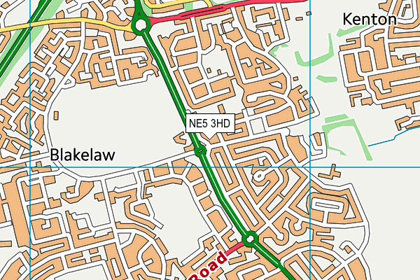
Cowgate Leisure Centre (Closed) on a map

Cowgate Leisure Centre (Closed) geodata
| Easting | 421809.7 |
| Northing | 567157.1 |
| Latitude | 54.998517 |
| Longitude | -1.660611 |
| Local Authority Name | Newcastle upon Tyne |
| Local Authority Code | E08000021 |
| Parliamentary Constituency Name | Newcastle upon Tyne Central |
| Parliamentary Constituency Code | E14000831 |
| Region Name | North East |
| Region Code | E15000001 |
| Ward Name | Blakelaw |
| Ward Code | E05011438 |
| Output Area Code | E00042503 |
About this data
This data is open data sourced from Active Places Power and licenced under the Active Places Open Data Licence.
| Created On | 14th Dec 2014 |
| Audited On | 26th Jan 2015 |
| Checked On | 19th Dec 2008 |
