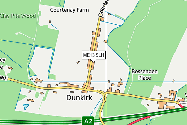
Courtenay Road Playing Field (Closed) - Dunkirk
Courtenay Road Playing Field (Closed) is located in Dunkirk, Faversham (ME13).
| Address | Courtenay Road, Dunkirk, Faversham, ME13 9LH |
| Car Park | Yes |
| Car Park Capacity | 30 |
| Management Type | Sport Club |
| Management Group | Others |
| Owner Type | Local Authority |
| Owner Group | Local Authority |
| Education Phase | Not applicable |
| Closure Date | 16th Oct 2017 |
| Closure Reason | Strategic Review - facility/site not being replaced |
Facilities
| Closure Date | 16th Oct 2017 |
| Closure Reason | Strategic Review - facility/site not being replaced |
| Accessibility | Sports Club / Community Association |
| Management Type | Sport Club |
| Changing Rooms | Yes |
| Year Changing Rooms Refurbished | 2005 |
| Date Record Checked | 16th Oct 2017 |
| Opening Times | Dawn To Dusk |
Facility specifics
Disabled access
| Disabled Access | Yes |
| Finding/Reaching Entrance | Yes |
| Doorways | Yes |
| Activity Areas | Yes |
| Social Areas | Yes |
| Emergency Exits | Yes |
Contact
Disabled access
Disabled access for Courtenay Road Playing Field (Closed)
| Disabled Access | Yes |
| Finding/Reaching Entrance | Yes |
| Doorways | Yes |
| Activity Areas | Yes |
| Social Areas | Yes |
| Emergency Exits | Yes |
Where is Courtenay Road Playing Field (Closed)?
| Sub Building Name | |
| Building Name | |
| Building Number | 0 |
| Dependent Thoroughfare | |
| Thoroughfare Name | Courtenay Road |
| Double Dependent Locality | |
| Dependent Locality | Dunkirk |
| PostTown | Faversham |
| Postcode | ME13 9LH |
Courtenay Road Playing Field (Closed) on a map

Courtenay Road Playing Field (Closed) geodata
| Easting | 607926.25 |
| Northing | 159586.69 |
| Latitude | 51.297424 |
| Longitude | 0.981123 |
| Local Authority Name | Swale |
| Local Authority Code | E07000113 |
| Parliamentary Constituency Name | Faversham and Mid Kent |
| Parliamentary Constituency Code | E14000700 |
| Region Name | South East |
| Region Code | E15000008 |
| Ward Name | Boughton and Courtenay |
| Ward Code | E05009547 |
| Output Area Code | E00124651 |
About this data
This data is open data sourced from Active Places Power and licenced under the Active Places Open Data Licence.
| Created On | 18th May 2007 |
| Audited On | 20th Oct 2016 |
| Checked On | 16th Oct 2017 |
