Coronation Recreation Ground (Hoole) - Chester
Coronation Recreation Ground (Hoole) is located in Chester (CH2), and offers Grass Pitches.
| Address | Park Drive, Chester, CH2 3HG |
| Management Type | Local Authority (in house) |
| Management Group | Local Authority |
| Owner Type | Local Authority |
| Owner Group | Local Authority |
| Education Phase | Not applicable |
Aliases
Coronation Recreation Ground (Hoole) is also known as:
- Coronation Playing Fields
- Coronation Playing Fields
- Hoole Playing Fields
Facilities
| Accessibility | Sports Club / Community Association |
| Management Type | Local Authority (in house) |
| Changing Rooms | Yes |
| Date Record Checked | 25th Nov 2022 |
| Opening Times | Dawn To Dusk |
Facility specifics
Disabled access
| Disabled Access | Yes |
| Reception Area | Yes |
| Doorways | Yes |
| Disabled Changing Facilities | Yes |
| Activity Areas | Yes |
| Disabled Toilets | Yes |
| Emergency Exits | Yes |
Contact
Disabled access
Disabled access for Coronation Recreation Ground (Hoole)
| Disabled Access | Yes |
| Reception Area | Yes |
| Doorways | Yes |
| Disabled Changing Facilities | Yes |
| Activity Areas | Yes |
| Disabled Toilets | Yes |
| Emergency Exits | Yes |
Where is Coronation Recreation Ground (Hoole)?
| Sub Building Name | |
| Building Name | |
| Building Number | 0 |
| Dependent Thoroughfare | |
| Thoroughfare Name | PARK DRIVE |
| Double Dependent Locality | |
| Dependent Locality | |
| PostTown | CHESTER |
| Postcode | CH2 3HG |
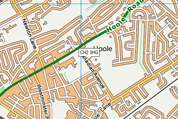
Coronation Recreation Ground (Hoole) on a map

Coronation Recreation Ground (Hoole) geodata
| Easting | 342125 |
| Northing | 367531 |
| Latitude | 53.201688 |
| Longitude | -2.867869 |
| Local Authority Name | Cheshire West and Chester |
| Local Authority Code | E06000050 |
| Parliamentary Constituency Name | City of Chester |
| Parliamentary Constituency Code | E14000640 |
| Region Name | North West |
| Region Code | E15000002 |
| Ward Name | Newton & Hoole |
| Ward Code | E05012228 |
| Output Area Code | E00092537 |
About this data
This data is open data sourced from Active Places Power and licenced under the Active Places Open Data Licence.
| toid | osgb1000035363557 |
| Created On | 28th Feb 2005 |
| Audited On | 25th Nov 2022 |
| Checked On | 25th Nov 2022 |
