College Heath Middle School (Closed) - Mildenhall
College Heath Middle School (Closed) is located in Mildenhall, Bury St Edmunds (IP28).
| Address | Girton Close, Mildenhall, Bury St Edmunds, IP28 7PT |
| Car Park | Yes |
| Car Park Capacity | 40 |
| Management Type | School/College/University (in house) |
| Management Group | Education |
| Owner Type | Community school |
| Owner Group | Education |
| Education Phase | Middle deemed Secondary |
| Closure Date | 1st Sep 2012 |
| Closure Reason | Unclassified |
Facilities
| Closure Date | 1st Sep 2012 |
| Closure Reason | Unclassified |
| Accessibility | Sports Club / Community Association |
| Management Type | Not Known |
| Year Built | 1978 |
| Changing Rooms | Yes |
| Year Changing Rooms Refurbished | 2009 |
| Date Record Checked | 22nd Nov 2012 |
| Opening Times | Detailed Timings |
Facility specifics
Contact
Where is College Heath Middle School (Closed)?
| Sub Building Name | |
| Building Name | |
| Building Number | 0 |
| Dependent Thoroughfare | |
| Thoroughfare Name | Girton Close |
| Double Dependent Locality | |
| Dependent Locality | Mildenhall |
| PostTown | Bury St Edmunds |
| Postcode | IP28 7PT |
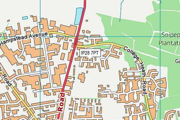
College Heath Middle School (Closed) on a map

College Heath Middle School (Closed) geodata
| Easting | 571350 |
| Northing | 275653 |
| Latitude | 52.352164 |
| Longitude | 0.51447 |
| Local Authority Name | West Suffolk |
| Local Authority Code | E07000245 |
| Parliamentary Constituency Name | West Suffolk |
| Parliamentary Constituency Code | E14001034 |
| Region Name | Eastern |
| Region Code | E15000006 |
| Ward Name | Mildenhall Great Heath |
| Ward Code | E05012786 |
| Output Area Code | E00152587 |
About this data
This data is open data sourced from Active Places Power and licenced under the Active Places Open Data Licence.
| Created On | 5th Feb 2007 |
| Audited On | 26th Jan 2015 |
| Checked On | 22nd Nov 2012 |
