Civil Service Sports Ground (Closed) - Bucklesham
Civil Service Sports Ground (Closed) is located in Bucklesham, Ipswich (IP10).
| Address | Straight Road, Bucklesham, Ipswich, IP10 0AU |
| Car Park | Yes |
| Car Park Capacity | 12 |
| Management Type | School/College/University (in house) |
| Management Group | Education |
| Owner Type | Government |
| Owner Group | Others |
| Education Phase | Not Known |
| Closure Date | 1st Apr 2004 |
| Closure Reason | Unclassified |
Facilities
| Closure Date | 1st Apr 2004 |
| Closure Reason | Unclassified |
| Accessibility | Private Use |
| Management Type | Not Known |
| Changing Rooms | Yes |
| Date Record Checked | 12th Oct 2009 |
| Opening Times | Detailed Timings |
Facility specifics
| Closure Date | 1st Apr 2004 |
| Closure Reason | Unclassified |
| Accessibility | Free Public Access |
| Management Type | Not Known |
| Changing Rooms | Yes |
| Date Record Checked | 12th Oct 2009 |
| Opening Times | Detailed Timings |
Facility specifics
| Closure Date | 1st Apr 2004 |
| Closure Reason | Unclassified |
| Accessibility | Free Public Access |
| Management Type | Not Known |
| Changing Rooms | Yes |
| Date Record Checked | 12th Oct 2009 |
| Opening Times | Detailed Timings |
Facility specifics
Where is Civil Service Sports Ground (Closed)?
| Sub Building Name | |
| Building Name | |
| Building Number | 0 |
| Dependent Thoroughfare | |
| Thoroughfare Name | Straight Road |
| Double Dependent Locality | |
| Dependent Locality | Bucklesham |
| PostTown | Ipswich |
| Postcode | IP10 0AU |
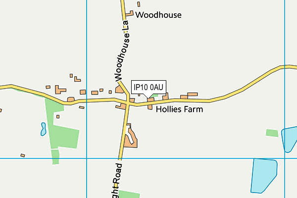
Civil Service Sports Ground (Closed) on a map

Civil Service Sports Ground (Closed) geodata
| Easting | 622165 |
| Northing | 241795 |
| Latitude | 52.030042 |
| Longitude | 1.237251 |
| Local Authority Name | East Suffolk |
| Local Authority Code | E07000244 |
| Parliamentary Constituency Name | Suffolk Coastal |
| Parliamentary Constituency Code | E14000981 |
| Region Name | Eastern |
| Region Code | E15000006 |
| Ward Name | Martlesham & Purdis Farm |
| Ward Code | E05012751 |
| Output Area Code | E00153974 |
About this data
This data is open data sourced from Active Places Power and licenced under the Active Places Open Data Licence.
| Created On | 26th Jul 2007 |
| Audited On | 26th Jan 2015 |
| Checked On | 12th Oct 2009 |
