Campsea Ashe Playing Field
Campsea Ashe Playing Field is located in Campsea Ashe (IP13).
| Address | PLAYING FIELD, Ashe Row, Campsea Ashe, IP13 0PT |
| Car Park | Yes |
| Car Park Capacity | 15 |
| Management Type | Community Organisation |
| Management Group | Others |
| Owner Type | Local Authority |
| Owner Group | Local Authority |
| Education Phase | Not applicable |
Aliases
Campsea Ashe Playing Field is also known as:
- Village Recreation Ground
Facilities
| Status Notes | Facility is available and maintained and is used by Villagers. Not currently used by clubs or organised groups. |
| Accessibility | Sports Club / Community Association |
| Management Type | Community Organisation |
| Year Built | 1940 |
| Year Refurbished | 2022 |
| Changing Rooms | No |
| Date Record Checked | 8th Jun 2022 |
Opening times
| Access description | Sports Club / Community Association |
|---|
| Opening time | 10:00 |
| Closing time | 22:00 |
| Period open for | Every day |
Facility specifics
Disabled access
| Disabled Access | Yes |
| Finding/Reaching Entrance | Yes |
| Reception Area | Yes |
| Doorways | Yes |
| Activity Areas | Yes |
| Disabled Toilets | Yes |
| Social Areas | Yes |
| Spectator Areas | Yes |
| Emergency Exits | Yes |
| Notes | access to toilets via front entrance of Village Hall located next to pitches. |
Contact
Disabled access
Disabled access for Campsea Ashe Playing Field
| Disabled Access | Yes |
| Finding/Reaching Entrance | Yes |
| Reception Area | Yes |
| Doorways | Yes |
| Activity Areas | Yes |
| Disabled Toilets | Yes |
| Social Areas | Yes |
| Spectator Areas | Yes |
| Emergency Exits | Yes |
| Notes | The Village Hall toilets were renovated in March 2022 and has a disability enabled access. |
Where is Campsea Ashe Playing Field?
| Sub Building Name | |
| Building Name | PLAYING FIELD |
| Building Number | 0 |
| Dependent Thoroughfare | |
| Thoroughfare Name | ASHE ROW |
| Double Dependent Locality | |
| Dependent Locality | |
| PostTown | CAMPSEA ASHE |
| Postcode | IP13 0PT |
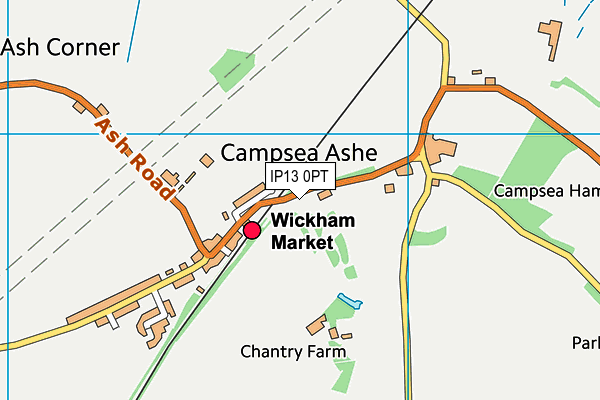
Campsea Ashe Playing Field on a map

Campsea Ashe Playing Field geodata
| Easting | 632492.4 |
| Northing | 255804.83 |
| Latitude | 52.151548 |
| Longitude | 1.397068 |
| Local Authority Name | East Suffolk |
| Local Authority Code | E07000244 |
| Parliamentary Constituency Name | Suffolk Coastal |
| Parliamentary Constituency Code | E14000981 |
| Region Name | Eastern |
| Region Code | E15000006 |
| Ward Name | Wickham Market |
| Ward Code | E05012760 |
| Output Area Code | E00154013 |
About this data
This data is open data sourced from Active Places Power and licenced under the Active Places Open Data Licence.
| toid | osgb1000002018674215 |
| Created On | 5th Feb 2007 |
| Audited On | 8th Jun 2022 |
| Checked On | 8th Aug 2022 |
