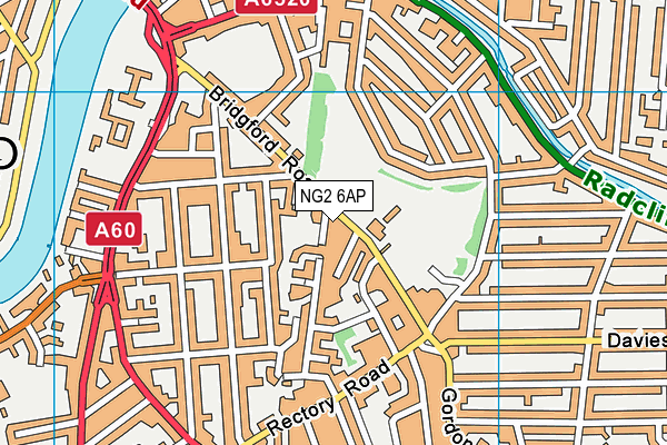
Bridgford Park - West Bridgford
Bridgford Park is located in West Bridgford, Nottingham (NG2), and offers Outdoor Tennis Courts.
| Address | Bridgford Road, West Bridgford, Nottingham, NG2 6AP |
| Car Park | Yes |
| Car Park Capacity | 200 |
| Management Type | Local Authority (in house) |
| Management Group | Local Authority |
| Owner Type | Local Authority |
| Owner Group | Local Authority |
| Education Phase | Not applicable |
Facilities
| Accessibility | Free Public Access |
| Management Type | Local Authority (in house) |
| Year Built | 2000 |
| Year Refurbished | 2006 |
| Changing Rooms | No |
| Date Record Checked | 3rd May 2023 |
| Opening Times | Dawn To Dusk |
Facility specifics
| Floodlit | No |
| Overmarked | No |
| Surface Type | Macadam |
Disabled access
| Disabled Access | Yes |
| Disabled Parking | Yes |
| Finding/Reaching Entrance | Yes |
| Activity Areas | Yes |
| Disabled Toilets | Yes |
| Social Areas | Yes |
| Spectator Areas | Yes |
| Notes | The area around the tennis courts is all on the same level allowing easy access across the site. |
Contact
Disabled access
Disabled access for Bridgford Park
| Disabled Access | Yes |
| Disabled Parking | Yes |
| Finding/Reaching Entrance | Yes |
| Activity Areas | Yes |
| Disabled Toilets | Yes |
| Social Areas | Yes |
| Spectator Areas | Yes |
Where is Bridgford Park?
| Sub Building Name | |
| Building Name | |
| Building Number | 0 |
| Dependent Thoroughfare | |
| Thoroughfare Name | BRIDGFORD ROAD |
| Double Dependent Locality | |
| Dependent Locality | WEST BRIDGFORD |
| PostTown | NOTTINGHAM |
| Postcode | NG2 6AP |
Bridgford Park on a map

Bridgford Park geodata
| Easting | 458612.17 |
| Northing | 337790.8 |
| Latitude | 52.934327 |
| Longitude | -1.129416 |
| Local Authority Name | Rushcliffe |
| Local Authority Code | E07000176 |
| Parliamentary Constituency Name | Rushcliffe |
| Parliamentary Constituency Code | E14000908 |
| Region Name | East Midlands |
| Region Code | E15000004 |
| Ward Name | Trent Bridge |
| Ward Code | E05009732 |
| Output Area Code | E00144797 |
About this data
This data is open data sourced from Active Places Power and licenced under the Active Places Open Data Licence.
| Created On | 10th Feb 2014 |
| Audited On | 3rd May 2023 |
| Checked On | 3rd May 2023 |
