Brearley Park - Old Whittington
Brearley Park is located in Old Whittington, Chesterfield (S41), and offers Grass Pitches.
| Address | Brearley Street, Old Whittington, Chesterfield, S41 9LW |
| Car Park | Yes |
| Car Park Capacity | 15 |
| Management Type | Local Authority (in house) |
| Management Group | Local Authority |
| Owner Type | Local Authority |
| Owner Group | Local Authority |
| Education Phase | Not applicable |
Facilities
| Accessibility | Pay and Play |
| Management Type | Local Authority (in house) |
| Changing Rooms | Yes |
| Date Record Checked | 3rd May 2022 |
| Opening Times | Dawn To Dusk |
Facility specifics
Disabled access
| Disabled Access | Yes |
| Finding/Reaching Entrance | Yes |
| Doorways | Yes |
| Disabled Changing Facilities | Yes |
| Activity Areas | Yes |
| Disabled Toilets | Yes |
| Emergency Exits | Yes |
| Closure Date | 6th Oct 2017 |
| Closure Reason | Strategic Review - facility/site not being replaced |
| Accessibility | Pay and Play |
| Management Type | Local Authority (in house) |
| Changing Rooms | Yes |
| Date Record Checked | 3rd May 2022 |
| Opening Times | Dawn To Dusk |
Facility specifics
Disabled access
| Disabled Access | Yes |
| Finding/Reaching Entrance | Yes |
| Doorways | Yes |
| Disabled Changing Facilities | Yes |
| Activity Areas | Yes |
| Disabled Toilets | Yes |
| Emergency Exits | Yes |
Contact
Where is Brearley Park?
| Sub Building Name | |
| Building Name | |
| Building Number | 0 |
| Dependent Thoroughfare | |
| Thoroughfare Name | BREARLEY STREET |
| Double Dependent Locality | |
| Dependent Locality | OLD WHITTINGTON |
| PostTown | CHESTERFIELD |
| Postcode | S41 9LW |
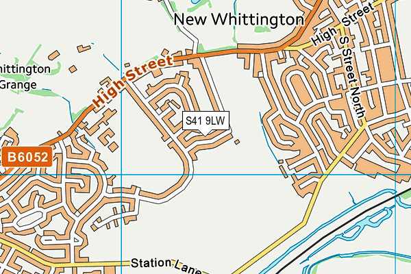
Brearley Park on a map

Brearley Park geodata
| Easting | 439422.7 |
| Northing | 375120.78 |
| Latitude | 53.271616 |
| Longitude | -1.410327 |
| Local Authority Name | Chesterfield |
| Local Authority Code | E07000034 |
| Parliamentary Constituency Name | North East Derbyshire |
| Parliamentary Constituency Code | E14000843 |
| Region Name | East Midlands |
| Region Code | E15000004 |
| Ward Name | Barrow Hill and New Whittington |
| Ward Code | E05003323 |
| Output Area Code | E00098764 |
About this data
This data is open data sourced from Active Places Power and licenced under the Active Places Open Data Licence.
| Created On | 24th Feb 2005 |
| Audited On | 3rd May 2022 |
| Checked On | 3rd May 2022 |
