Bournemouth Velodrome
Bournemouth Velodrome is located in Bournemouth (BH10), and offers Cycling.
| Address | BOURNEMOUTH VELODROME , Ensbury Avenue, Bournemouth, BH10 4EP |
| Car Park | Yes |
| Car Park Capacity | 140 |
| Management Type | Community Organisation |
| Management Group | Others |
| Owner Type | Local Authority |
| Owner Group | Local Authority |
| Education Phase | Not applicable |
Facilities
| Accessibility | Sports Club / Community Association |
| Management Type | Sport Club |
| Year Built | 2011 |
| Changing Rooms | Yes |
| Date Record Created | 24th Feb 2017 |
| Date Record Checked | 1st Sep 2022 |
| Opening Times | Dawn To Dusk |
Facility specifics
| Degree Of Banking At Middle Of Bends | 33° |
| Degree Of Banking At Middle Of Straights | 5.5° |
| Floodlit | No |
| Length Of Straights | 50m |
| Overall Width | 7m |
| Surface | Macadam |
| Timing System | No |
| Total Length | 250m |
Disabled access
| Disabled Access | Yes |
| Finding/Reaching Entrance | Yes |
| Emergency Exits | Yes |
Contact
Disabled access
Disabled access for Bournemouth Velodrome
| Disabled Access | Yes |
| Finding/Reaching Entrance | Yes |
| Emergency Exits | Yes |
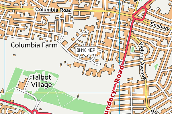
Where is Bournemouth Velodrome?
| Sub Building Name | |
| Building Name | BOURNEMOUTH VELODROME |
| Building Number | 0 |
| Dependent Thoroughfare | |
| Thoroughfare Name | ENSBURY AVENUE |
| Double Dependent Locality | |
| Dependent Locality | |
| PostTown | BOURNEMOUTH |
| Postcode | BH10 4EP |
Bournemouth Velodrome on a map

Bournemouth Velodrome geodata
| Easting | 407612.49 |
| Northing | 94144.06 |
| Latitude | 50.746852 |
| Longitude | -1.893468 |
| Local Authority Name | Bournemouth, Christchurch and Poole |
| Local Authority Code | E06000058 |
| Parliamentary Constituency Name | Bournemouth West |
| Parliamentary Constituency Code | E14000585 |
| Region Name | South West |
| Region Code | E15000009 |
| Ward Name | Wallisdown & Winton West |
| Ward Code | E05012678 |
| Output Area Code | E00077635 |
About this data
This data is open data sourced from Active Places Power and licenced under the Active Places Open Data Licence.
| Created On | 24th Feb 2017 |
| Audited On | 1st Sep 2022 |
| Checked On | 1st Sep 2022 |
