Blakes Golf Club - North Weald
Blakes Golf Club is located in North Weald, Epping (CM16), and offers Golf.
| Address | Epping Road, North Weald, Epping, CM16 6RZ |
| Car Park | Yes |
| Car Park Capacity | 100 |
| Management Type | Sport Club |
| Management Group | Others |
| Owner Type | Commercial |
| Owner Group | Commercial |
| Education Phase | Not applicable |
| Start Date | 1st Jun 2005 |
Facilities
| Accessibility | Pay and Play |
| Management Type | Sport Club |
| Year Built | 2005 |
| Changing Rooms | Yes |
| Date Record Checked | 1st Sep 2023 |
| Opening Times | Dawn To Dusk |
Facility specifics
Disabled access
| Disabled Access | Yes |
| Disabled Parking | Yes |
| Finding/Reaching Entrance | Yes |
| Reception Area | Yes |
| Doorways | Yes |
| Activity Areas | Yes |
| Disabled Toilets | Yes |
| Social Areas | Yes |
| Spectator Areas | Yes |
| Emergency Exits | Yes |
| Closure Date | 1st Jan 2018 |
| Closure Reason | Strategic Review - facility/site to be replaced at existing site |
| Accessibility | Pay and Play |
| Management Type | Sport Club |
| Year Built | 2005 |
| Changing Rooms | Yes |
| Date Record Checked | 1st Sep 2023 |
| Opening Times | Dawn To Dusk |
Facility specifics
Disabled access
| Disabled Access | Yes |
| Disabled Parking | Yes |
| Finding/Reaching Entrance | Yes |
| Doorways | Yes |
| Activity Areas | Yes |
| Disabled Toilets | Yes |
| Social Areas | Yes |
| Emergency Exits | Yes |
Contact
Disabled access
Disabled access for Blakes Golf Club
| Disabled Access | Yes |
| Disabled Parking | Yes |
| Finding/Reaching Entrance | Yes |
| Reception Area | Yes |
| Doorways | Yes |
| Activity Areas | Yes |
| Disabled Toilets | Yes |
| Social Areas | Yes |
| Spectator Areas | Yes |
| Emergency Exits | Yes |
Where is Blakes Golf Club?
| Sub Building Name | |
| Building Name | |
| Building Number | 0 |
| Dependent Thoroughfare | |
| Thoroughfare Name | EPPING ROAD |
| Double Dependent Locality | |
| Dependent Locality | NORTH WEALD |
| PostTown | EPPING |
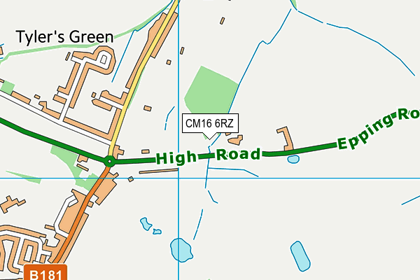
| Postcode | CM16 6RZ |
Blakes Golf Club on a map

Blakes Golf Club geodata
| Easting | 550867 |
| Northing | 204407 |
| Latitude | 51.718103 |
| Longitude | 0.182575 |
| Local Authority Name | Epping Forest |
| Local Authority Code | E07000072 |
| Parliamentary Constituency Name | Brentwood and Ongar |
| Parliamentary Constituency Code | E14000594 |
| Region Name | Eastern |
| Region Code | E15000006 |
| Ward Name | Moreton and Fyfield |
| Ward Code | E05008941 |
| Output Area Code | E00110718 |
About this data
This data is open data sourced from Active Places Power and licenced under the Active Places Open Data Licence.
| toid | osgb1000002314446675 |
| Created On | 20th Feb 2006 |
| Audited On | 1st Sep 2023 |
| Checked On | 1st Sep 2023 |
