Bishops Park (Oldham)
Bishops Park (Oldham) is located in Oldham (OL4), and offers Golf.
| Address | Grains Bar, Oldham, OL4 2JY |
| Car Park | Yes |
| Car Park Capacity | 30 |
| Management Type | Commercial Management |
| Management Group | Commercial |
| Owner Type | Local Authority |
| Owner Group | Local Authority |
| Education Phase | Not applicable |
Facilities
| Accessibility | Sports Club / Community Association |
| Management Type | Local Authority (in house) |
| Changing Rooms | No |
| Date Record Checked | 13th Sep 2022 |
| Opening Times | Dawn To Dusk |
Facility specifics
Disabled access
| Disabled Access | Yes |
| Activity Areas | Yes |
| Accessibility | Sports Club / Community Association |
| Management Type | Local Authority (in house) |
| Year Built | 2014 |
| Changing Rooms | No |
| Date Record Checked | 13th Sep 2022 |
| Opening Times | Dawn To Dusk |
Facility specifics
Disabled access
| Disabled Access | Yes |
| Activity Areas | Yes |
| Accessibility | Pay and Play |
| Management Type | Commercial Management |
| Year Built | 2017 |
| Date Record Created | 2nd Jul 2018 |
| Date Record Checked | 13th Sep 2022 |
Opening times
| Access description | Pay and Play |
|---|
| Opening time | 09:00 |
| Closing time | 20:00 |
| Period open for | Weekend |
| |
| Access description | Pay and Play |
|---|
| Opening time | 09:00 |
| Closing time | 18:00 |
| Period open for | Monday-Friday |
Facility specifics
Disabled access
| Disabled Access | Yes |
| Activity Areas | Yes |
| Spectator Areas | Yes |
Contact
Disabled access
Disabled access for Bishops Park (Oldham)
| Disabled Access | Yes |
| Activity Areas | Yes |
| Spectator Areas | Yes |
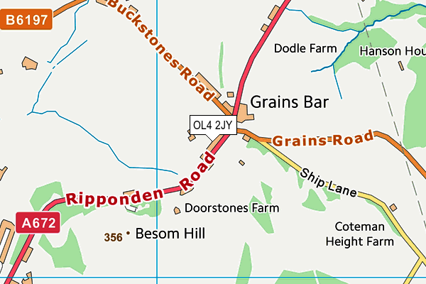
Where is Bishops Park (Oldham)?
| Sub Building Name | |
| Building Name | |
| Building Number | 0 |
| Dependent Thoroughfare | |
| Thoroughfare Name | GRAINS BAR |
| Double Dependent Locality | |
| Dependent Locality | |
| PostTown | OLDHAM |
| Postcode | OL4 2JY |
Bishops Park (Oldham) on a map

Bishops Park (Oldham) geodata
| Easting | 396253.09 |
| Northing | 408337.15 |
| Latitude | 53.571625 |
| Longitude | -2.058052 |
| Local Authority Name | Oldham |
| Local Authority Code | E08000004 |
| Parliamentary Constituency Name | Oldham East and Saddleworth |
| Parliamentary Constituency Code | E14000870 |
| Region Name | North West |
| Region Code | E15000002 |
| Ward Name | Shaw |
| Ward Code | E05000736 |
| Output Area Code | E00027553 |
About this data
This data is open data sourced from Active Places Power and licenced under the Active Places Open Data Licence.
| Created On | 28th Sep 2005 |
| Audited On | 13th Sep 2022 |
| Checked On | 13th Sep 2022 |
