Bentley Tennis Club - Pilgrims Hatch
Bentley Tennis Club is located in Pilgrims Hatch (CM14), and offers Outdoor Tennis Courts.
| Address | TENNIS 57M FROM BENTLEY VILLAGE HALL, ONGAR ROAD 57M FROM A128, Pilgrims Lane, Pilgrims Hatch, CM14 5PN |
| Car Park | Yes |
| Car Park Capacity | 60 |
| Management Type | Sport Club |
| Management Group | Others |
| Owner Type | Sports Club |
| Owner Group | Sports Club |
| Education Phase | Not applicable |
Facilities
| Accessibility | Sports Club / Community Association |
| Management Type | Sport Club |
| Year Built | 1936 |
| Year Refurbished | 2008 |
| Changing Rooms | Yes |
| Date Record Created | 26th Feb 2018 |
| Date Record Checked | 23rd Nov 2022 |
Opening times
| Access description | Sports Club / Community Association |
|---|
| Opening time | 08:00 |
| Closing time | 22:00 |
| Period open for | Every day |
Facility specifics
| Floodlit | Yes |
| Overmarked | No |
| Surface Type | Macadam |
Disabled access
| Disabled Access | Yes |
| Finding/Reaching Entrance | Yes |
| Activity Areas | Yes |
Contact
Disabled access
Disabled access for Bentley Tennis Club
| Disabled Access | Yes |
| Finding/Reaching Entrance | Yes |
| Activity Areas | Yes |
Where is Bentley Tennis Club?
| Sub Building Name | |
| Building Name | TENNIS 57M FROM BENTLEY VILLAGE HALL, ONGAR ROAD 57M FROM A128 |
| Building Number | 0 |
| Dependent Thoroughfare | |
| Thoroughfare Name | PILGRIMS LANE |
| Double Dependent Locality | |
| Dependent Locality | |
| PostTown | PILGRIMS HATCH |
| Postcode | CM14 5PN |
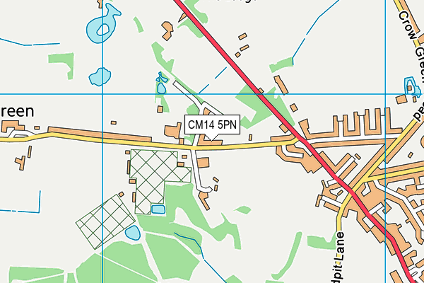
Bentley Tennis Club on a map

Bentley Tennis Club geodata
| Easting | 557580.56 |
| Northing | 195881.93 |
| Latitude | 51.639669 |
| Longitude | 0.275837 |
| Local Authority Name | Brentwood |
| Local Authority Code | E07000068 |
| Parliamentary Constituency Name | Brentwood and Ongar |
| Parliamentary Constituency Code | E14000594 |
| Region Name | Eastern |
| Region Code | E15000006 |
| Ward Name | Pilgrims Hatch |
| Ward Code | E05004077 |
| Output Area Code | E00109040 |
About this data
This data is open data sourced from Active Places Power and licenced under the Active Places Open Data Licence.
| toid | osgb1000001816555998 |
| Created On | 26th Feb 2018 |
| Audited On | 23rd Nov 2022 |
| Checked On | 23rd Nov 2022 |
