Arncott Wood Road Playing Field
Arncott Wood Road Playing Field is located in Arncott, Bicester (OX25), and offers Artificial Grass Pitch, and Grass Pitches.
| Address | Arncott Wood Road, Arncott, Bicester, OX25 1PP |
| Management Type | MOD |
| Management Group | Others |
| Owner Type | MOD |
| Owner Group | Others |
| Education Phase | Not applicable |
Facilities
| Accessibility | Private Use |
| Management Type | MOD |
| Year Built | 2015 |
| Changing Rooms | Yes |
| Date Record Created | 30th Sep 2022 |
| Date Record Checked | 30th Sep 2022 |
Opening times
| Access description | Private Use |
|---|
| Opening time | 09:00 |
| Closing time | 21:00 |
| Period open for | Every day |
Facility specifics
| Area | 999m² |
| Fill | Yes - Rubber |
| Floodlit | Yes |
| Indoor | No |
| Length | 37m |
| Pile Length | 50mm |
| Width | 27m |
| WR22 Compliant Pitch | No |
Disabled access
| Disabled Access | Yes |
| Activity Areas | Yes |
| Accessibility | Private Use |
| Management Type | MOD |
| Changing Rooms | Yes |
| Date Record Created | 30th Sep 2022 |
| Date Record Checked | 30th Sep 2022 |
| Opening Times | Dawn To Dusk |
Facility specifics
Disabled access
| Disabled Access | Yes |
| Activity Areas | Yes |
Contact
Disabled access
Disabled access for Arncott Wood Road Playing Field
| Disabled Access | Yes |
| Activity Areas | Yes |
Where is Arncott Wood Road Playing Field?
| Sub Building Name | |
| Building Name | |
| Building Number | 0 |
| Dependent Thoroughfare | |
| Thoroughfare Name | ARNCOTT WOOD ROAD |
| Double Dependent Locality | |
| Dependent Locality | ARNCOTT |
| PostTown | BICESTER |
| Postcode | OX25 1PP |
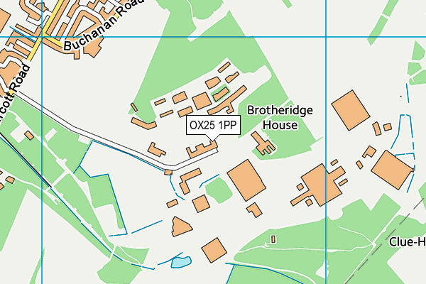
Arncott Wood Road Playing Field on a map

Arncott Wood Road Playing Field geodata
| Easting | 461439.52 |
| Northing | 216522.2 |
| Latitude | 51.84393 |
| Longitude | -1.10956 |
| Local Authority Name | Cherwell |
| Local Authority Code | E07000177 |
| Parliamentary Constituency Name | Banbury |
| Parliamentary Constituency Code | E14000539 |
| Region Name | South East |
| Region Code | E15000008 |
| Ward Name | Launton & Otmoor |
| Ward Code | E05010934 |
| Output Area Code | E00169031 |
About this data
This data is open data sourced from Active Places Power and licenced under the Active Places Open Data Licence.
| toid | osgb1000000118150317 |
| Created On | 30th Sep 2022 |
| Audited On | 30th Sep 2022 |
| Checked On | 30th Sep 2022 |
