Amesbury School (High Pitfold Playing Field) - Hindhead
Amesbury School (High Pitfold Playing Field) is located in Hindhead (GU26), and offers Grass Pitches.
| Address | High Pitfold, Hindhead, GU26 6BN |
| Management Type | School/College/University (in house) |
| Management Group | Education |
| Owner Type | Other Independent School |
| Owner Group | Education |
| Education Phase | Primary |
Facilities
| Accessibility | Private Use |
| Management Type | School/College/University (in house) |
| Changing Rooms | No |
| Date Record Created | 13th Jul 2017 |
| Date Record Checked | 23rd Dec 2022 |
| Opening Times | Dawn To Dusk |
Facility specifics
| Accessibility | Private Use |
| Management Type | School/College/University (in house) |
| Changing Rooms | No |
| Date Record Created | 13th Jul 2017 |
| Date Record Checked | 23rd Dec 2022 |
| Opening Times | Dawn To Dusk |
Facility specifics
| Accessibility | Private Use |
| Management Type | School/College/University (in house) |
| Changing Rooms | No |
| Date Record Created | 9th Aug 2018 |
| Date Record Checked | 23rd Dec 2022 |
| Opening Times | Dawn To Dusk |
Facility specifics
Contact
Where is Amesbury School (High Pitfold Playing Field)?
| Sub Building Name | |
| Building Name | |
| Building Number | 0 |
| Dependent Thoroughfare | |
| Thoroughfare Name | HIGH PITFOLD |
| Double Dependent Locality | |
| Dependent Locality | |
| PostTown | HINDHEAD |
| Postcode | GU26 6BN |
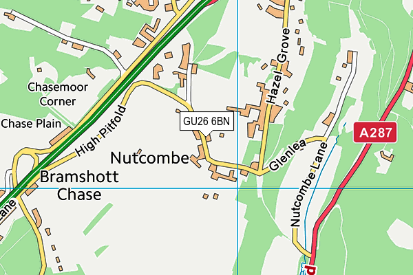
Amesbury School (High Pitfold Playing Field) on a map

Amesbury School (High Pitfold Playing Field) geodata
| Easting | 487675.31 |
| Northing | 134302.13 |
| Latitude | 51.101328 |
| Longitude | -0.749187 |
| Local Authority Name | Waverley |
| Local Authority Code | E07000216 |
| Parliamentary Constituency Name | South West Surrey |
| Parliamentary Constituency Code | E14000953 |
| Region Name | South East |
| Region Code | E15000008 |
| Ward Name | Haslemere Critchmere and Shottermill |
| Ward Code | E05007434 |
| Output Area Code | E00157665 |
About this data
This data is open data sourced from Active Places Power and licenced under the Active Places Open Data Licence.
| toid | osgb1000014697396 |
| Created On | 13th Jul 2017 |
| Audited On | 23rd Dec 2022 |
| Checked On | 23rd Dec 2022 |
