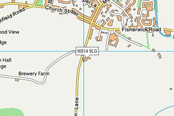
Whittington Primary and Nursery School is located in Whittington, Lichfield and falls under the local authority of Staffordshire. This mixed-sex primary school has 307 pupils, with a capacity of 336, aged from three up to eleven, and the type of establishment is academy converter.
| Address | Whittington Primary and Nursery School Common Lane Whittington Lichfield Staffordshire WS14 9LG |
| Website | http://www.whittington-school.co.uk/ |
| Headteacher | Mrs N Leeson |
GetTheData
Source: Get Information About Schools
Licence: Open Government Licence
| Phase of Education | Primary |
| Type of Establishment | Academy converter |
| Admissions Policy | Not applicable |
| Statutory Low Age | 3 |
| Statutory High Age | 11 |
| Boarders | No boarders |
| Official Sixth Form | Does not have a sixth form |
| Gender | Mixed |
| Religious Character | Does not apply |
| Diocese | Not applicable |
| Special Classes | No Special Classes |
GetTheData
Source: Get Information About Schools
Licence: Open Government Licence
| Census Date | 19th January 2023 | |
| School Capacity | 336 | |
| Number of Pupils | 307 | 91% capacity |
| Number of Boys | 160 | 52% |
| Number of Girls | 147 | 48% |
| Free School Meals (%) | 6.50% |
GetTheData
Source: Get Information About Schools
Licence: Open Government Licence
| Street Address | Common Lane |
| Locality | Whittington |
| Town | Lichfield |
| County | Staffordshire |
| Postcode | WS14 9LG |
| ➜ More WS14 9LG open data | |
GetTheData
Source: Get Information About Schools
Licence: Open Government Licence

GetTheData
Source: OS VectorMap District (Ordnance Survey)
Licence: Open Government Licence (requires attribution)
| Ofsted Special Measures | Not applicable |
GetTheData
Source: Get Information About Schools
Licence: Open Government Licence
| Establishment Name | Whittington Primary and Nursery School |
| Establishment Number | 2309 |
| Unique Reference Number | 149421 |
| Local Authority | Staffordshire |
| Local Authority Code | 860 |
| Previous Local Authority | Pre LGR (1997) Staffordshire |
| Previous Local Authority Code | 934 |
| Government Statistical Service Local Authority Code | E10000028 |
| Government Office Region | West Midlands |
| District | Lichfield |
| District Code | E07000194 |
| Ward | Whittington & Streethay |
| Parliamentary Constituency | Lichfield |
| Urban/Rural Description | (England/Wales) Rural town and fringe |
| Middle Super Output Area | Lichfield 008 |
| Lower Super Output Area | Lichfield 008D |
GetTheData
Source: Get Information About Schools
Licence: Open Government Licence
| Establishment Status | Open |
| Last Changed Date | 24th January 2024 |
| Reason Establishment Opened | Academy Converter |
| Open Date | 1st November 2022 |
GetTheData
Source: Get Information About Schools
Licence: Open Government Licence
| Teenage Mothers | Not applicable |
| Child Care Facilities | Not applicable |
| Special Educational Needs (SEN) Provision in Primary Care Unit | Not applicable |
| Pupil Referral Unit (PRU) Provides for Educational and Behavioural Difficulties (EBD) | Not applicable |
| Pupil Referral Unit (PRU) Provides for Full Time Provision | Not applicable |
| Pupil Referral Unit (PRU) Offers Tuition by Another Provider | Not applicable |
GetTheData
Source: Get Information About Schools
Licence: Open Government Licence
| Section 41 Approved | Not applicable |
GetTheData
Source: Get Information About Schools
Licence: Open Government Licence
| Trust flag | Supported by a multi-academy trust |
| Trust | JOHN TAYLOR MAT |
| School Sponsor flag | Linked to a sponsor |
| School Sponsor | John Taylor MAT |
GetTheData
Source: Get Information About Schools
Licence: Open Government Licence
| Federation flag | Not applicable |
GetTheData
Source: Get Information About Schools
Licence: Open Government Licence
| UK Provider Reference Number | 10091403 |
GetTheData
Source: Get Information About Schools
Licence: Open Government Licence
| Easting | 416029 |
| Northing | 307940 |
| Latitude | 52.66894 |
| Longitude | -1.7644 |
GetTheData
Source: Get Information About Schools
Licence: Open Government Licence
| School | Phase of Education | Distance |
|---|---|---|
| Streethay Primary School Yoxall Way, Lichfield, WS13 8FT | Primary | 3.2km |
| Thomas Barnes Primary School School Lane, Hopwas, Tamworth, B78 3AD | Primary | 3.3km |
| Saxon Hill Academy Kings Hill Road, Lichfield, WS14 9DE | Not applicable | 3.8km |
| The Howard Primary School The Square, Elford, Tamworth, B79 9DB | Primary | 3.9km |
| Five Spires Academy Cherry Orchard, Lichfield, WS14 9AN | Primary | 3.9km |
| Scotch Orchard Primary School Scotch Orchard, Lichfield, WS13 6DE | Primary | 3.9km |
| St Joseph's Catholic Primary School Cherry Orchard, Lichfield, WS14 9AN | Primary | 4km |
| St Michael's CofE (C) Primary School Cherry Orchard, Lichfield, WS14 9AN | Primary | 4km |
| King Edward VI School Upper St John Street, Lichfield, WS14 9EE | Secondary | 4km |
| St Chad's CofE Primary School St Michael Road, Lichfield, WS13 6SN | Primary | 4.1km |
GetTheData
Source: Get Information About Schools
Licence: Open Government Licence