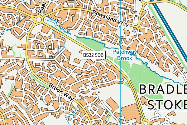
Wheatfield Primary School is located in Bradley Stoke, Bristol and falls under the local authority of South Gloucestershire. This mixed-sex primary school has a capacity of 420 pupils, aged from four up to eleven, and the type of establishment is academy converter.
| Address | Wheatfield Primary School Wheatfield Drive Bradley Stoke Bristol BS32 9DB |
| Website | http://www.wheatfieldprimary.com |
| Headteacher | Mrs Wendy Carver |
GetTheData
Source: Get Information About Schools
Licence: Open Government Licence
| Phase of Education | Primary |
| Type of Establishment | Academy converter |
| Admissions Policy | Not applicable |
| Statutory Low Age | 4 |
| Statutory High Age | 11 |
| Boarders | No boarders |
| Official Sixth Form | Does not have a sixth form |
| Gender | Mixed |
| Religious Character | Does not apply |
| Diocese | Not applicable |
| Special Classes | Not applicable |
GetTheData
Source: Get Information About Schools
Licence: Open Government Licence
| School Capacity | 420 |
GetTheData
Source: Get Information About Schools
Licence: Open Government Licence
| Street Address | Wheatfield Drive |
| Locality | Bradley Stoke |
| Town | Bristol |
| Postcode | BS32 9DB |
| ➜ More BS32 9DB open data | |
GetTheData
Source: Get Information About Schools
Licence: Open Government Licence

GetTheData
Source: OS VectorMap District (Ordnance Survey)
Licence: Open Government Licence (requires attribution)
| Ofsted Special Measures | Not applicable |
GetTheData
Source: Get Information About Schools
Licence: Open Government Licence
| Establishment Name | Wheatfield Primary School |
| Establishment Number | 2005 |
| Unique Reference Number | 149999 |
| Local Authority | South Gloucestershire |
| Local Authority Code | 803 |
| Previous Local Authority Code | 999 |
| Government Statistical Service Local Authority Code | E06000025 |
| Government Office Region | South West |
| District | South Gloucestershire |
| District Code | E06000025 |
| Ward | Bradley Stoke North |
| Parliamentary Constituency | Filton and Bradley Stoke |
| Urban/Rural Description | (England/Wales) Urban city and town |
| Middle Super Output Area | South Gloucestershire 009 |
| Lower Super Output Area | South Gloucestershire 009D |
GetTheData
Source: Get Information About Schools
Licence: Open Government Licence
| Establishment Status | Open |
| Last Changed Date | 3rd January 2024 |
| Reason Establishment Opened | Academy Converter |
| Open Date | 1st September 2023 |
GetTheData
Source: Get Information About Schools
Licence: Open Government Licence
| Teenage Mothers | Not applicable |
| Child Care Facilities | Not applicable |
| Special Educational Needs (SEN) Provision in Primary Care Unit | Not applicable |
| Pupil Referral Unit (PRU) Provides for Educational and Behavioural Difficulties (EBD) | Not applicable |
| Pupil Referral Unit (PRU) Provides for Full Time Provision | Not applicable |
| Pupil Referral Unit (PRU) Offers Tuition by Another Provider | Not applicable |
GetTheData
Source: Get Information About Schools
Licence: Open Government Licence
| Section 41 Approved | Not applicable |
GetTheData
Source: Get Information About Schools
Licence: Open Government Licence
| Trust flag | Supported by a multi-academy trust |
| Trust | THE LEAF TRUST |
| School Sponsor flag | - |
GetTheData
Source: Get Information About Schools
Licence: Open Government Licence
| Federation flag | Not applicable |
GetTheData
Source: Get Information About Schools
Licence: Open Government Licence
| UK Provider Reference Number | 10092999 |
GetTheData
Source: Get Information About Schools
Licence: Open Government Licence
| Easting | 361653 |
| Northing | 182397 |
| Latitude | 51.53916 |
| Longitude | -2.5543 |
GetTheData
Source: Get Information About Schools
Licence: Open Government Licence
| School | Phase of Education | Distance |
|---|---|---|
| Bowsland Green Primary School Ellicks Close, Bradley Stoke, Bristol, BS32 0ES | Primary | 458m |
| St Chad's Patchway CofE Primary School Cranham Drive, Patchway, Bristol, BS34 6AQ | Primary | 548m |
| Holy Trinity Primary School Broad Croft, Bradley Stoke, Bristol, BS32 0BD | Primary | 572m |
| Stoke Lodge Primary School School Close, Bourton Avenue, Patchway, Bristol, BS34 6DW | Primary | 594m |
| Bradley Stoke Community School Fiddlers Wood Lane, Bradley Stoke, Bristol, BS32 9BS | All-through | 681m |
| Meadowbrook Primary School Three Brooks Lane, Bradley Stoke, Bristol, BS32 8TA | Primary | 801m |
| Patchway Community School Hempton Lane, Almondsbury, BS32 4AJ | Secondary | 941m |
| SGS Pegasus School Hempton Lane, Patchway, Almondsbury, Bristol, BS32 4AJ | Not applicable | 1km |
| Holy Family Catholic Primary School Amberley Road, Patchway, Holy Family School, Patchway, Bristol, BS34 6BY | Primary | 1.1km |
| Little Stoke Primary School Little Stoke Lane, Little Stoke, Bristol, BS34 6HY | Primary | 1.5km |
GetTheData
Source: Get Information About Schools
Licence: Open Government Licence