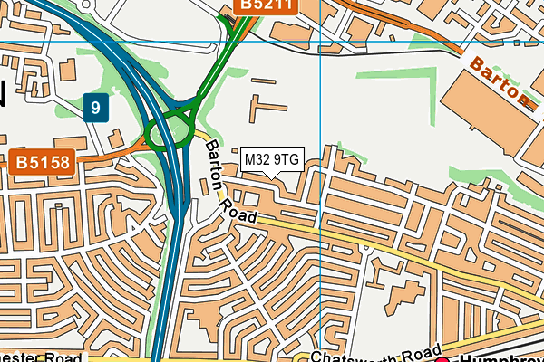
The Orchards is located in Stretford and falls under the local authority of Trafford. This mixed-sex school has 125 pupils, with a capacity of 133, aged from three up to eleven, and the type of establishment is free schools special. The most recend Ofsted inspection was 10th July 2019 resulting in an good rating.
| Address | The Orchards Audley Avenue Stretford Greater Manchester M32 9TG |
| Website | https://theorchards.bright-futures.co.uk/ |
| Headteacher | Ms Helen O'Brien |
GetTheData
Source: Get Information About Schools
Licence: Open Government Licence
| Phase of Education | Not applicable |
| Type of Establishment | Free schools special |
| Statutory Low Age | 3 |
| Statutory High Age | 11 |
| Boarders | No boarders |
| Official Sixth Form | Does not have a sixth form |
| Gender | Mixed |
| Religious Character | Does not apply |
| Special Classes | Has Special Classes |
GetTheData
Source: Get Information About Schools
Licence: Open Government Licence
| Census Date | 19th January 2023 | |
| School Capacity | 133 | |
| Number of Pupils | 125 | 94% capacity |
| Number of Boys | 98 | 78% |
| Number of Girls | 27 | 22% |
| Free School Meals (%) | 49.60% |
GetTheData
Source: Get Information About Schools
Licence: Open Government Licence
| Street Address | Audley Avenue |
| Town | Stretford |
| County | Greater Manchester |
| Postcode | M32 9TG |
| ➜ More M32 9TG open data | |
GetTheData
Source: Get Information About Schools
Licence: Open Government Licence

GetTheData
Source: OS VectorMap District (Ordnance Survey)
Licence: Open Government Licence (requires attribution)
| LAESTAB | 3587002 |
| Ofsted Region | North West |
| Inspection number | 10087790 |
|---|---|
| Inspection type | S5 Inspection |
| Inspection type grouping | S5 Inspection |
| Event type grouping | Schools - S5 |
| Inspection start date | 9th July 2019 |
| Inspection end date | 10th July 2019 |
| Publication date | 31st July 2019 |
| Overall effectiveness | Good |
| Effectiveness of leadership and management | Good |
| Early years provision (where applicable) | Good |
GetTheData
Source: Ofsted: State-funded schools inspections and outcomes as at 31 March 2018: most recent inspection data at 31 March 2018
Licence: Open Government Licence
| Ofsted Last Inspection | 10th July 2019 |
| Ofsted Rating | Good |
| Ofsted Special Measures | Not applicable |
GetTheData
Source: Get Information About Schools
Licence: Open Government Licence
| Establishment Name | The Orchards |
| Establishment Number | 7002 |
| Unique Reference Number | 142782 |
| Local Authority | Trafford |
| Local Authority Code | 358 |
| Previous Local Authority Code | 999 |
| Government Statistical Service Local Authority Code | E08000009 |
| Government Office Region | North West |
| District | Trafford |
| District Code | E08000009 |
| Ward | Lostock & Barton |
| Parliamentary Constituency | Stretford and Urmston |
| Urban/Rural Description | (England/Wales) Urban major conurbation |
| Middle Super Output Area | Trafford 008 |
| Lower Super Output Area | Trafford 008B |
GetTheData
Source: Get Information About Schools
Licence: Open Government Licence
| Establishment Status | Open |
| Last Changed Date | 28th November 2023 |
| Open Date | 1st September 2016 |
GetTheData
Source: Get Information About Schools
Licence: Open Government Licence
| Teenage Mothers | Not applicable |
| Special Educational Needs (SEN) Provision in Primary Care Unit | Not applicable |
| Pupil Referral Unit (PRU) Provides for Educational and Behavioural Difficulties (EBD) | Not applicable |
GetTheData
Source: Get Information About Schools
Licence: Open Government Licence
| Section 41 Approved | Not applicable |
GetTheData
Source: Get Information About Schools
Licence: Open Government Licence
| Trust flag | Supported by a multi-academy trust |
| Trust | BRIGHT FUTURES EDUCATIONAL TRUST |
| School Sponsor flag | Linked to a sponsor |
| School Sponsor | Bright Futures Educational Trust |
GetTheData
Source: Get Information About Schools
Licence: Open Government Licence
| Federation flag | Not applicable |
GetTheData
Source: Get Information About Schools
Licence: Open Government Licence
| UK Provider Reference Number | 10057000 |
GetTheData
Source: Get Information About Schools
Licence: Open Government Licence
| Easting | 377829 |
| Northing | 395664 |
| Latitude | 53.45726 |
| Longitude | -2.33537 |
GetTheData
Source: Get Information About Schools
Licence: Open Government Licence
| School | Phase of Education | Distance |
|---|---|---|
| Barton Clough Primary School Audley Avenue, Stretford, Manchester, M32 9TG | Primary | 158m |
| Kingsway Primary School Kingsway Park, Davyhulme, Urmston, Manchester, M41 0SP | Primary | 401m |
| Lostock High School Selby Road, Stretford, Manchester, M32 9PL | Secondary | 432m |
| St Hugh of Lincoln RC Primary School Glastonbury Road, Stretford, M32 9PD | Primary | 480m |
| Egerton High School Kingsway Park, Urmston, Manchester, M41 7FZ | Not applicable | 571m |
| St Antony's Roman Catholic School, a Voluntary Academy Bradfield Road, Urmston, Manchester, M41 9PD | Secondary | 887m |
| Highfield Primary School Bridgenorth Avenue, Urmston, Manchester, M41 9PA | Primary | 1km |
| Davyhulme Primary School Canterbury Road, Urmston, Manchester, M41 0RX | Primary | 1.1km |
| Moss Park Primary School Moss Park Road, Stretford, Manchester, M32 9HR | Primary | 1.4km |
| Our Lady of the Rosary RC Primary School Davyhulme Road, Davyhulme, Urmston, Manchester, M41 7DS | Primary | 1.7km |
GetTheData
Source: Get Information About Schools
Licence: Open Government Licence