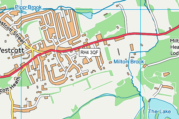
Surrey Hills All Saints Primary School is located in Dorking and falls under the local authority of Surrey. The school's religious denomination is Church of England. This mixed-sex primary school has 153 pupils, with a capacity of 250, aged from four up to eleven, and the type of establishment is academy sponsor led. The most recend Ofsted inspection was 22nd March 2023 resulting in an requires improvement rating.
| Address | Surrey Hills All Saints Primary School School Lane Westcott Dorking RH4 3QF |
| Website | http://www.surreyhillsprimaryschool.org.uk |
| Headteacher | Mrs Jacky Fyson |
GetTheData
Source: Get Information About Schools
Licence: Open Government Licence
| Phase of Education | Primary |
| Type of Establishment | Academy sponsor led |
| Admissions Policy | Not applicable |
| Statutory Low Age | 4 |
| Statutory High Age | 11 |
| Boarders | Not applicable |
| Official Sixth Form | Does not have a sixth form |
| Gender | Mixed |
| Religious Character | Church of England |
| Diocese | Diocese of Guildford |
| Special Classes | No Special Classes |
GetTheData
Source: Get Information About Schools
Licence: Open Government Licence
| Census Date | 19th January 2023 | |
| School Capacity | 250 | |
| Number of Pupils | 153 | 61% capacity |
| Number of Boys | 85 | 56% |
| Number of Girls | 68 | 44% |
| Free School Meals (%) | 15.70% |
GetTheData
Source: Get Information About Schools
Licence: Open Government Licence
| Street Address | School Lane |
| Address 3 | Westcott |
| Town | Dorking |
| Postcode | RH4 3QF |
| ➜ More RH4 3QF open data | |
GetTheData
Source: Get Information About Schools
Licence: Open Government Licence

GetTheData
Source: OS VectorMap District (Ordnance Survey)
Licence: Open Government Licence (requires attribution)
| Ofsted Last Inspection | 22nd March 2023 |
| Ofsted Rating | Requires improvement |
| Ofsted Special Measures | Not applicable |
GetTheData
Source: Get Information About Schools
Licence: Open Government Licence
| Establishment Name | Surrey Hills All Saints Primary School |
| Establishment Number | 2042 |
| Unique Reference Number | 146438 |
| Local Authority | Surrey |
| Local Authority Code | 936 |
| Previous Local Authority Code | 999 |
| Government Statistical Service Local Authority Code | E10000030 |
| Government Office Region | South East |
| District | Mole Valley |
| District Code | E07000210 |
| Ward | Mickleham, Westcott & Okewood |
| Parliamentary Constituency | Mole Valley |
| Urban/Rural Description | (England/Wales) Rural town and fringe |
| Middle Super Output Area | Mole Valley 012 |
| Lower Super Output Area | Mole Valley 012D |
GetTheData
Source: Get Information About Schools
Licence: Open Government Licence
| Establishment Status | Open |
| Last Changed Date | 20th November 2023 |
| Reason Establishment Opened | New Provision |
| Open Date | 1st December 2018 |
GetTheData
Source: Get Information About Schools
Licence: Open Government Licence
| Teenage Mothers | Not applicable |
| Special Educational Needs (SEN) Provision in Primary Care Unit | Not applicable |
| Pupil Referral Unit (PRU) Provides for Educational and Behavioural Difficulties (EBD) | Not applicable |
GetTheData
Source: Get Information About Schools
Licence: Open Government Licence
| Section 41 Approved | Not applicable |
GetTheData
Source: Get Information About Schools
Licence: Open Government Licence
| Trust flag | Supported by a multi-academy trust |
| Trust | THE GOOD SHEPHERD TRUST |
| School Sponsor flag | Linked to a sponsor |
| School Sponsor | The Good Shepherd Trust |
GetTheData
Source: Get Information About Schools
Licence: Open Government Licence
| Federation flag | Not applicable |
GetTheData
Source: Get Information About Schools
Licence: Open Government Licence
| UK Provider Reference Number | 10081198 |
GetTheData
Source: Get Information About Schools
Licence: Open Government Licence
| Easting | 514601 |
| Northing | 148521 |
| Latitude | 51.22439 |
| Longitude | -0.36025 |
GetTheData
Source: Get Information About Schools
Licence: Open Government Licence
| School | Phase of Education | Distance |
|---|---|---|
| Powell Corderoy Primary School Longfield Road, Dorking, RH4 3DF | Primary | 1.1km |
| The Priory CofE Voluntary Aided School West Bank, Dorking, RH4 3DG | Secondary | 1.3km |
| St Joseph's Catholic Primary School Norfolk Road, Dorking, RH4 3JA | Primary | 1.7km |
| Dorking Nursery School West Street, Dorking, RH4 1BY | Nursery | 1.8km |
| St Martin's CofE Controlled Primary School, Dorking St Martin's Cof E Controlled Primary School,Ranmore Road, Dorking, RH4 1HW | Primary | 2.1km |
| St Paul's CofE (Aided) Primary School St Paul's Road West, Dorking, RH4 2HS | Primary | 2.3km |
| St John's Church of England Primary School Goodwyns Road, Dorking, RH4 2LR | Primary | 2.5km |
| The Ashcombe School Ashcombe Road, Dorking, RH4 1LY | Secondary | 2.7km |
| Unified Academy Chart Lane South, Dorking, RH5 4DB | Not applicable | 2.9km |
| St Teresa's School Effingham Hill, Dorking, RH5 6ST | Not applicable | 3.7km |
GetTheData
Source: Get Information About Schools
Licence: Open Government Licence