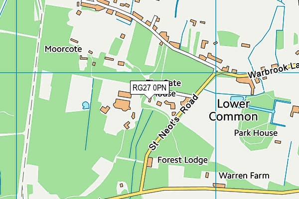
St Neot's School is located in Eversley, Hook and falls under the local authority of Hampshire. This mixed-sex school has 283 pupils, with a capacity of 359, aged from two up to thirteen, and the type of establishment is other independent school.
| Address | St Neot's School St Neot's Road Eversley Hook Hampshire RG27 0PN |
| Website | http://www.stneotsprep.co.uk |
| Headteacher | Mr Jonathan Slot |
GetTheData
Source: Get Information About Schools
Licence: Open Government Licence
| Phase of Education | Not applicable |
| Type of Establishment | Other independent school |
| Admissions Policy | Non-selective |
| Statutory Low Age | 2 |
| Statutory High Age | 13 |
| Boarders | No boarders |
| Boarding Establishment | Does not have boarders |
| Official Sixth Form | Does not have a sixth form |
| Gender | Mixed |
| Religious Character | None |
| Diocese | Not applicable |
| Special Classes | No Special Classes |
GetTheData
Source: Get Information About Schools
Licence: Open Government Licence
| Census Date | 20th January 2022 | |
| School Capacity | 359 | |
| Number of Pupils | 283 | 79% capacity |
| Number of Boys | 147 | 52% |
| Number of Girls | 136 | 48% |
| Free School Meals (%) | 0.0% |
GetTheData
Source: Get Information About Schools
Licence: Open Government Licence
| Street Address | St Neot's Road |
| Locality | Eversley |
| Town | Hook |
| County | Hampshire |
| Postcode | RG27 0PN |
| ➜ More RG27 0PN open data | |
GetTheData
Source: Get Information About Schools
Licence: Open Government Licence

GetTheData
Source: OS VectorMap District (Ordnance Survey)
Licence: Open Government Licence (requires attribution)
| Ofsted Special Measures | Not applicable |
GetTheData
Source: Get Information About Schools
Licence: Open Government Licence
| Establishment Name | St Neot's School |
| Establishment Number | 6019 |
| Previous Establishment Number | 6008 |
| Unique Reference Number | 116516 |
| Local Authority | Hampshire |
| Local Authority Code | 850 |
| Previous Local Authority | Pre LGR (1997) Hampshire |
| Previous Local Authority Code | 917 |
| Government Statistical Service Local Authority Code | E10000014 |
| Government Office Region | South East |
| District | Hart |
| District Code | E07000089 |
| Ward | Hartley Wintney |
| Parliamentary Constituency | North East Hampshire |
| Urban/Rural Description | (England/Wales) Rural hamlet and isolated dwellings |
| Middle Super Output Area | Hart 002 |
| Lower Super Output Area | Hart 002A |
GetTheData
Source: Get Information About Schools
Licence: Open Government Licence
| Establishment Status | Open |
| Last Changed Date | 28th November 2023 |
| Reason Establishment Opened | Not applicable |
| Open Date | 1st January 1932 |
| Reason Establishment Closed | Not applicable |
GetTheData
Source: Get Information About Schools
Licence: Open Government Licence
| Teenage Mothers | Not applicable |
| Child Care Facilities | Not applicable |
| Special Educational Needs (SEN) Provision in Primary Care Unit | Not applicable |
| Pupil Referral Unit (PRU) Provides for Educational and Behavioural Difficulties (EBD) | Not applicable |
| Pupil Referral Unit (PRU) Offers Tuition by Another Provider | Not applicable |
GetTheData
Source: Get Information About Schools
Licence: Open Government Licence
| Section 41 Approved | Not approved |
GetTheData
Source: Get Information About Schools
Licence: Open Government Licence
| Trust flag | Not applicable |
| School Sponsor flag | Not applicable |
GetTheData
Source: Get Information About Schools
Licence: Open Government Licence
| Federation flag | Not applicable |
GetTheData
Source: Get Information About Schools
Licence: Open Government Licence
| UK Provider Reference Number | 10018818 |
| Further Education Type | Not applicable |
GetTheData
Source: Get Information About Schools
Licence: Open Government Licence
| Easting | 476532 |
| Northing | 161852 |
| Latitude | 51.35061 |
| Longitude | -0.90243 |
GetTheData
Source: Get Information About Schools
Licence: Open Government Licence
| School | Phase of Education | Distance |
|---|---|---|
| Charles Kingsley's Church of England Primary School Glaston Hill Road, Eversley, Hook, RG27 0LX | Primary | 1.8km |
| Farley Hill Primary School Baston Road, Arborfield Green, RG2 9YW | Primary | 2.6km |
| Finchampstead CofE VA Primary School The Village, Finchampstead, Wokingham, RG40 4JR | Primary | 2.9km |
| Bohunt School Wokingham Remount Drive, Arborfield, Wokingham, RG2 9GB | Secondary | 3.3km |
| Gorse Ride Junior School Gorse Ride South, Finchampstead, Wokingham, RG40 4JJ | Primary | 4.2km |
| Gorse Ride Infants' School Gorse Ride South, Finchampstead, Wokingham, RG40 4EH | Primary | 4.3km |
| Nine Mile Ride Primary School 430 Finchampstead Road, Finchampstead, Wokingham, RG40 3RB | Primary | 4.3km |
| Westfields Infant School School Lane, Yateley, GU46 6NN | Primary | 4.5km |
| Westfields Junior School School Lane, Yateley, GU46 6NN | Primary | 4.5km |
| Yateley School School Lane, Yateley, GU46 6NW | Secondary | 4.8km |
GetTheData
Source: Get Information About Schools
Licence: Open Government Licence