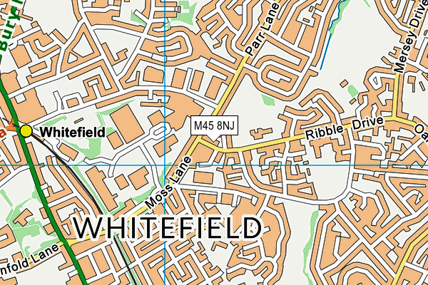
| Address | Ribble Drive Whitefield Manchester Lancashire M45 8NJ |
| Website | http://www.stmichaels.stoccat.org.uk |
| Headteacher | Mrs Patricia Grogan |
GetTheData
Source: Get Information About Schools
Licence: Open Government Licence
| Phase of Education | Primary |
| Type of Establishment | Academy sponsor led |
| Admissions Policy | Not applicable |
| Statutory Low Age | 3 |
| Statutory High Age | 11 |
| Boarders | No boarders |
| Official Sixth Form | Does not have a sixth form |
| Gender | Mixed |
| Religious Character | Roman Catholic |
| Diocese | Diocese of Salford |
| Special Classes | No Special Classes |
GetTheData
Source: Get Information About Schools
Licence: Open Government Licence
| School Capacity | 236 |
GetTheData
Source: Get Information About Schools
Licence: Open Government Licence
| Street Address | Ribble Drive |
| Locality | Whitefield |
| Town | Manchester |
| County | Lancashire |
| Postcode | M45 8NJ |
| ➜ More M45 8NJ open data | |
GetTheData
Source: Get Information About Schools
Licence: Open Government Licence

GetTheData
Source: OS VectorMap District (Ordnance Survey)
Licence: Open Government Licence (requires attribution)
| Ofsted Special Measures | Not applicable |
GetTheData
Source: Get Information About Schools
Licence: Open Government Licence
| Establishment Number | 2018 |
| Unique Reference Number | 149679 |
| Local Authority | Bury |
| Local Authority Code | 351 |
| Previous Local Authority Code | 999 |
| Government Statistical Service Local Authority Code | E08000002 |
| Government Office Region | North West |
| District | Bury |
| District Code | E08000002 |
| Ward | Besses |
| Parliamentary Constituency | Bury South |
| Urban/Rural Description | (England/Wales) Urban major conurbation |
| Middle Super Output Area | Bury 021 |
| Lower Super Output Area | Bury 021B |
GetTheData
Source: Get Information About Schools
Licence: Open Government Licence
| Establishment Status | Open |
| Last Changed Date | 27th November 2023 |
| Reason Establishment Opened | New Provision |
| Open Date | 1st April 2023 |
GetTheData
Source: Get Information About Schools
Licence: Open Government Licence
| Teenage Mothers | Not applicable |
| Special Educational Needs (SEN) Provision in Primary Care Unit | Not applicable |
| Pupil Referral Unit (PRU) Provides for Educational and Behavioural Difficulties (EBD) | Not applicable |
GetTheData
Source: Get Information About Schools
Licence: Open Government Licence
| Section 41 Approved | Not applicable |
GetTheData
Source: Get Information About Schools
Licence: Open Government Licence
| Trust flag | Supported by a multi-academy trust |
| Trust | ST TERESA OF CALCUTTA CATHOLIC ACADEMY TRUST |
| School Sponsor flag | Linked to a sponsor |
| School Sponsor | St Teresa Of Calcutta Catholic Academy Trust |
GetTheData
Source: Get Information About Schools
Licence: Open Government Licence
| Federation flag | Not applicable |
GetTheData
Source: Get Information About Schools
Licence: Open Government Licence
| UK Provider Reference Number | 10092128 |
GetTheData
Source: Get Information About Schools
Licence: Open Government Licence
| Easting | 381540 |
| Northing | 406036 |
| Latitude | 53.55063 |
| Longitude | -2.28009 |
GetTheData
Source: Get Information About Schools
Licence: Open Government Licence
| School | Phase of Education | Distance |
|---|---|---|
| Ribble Drive Community Primary School Ribble Drive, Whitefield, Bury, Manchester, M45 8TD | Primary | 227m |
| Whitefield Community Primary School Victoria Avenue, Whitefield, Manchester, M45 6DP | Primary | 565m |
| Unsworth Primary School Blackley Close, Unsworth, Bury, BL9 8LY | Primary | 761m |
| All Saints Church of England Primary School, Stand Rufford Drive, Whitefield, Manchester, M45 8PL | Primary | 807m |
| Mersey Drive Community Primary School Mersey Drive, Whitefield, Manchester, M45 8LN | Primary | 849m |
| Elms Bank Ripon Avenue, Whitefield, Bury, M45 8PJ | Not applicable | 1km |
| Bury and Whitefield Jewish Primary School Parr Lane, Unsworth, Bury, BL9 8JT | Primary | 1.1km |
| St Margaret's Church of England Primary School Heywood Road, Prestwich, Manchester, M25 2BW | Primary | 1.1km |
| Higher Lane Primary School Egerton Road, Whitefield, Manchester, M45 7EX | Primary | 1.1km |
| St Bernadette's Roman Catholic Primary School, Whitefield Abingdon Avenue, Whitefield, Manchester, M45 8PT | Primary | 1.2km |
GetTheData
Source: Get Information About Schools
Licence: Open Government Licence