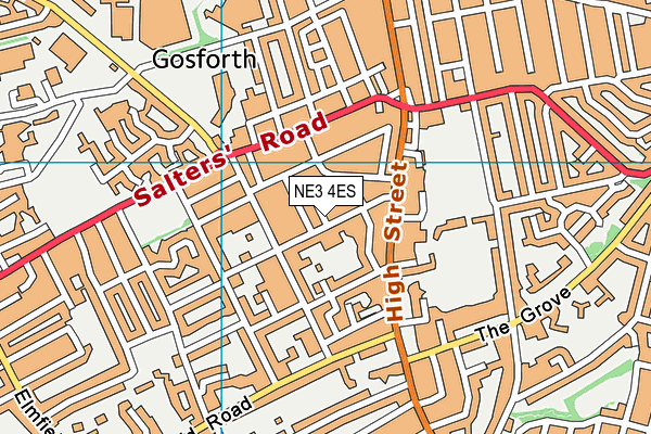
Newcastle School for Boys is located in Newcastle-upon-Tyne and falls under the local authority of Newcastle upon Tyne. This boys only school has 373 pupils, with a capacity of 433, aged from two up to eighteen, and the type of establishment is other independent school.
| Address | Newcastle School for Boys 30 West Avenue Newcastle-upon-Tyne Tyne and Wear NE3 4ES |
| Website | https://newcastleschool.co.uk |
| Headmaster | Mr David Tickner |
GetTheData
Source: Get Information About Schools
Licence: Open Government Licence
| Phase of Education | Not applicable |
| Type of Establishment | Other independent school |
| Admissions Policy | Selective |
| Statutory Low Age | 2 |
| Statutory High Age | 18 |
| Boarders | No boarders |
| Boarding Establishment | Does not have boarders |
| Official Sixth Form | Has a sixth form |
| Gender | Boys |
| Religious Character | None |
| Diocese | Not applicable |
| Special Classes | No Special Classes |
GetTheData
Source: Get Information About Schools
Licence: Open Government Licence
| Census Date | 20th January 2022 | |
| School Capacity | 433 | |
| Number of Pupils | 373 | 86% capacity |
| Number of Boys | 373 |
GetTheData
Source: Get Information About Schools
Licence: Open Government Licence
| Street Address | 30 West Avenue |
| Town | Newcastle-upon-Tyne |
| County | Tyne and Wear |
| Postcode | NE3 4ES |
| ➜ More NE3 4ES open data | |
GetTheData
Source: Get Information About Schools
Licence: Open Government Licence

GetTheData
Source: OS VectorMap District (Ordnance Survey)
Licence: Open Government Licence (requires attribution)
| Ofsted Special Measures | Not applicable |
GetTheData
Source: Get Information About Schools
Licence: Open Government Licence
| Establishment Name | Newcastle School for Boys |
| Establishment Number | 6014 |
| Unique Reference Number | 108544 |
| Local Authority | Newcastle upon Tyne |
| Local Authority Code | 391 |
| Previous Local Authority Code | 999 |
| Government Statistical Service Local Authority Code | E08000021 |
| Government Office Region | North East |
| District | Newcastle upon Tyne |
| District Code | E08000021 |
| Ward | Gosforth |
| Parliamentary Constituency | Newcastle upon Tyne Central |
| Urban/Rural Description | (England/Wales) Urban major conurbation |
| Middle Super Output Area | Newcastle upon Tyne 006 |
| Lower Super Output Area | Newcastle upon Tyne 006E |
GetTheData
Source: Get Information About Schools
Licence: Open Government Licence
| Establishment Status | Open |
| Last Changed Date | 28th November 2023 |
| Reason Establishment Opened | Not applicable |
| Open Date | 1st January 1956 |
| Reason Establishment Closed | Not applicable |
GetTheData
Source: Get Information About Schools
Licence: Open Government Licence
| Teenage Mothers | Not applicable |
| Child Care Facilities | Not applicable |
| Special Educational Needs (SEN) Provision in Primary Care Unit | Not applicable |
| Pupil Referral Unit (PRU) Provides for Educational and Behavioural Difficulties (EBD) | Not applicable |
| Pupil Referral Unit (PRU) Offers Tuition by Another Provider | Not applicable |
GetTheData
Source: Get Information About Schools
Licence: Open Government Licence
| Section 41 Approved | Not approved |
GetTheData
Source: Get Information About Schools
Licence: Open Government Licence
| Trust flag | Not applicable |
| School Sponsor flag | Not applicable |
GetTheData
Source: Get Information About Schools
Licence: Open Government Licence
| Federation flag | Not applicable |
GetTheData
Source: Get Information About Schools
Licence: Open Government Licence
| UK Provider Reference Number | 10018791 |
| Further Education Type | Not applicable |
GetTheData
Source: Get Information About Schools
Licence: Open Government Licence
| Easting | 424144 |
| Northing | 567827 |
| Latitude | 55.00443 |
| Longitude | -1.62407 |
GetTheData
Source: Get Information About Schools
Licence: Open Government Licence
| School | Phase of Education | Distance |
|---|---|---|
| Archibald First School Archibald Street, Gosforth, Newcastle-upon-Tyne, NE3 1EB | Primary | 313m |
| Gosforth Junior High Academy Regent Avenue, Gosforth, Newcastle-upon-Tyne, NE3 1EE | Middle deemed secondary | 464m |
| Westfield School Oakfield Road, Gosforth, Newcastle-upon-Tyne, NE3 4HS | Not applicable | 636m |
| NHS England (Choices College) The Grainger Suite, Dobson House, Regent Centre, Newcastle-upon-Tyne, NE3 3PF | Not applicable | 753m |
| Gosforth Central Middle School Great North Road, Gosforth, Newcastle-upon-Tyne, NE3 1UN | Middle deemed secondary | 781m |
| St Charles' Catholic Primary School Regent Farm Road, Gosforth, Newcastle-upon-Tyne, NE3 3HE | Primary | 839m |
| Gosforth Academy Knightsbridge, Great North Road, Gosforth, Newcastle-upon-Tyne, NE3 2JH | Secondary | 961m |
| Great Park Academy Knightsbridge, Great North Road, Gosforth, Newcastle-upon-Tyne, NE3 2JH | Middle deemed secondary | 972m |
| South Gosforth First School Alnmouth Drive, South Gosforth, Newcastle-upon-Tyne, NE3 1YF | Primary | 1km |
| Grange First School Norham Road, Gosforth, Newcastle-upon-Tyne, NE3 2NP | Primary | 1.1km |
GetTheData
Source: Get Information About Schools
Licence: Open Government Licence