Merryfields School is located in Newcastle and falls under the local authority of Staffordshire. This mixed-sex school has 108 pupils aged from two up to eleven, and the type of establishment is academy special converter. The most recend Ofsted inspection was 15th January 2020 resulting in an good rating.
| Address | Merryfields School Hoon Avenue Newcastle Staffordshire ST5 9NY |
| Website | http://merryfields.manorhall.academy |
| Headteacher | Mr Neil Brannigan |
GetTheData
Source: Get Information About Schools
Licence: Open Government Licence
| Phase of Education | Not applicable |
| Type of Establishment | Academy special converter |
| Admissions Policy | Not applicable |
| Statutory Low Age | 2 |
| Statutory High Age | 11 |
| Boarders | No boarders |
| Official Sixth Form | Not applicable |
| Gender | Mixed |
| Religious Character | Does not apply |
| Diocese | Not applicable |
| Special Classes | Has Special Classes |
GetTheData
Source: Get Information About Schools
Licence: Open Government Licence
| Census Date | 19th January 2023 | |
| Number of Pupils | 108 | |
| Number of Boys | 88 | 81% |
| Number of Girls | 20 | 19% |
| Free School Meals (%) | 36.10% |
GetTheData
Source: Get Information About Schools
Licence: Open Government Licence
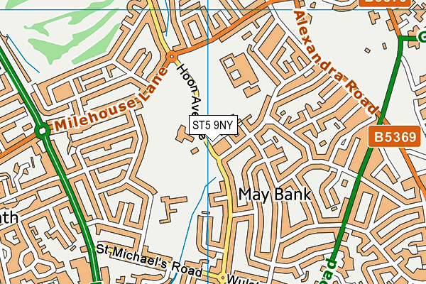
| Street Address | Hoon Avenue |
| Town | Newcastle |
| County | Staffordshire |
| Postcode | ST5 9NY |
| ➜ More ST5 9NY open data | |
GetTheData
Source: Get Information About Schools
Licence: Open Government Licence

GetTheData
Source: OS VectorMap District (Ordnance Survey)
Licence: Open Government Licence (requires attribution)
| Ofsted Last Inspection | 15th January 2020 |
| Ofsted Rating | Good |
| Ofsted Special Measures | Not applicable |
GetTheData
Source: Get Information About Schools
Licence: Open Government Licence
| Establishment Name | Merryfields School |
| Establishment Number | 7038 |
| Unique Reference Number | 143897 |
| Local Authority | Staffordshire |
| Local Authority Code | 860 |
| Previous Local Authority | Pre LGR (1997) Staffordshire |
| Previous Local Authority Code | 934 |
| Government Statistical Service Local Authority Code | E10000028 |
| Government Office Region | West Midlands |
| District | Newcastle-under-Lyme |
| District Code | E07000195 |
| Ward | May Bank |
| Parliamentary Constituency | Newcastle-under-Lyme |
| Urban/Rural Description | (England/Wales) Urban city and town |
| Middle Super Output Area | Newcastle-under-Lyme 009 |
| Lower Super Output Area | Newcastle-under-Lyme 009E |
GetTheData
Source: Get Information About Schools
Licence: Open Government Licence
| Establishment Status | Open |
| Last Changed Date | 15th January 2024 |
| Reason Establishment Opened | Academy Converter |
| Open Date | 1st February 2017 |
GetTheData
Source: Get Information About Schools
Licence: Open Government Licence
| Teenage Mothers | Not applicable |
| Child Care Facilities | Not applicable |
| Special Educational Needs (SEN) Provision in Primary Care Unit | Not applicable |
| Pupil Referral Unit (PRU) Provides for Educational and Behavioural Difficulties (EBD) | Not applicable |
| Pupil Referral Unit (PRU) Offers Tuition by Another Provider | Not applicable |
GetTheData
Source: Get Information About Schools
Licence: Open Government Licence
| Section 41 Approved | Not applicable |
| Special Educational Needs (SEN) Priority 1 | SLD - Severe Learning Difficulty |
GetTheData
Source: Get Information About Schools
Licence: Open Government Licence
| Trust flag | Supported by a multi-academy trust |
| Trust | MANOR HALL ACADEMY TRUST |
| School Sponsor flag | Linked to a sponsor |
| School Sponsor | Manor Hall Academy Trust |
GetTheData
Source: Get Information About Schools
Licence: Open Government Licence
| Federation flag | Not applicable |
GetTheData
Source: Get Information About Schools
Licence: Open Government Licence
| UK Provider Reference Number | 10062423 |
| Further Education Type | Not applicable |
GetTheData
Source: Get Information About Schools
Licence: Open Government Licence
| Easting | 384920 |
| Northing | 347565 |
| Latitude | 53.02516 |
| Longitude | -2.22628 |
GetTheData
Source: Get Information About Schools
Licence: Open Government Licence
| School | Phase of Education | Distance |
|---|---|---|
| Hempstalls Primary School Collard Avenue, Cross Heath, Newcastle, ST5 9LH | Primary | 265m |
| The Orme Academy Milehouse Lane, Newcastle, ST5 9JU | Secondary | 305m |
| St Margaret's CofE (VC) Junior School Knutton Road, Wolstanton, Newcastle, ST5 0HU | Primary | 784m |
| May Bank Infants' School Basford Park Road, May Bank, Newcastle, ST5 0PT | Primary | 798m |
| St Wulstan's Catholic Primary School Church Lane, Wolstanton, Newcastle, ST5 0EF | Primary | 917m |
| Cedars - Newcastle, Moorlands and Darwin Bases High Street, Knutton, Newcastle-under-Lyme, ST5 6BX | Not applicable | 1km |
| Ellison Primary Academy Ellison Street, Wolstanton, Newcastle, ST5 0BL | Primary | 1.1km |
| St John Fisher Catholic College Ashfields New Road, Newcastle Under Lyme, ST5 2SJ | Secondary | 1.2km |
| Oaklands Nursery School Oaklands Avenue, Porthill, Newcastle, ST5 0EX | Nursery | 1.3km |
| Kaleidoscope School Porthill Lodge, High Street, Wolstanton, Newcastle-Under-Lyme, ST5 0EZ | Not applicable | 1.3km |
GetTheData
Source: Get Information About Schools
Licence: Open Government Licence