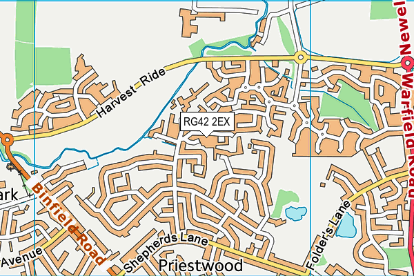
Kennel Lane School is located in Bracknell and falls under the local authority of Bracknell Forest. This mixed-sex school has 198 pupils, with a capacity of 198, aged from three up to nineteen, and the type of establishment is community special school. The most recend Ofsted inspection was 25th April 2019 resulting in an good rating.
| Address | Kennel Lane School Kennel Lane Bracknell Berkshire RG42 2EX |
| Website | http://www.kennellaneschool.com |
| Headteacher | Ms Jennifer Baker (Gibson) |
GetTheData
Source: Get Information About Schools
Licence: Open Government Licence
| Phase of Education | Not applicable |
| Type of Establishment | Community special school |
| Admissions Policy | Not applicable |
| Statutory Low Age | 3 |
| Statutory High Age | 19 |
| Boarders | No boarders |
| Official Sixth Form | Has a sixth form |
| Gender | Mixed |
| Religious Character | Does not apply |
| Diocese | Not applicable |
| Special Classes | Has Special Classes |
GetTheData
Source: Get Information About Schools
Licence: Open Government Licence
| Census Date | 19th January 2023 | |
| School Capacity | 198 | |
| Number of Pupils | 198 | 100% capacity |
| Number of Boys | 146 | 74% |
| Number of Girls | 52 | 26% |
| Free School Meals (%) | 37.40% |
GetTheData
Source: Get Information About Schools
Licence: Open Government Licence
| Street Address | Kennel Lane |
| Town | Bracknell |
| County | Berkshire |
| Postcode | RG42 2EX |
| ➜ More RG42 2EX open data | |
GetTheData
Source: Get Information About Schools
Licence: Open Government Licence

GetTheData
Source: OS VectorMap District (Ordnance Survey)
Licence: Open Government Licence (requires attribution)
| Ofsted Last Inspection | 25th April 2019 |
| Ofsted Rating | Good |
| Ofsted Special Measures | Not applicable |
GetTheData
Source: Get Information About Schools
Licence: Open Government Licence
| Establishment Name | Kennel Lane School |
| Establishment Number | 7032 |
| Previous Establishment Number | 7032 |
| Unique Reference Number | 110190 |
| Local Authority | Bracknell Forest |
| Local Authority Code | 867 |
| Previous Local Authority | Pre LGR (1998) Berkshire |
| Previous Local Authority Code | 903 |
| Government Statistical Service Local Authority Code | E06000036 |
| Government Office Region | South East |
| District | Bracknell Forest |
| District Code | E06000036 |
| Ward | Priestwood & Garth |
| Parliamentary Constituency | Windsor |
| Urban/Rural Description | (England/Wales) Urban city and town |
| Middle Super Output Area | Bracknell Forest 003 |
| Lower Super Output Area | Bracknell Forest 003F |
GetTheData
Source: Get Information About Schools
Licence: Open Government Licence
| Establishment Status | Open |
| Last Changed Date | 10th January 2024 |
| Reason Establishment Opened | Not applicable |
GetTheData
Source: Get Information About Schools
Licence: Open Government Licence
| Teenage Mothers | Not applicable |
| Child Care Facilities | Not applicable |
| Special Educational Needs (SEN) Provision in Primary Care Unit | Not applicable |
| Pupil Referral Unit (PRU) Provides for Educational and Behavioural Difficulties (EBD) | Not applicable |
| Pupil Referral Unit (PRU) Offers Tuition by Another Provider | Not applicable |
GetTheData
Source: Get Information About Schools
Licence: Open Government Licence
| Section 41 Approved | Not applicable |
| Special Educational Needs (SEN) Priority 1 | ASD - Autistic Spectrum Disorder |
| Special Educational Needs (SEN) Priority 2 | PD - Physical Disability |
| Special Educational Needs (SEN) Priority 3 | MLD - Moderate Learning Difficulty |
GetTheData
Source: Get Information About Schools
Licence: Open Government Licence
| Trust flag | Not applicable |
| School Sponsor flag | Not applicable |
GetTheData
Source: Get Information About Schools
Licence: Open Government Licence
| Federation flag | Not under a federation |
GetTheData
Source: Get Information About Schools
Licence: Open Government Licence
| UK Provider Reference Number | 10016331 |
| Further Education Type | Not applicable |
GetTheData
Source: Get Information About Schools
Licence: Open Government Licence
| Easting | 486558 |
| Northing | 170641 |
| Latitude | 51.42817 |
| Longitude | -0.75635 |
GetTheData
Source: Get Information About Schools
Licence: Open Government Licence
| School | Phase of Education | Distance |
|---|---|---|
| Warfield Church of England Primary School Sopwith Road, Bracknell, RG42 6BR | Primary | 533m |
| Sandy Lane Primary School Sandy Lane, Bracknell, RG12 2JG | Primary | 806m |
| Meadow Vale Primary School Moordale Avenue, Bracknell, RG42 1SY | Primary | 1km |
| Garth Hill College Bull Lane, Bracknell, RG42 2AD | Secondary | 1.1km |
| King's Academy Binfield St. Georges Park, Binfield, Bracknell, RG42 4FS | All-through | 1.6km |
| St Joseph's Catholic Primary School, Bracknell Gipsy Lane, Bracknell Forest, RG12 9AP | Primary | 1.9km |
| Ranelagh School Ranelagh Drive, Bracknell, RG12 9DA | Secondary | 2km |
| Newbold School Popeswood Rd, Binfield, Berks, RG42 4AH | Not applicable | 2.1km |
| Holly Spring Primary School Lily Hill Road, Bracknell, RG12 2SW | Primary | 2.1km |
| Cressex Lodge School Cressex Lodge, Terrace Road South, Binfield, Reading, RG42 4DE | Not applicable | 2.2km |
GetTheData
Source: Get Information About Schools
Licence: Open Government Licence