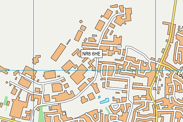
Include School Norfolk is located in Airport Industrial Estate, Norfolk and falls under the local authority of Norfolk. This mixed-sex school has 83 pupils, with a capacity of 117, aged from fourteen up to sixteen, and the type of establishment is other independent school. The most recend Ofsted inspection was 18th May 2023 resulting in an good rating.
| Address | Include School Norfolk 27 Hurricane Way Airport Industrial Estate Norwich Norfolk NR6 6HE |
| Website | https://www.includenorfolk.org.uk/ |
| Headteacher | Mr Jamie Nielsen |
GetTheData
Source: Get Information About Schools
Licence: Open Government Licence
| Phase of Education | Not applicable |
| Type of Establishment | Other independent school |
| Admissions Policy | Selective |
| Statutory Low Age | 14 |
| Statutory High Age | 16 |
| Boarders | No boarders |
| Boarding Establishment | Does not have boarders |
| Official Sixth Form | Does not have a sixth form |
| Gender | Mixed |
| Religious Character | None |
| Diocese | Not applicable |
| Special Classes | Not applicable |
GetTheData
Source: Get Information About Schools
Licence: Open Government Licence
| Census Date | 20th January 2022 | |
| School Capacity | 117 | |
| Number of Pupils | 83 | 71% capacity |
| Number of Boys | 49 | 59% |
| Number of Girls | 34 | 41% |
| Free School Meals (%) | 0.00% |
GetTheData
Source: Get Information About Schools
Licence: Open Government Licence
| Street Address | 27 Hurricane Way |
| Locality | Airport Industrial Estate |
| Address 3 | Norwich |
| Town | Norfolk |
| Postcode | NR6 6HE |
| ➜ More NR6 6HE open data | |
GetTheData
Source: Get Information About Schools
Licence: Open Government Licence

GetTheData
Source: OS VectorMap District (Ordnance Survey)
Licence: Open Government Licence (requires attribution)
| Ofsted Last Inspection | 18th May 2023 |
| Ofsted Rating | Good |
| Ofsted Special Measures | Not applicable |
GetTheData
Source: Get Information About Schools
Licence: Open Government Licence
| Establishment Name | Include School Norfolk |
| Establishment Number | 6150 |
| Unique Reference Number | 134440 |
| Local Authority | Norfolk |
| Local Authority Code | 926 |
| Previous Local Authority Code | 999 |
| Government Statistical Service Local Authority Code | E10000020 |
| Government Office Region | East of England |
| District | Norwich |
| District Code | E07000148 |
| Ward | Catton Grove |
| Parliamentary Constituency | Norwich North |
| Urban/Rural Description | (England/Wales) Urban city and town |
| Middle Super Output Area | Norwich 001 |
| Lower Super Output Area | Norwich 001A |
GetTheData
Source: Get Information About Schools
Licence: Open Government Licence
| Establishment Status | Open |
| Last Changed Date | 30th November 2023 |
| Reason Establishment Opened | New Provision |
| Open Date | 29th August 2003 |
| Reason Establishment Closed | Not applicable |
GetTheData
Source: Get Information About Schools
Licence: Open Government Licence
| Teenage Mothers | Not applicable |
| Child Care Facilities | Not applicable |
| Special Educational Needs (SEN) Provision in Primary Care Unit | Not applicable |
| Pupil Referral Unit (PRU) Provides for Educational and Behavioural Difficulties (EBD) | Not applicable |
| Pupil Referral Unit (PRU) Offers Tuition by Another Provider | Not applicable |
GetTheData
Source: Get Information About Schools
Licence: Open Government Licence
| Section 41 Approved | Not approved |
GetTheData
Source: Get Information About Schools
Licence: Open Government Licence
| Trust flag | Not applicable |
| School Sponsor flag | Not applicable |
GetTheData
Source: Get Information About Schools
Licence: Open Government Licence
| Federation flag | Not applicable |
GetTheData
Source: Get Information About Schools
Licence: Open Government Licence
| UK Provider Reference Number | 10043899 |
| Further Education Type | Not applicable |
GetTheData
Source: Get Information About Schools
Licence: Open Government Licence
| Easting | 622425 |
| Northing | 312881 |
| Latitude | 52.66797 |
| Longitude | 1.28808 |
GetTheData
Source: Get Information About Schools
Licence: Open Government Licence
| School | Phase of Education | Distance |
|---|---|---|
| Garrick Green Infant School Garrick Green, Old Catton, Norwich, NR6 7AL | Primary | 802m |
| Hall School St Faith's Road, Old Catton, Norwich, NR6 7AD | Not applicable | 946m |
| Lodge Lane Infant School Lodge Lane, Old Catton, Norwich, NR6 7HL | Primary | 960m |
| Old Catton CofE VC Junior School Church Street, Old Catton, Norwich, NR6 7DS | Primary | 1.1km |
| Firside Junior School Firside Junior School, Middletons Lane, Norwich, NR6 5NF | Primary | 1.2km |
| Heather Avenue Infant School Heather Avenue, Hellesdon, Norwich, NR6 6LT | Primary | 1.3km |
| Catton Grove Primary School Weston Road, Norwich, NR3 3TP | Primary | 1.5km |
| White Woman Lane Junior School White Woman Lane, Sprowston, Norwich, NR6 7JA | Primary | 1.5km |
| Mile Cross Primary School Braiser Road, Mile Cross, Norwich, NR3 2QU | Primary | 2.1km |
| Kinsale Infant School Kinsale Avenue, Hellesdon, Norwich, NR6 5SG | Primary | 2.1km |
GetTheData
Source: Get Information About Schools
Licence: Open Government Licence