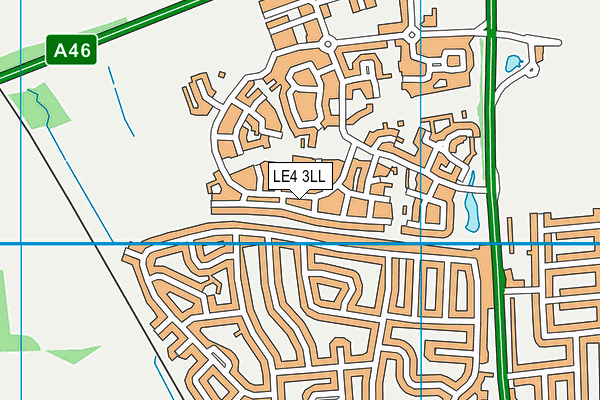
Hallam Fields, Birstall is located in Birstall, Leicester and falls under the local authority of Leicestershire. The school's religious denomination is Multi-faith. This mixed-sex primary school has 168 pupils, with a capacity of 210, aged from four up to eleven, and the type of establishment is free schools. The most recend Ofsted inspection was 13th January 2022 resulting in an requires improvement rating.
| Address | Hallam Fields, Birstall Long Meadow Way Birstall Leicester Leicestershire LE4 3LL |
| Headteacher | Mrs Ifat Sultana |
GetTheData
Source: Get Information About Schools
Licence: Open Government Licence
| Phase of Education | Primary |
| Type of Establishment | Free schools |
| Statutory Low Age | 4 |
| Statutory High Age | 11 |
| Official Sixth Form | Does not have a sixth form |
| Gender | Mixed |
| Religious Character | Multi-faith |
| Special Classes | Not applicable |
GetTheData
Source: Get Information About Schools
Licence: Open Government Licence
| Census Date | 19th January 2023 | |
| School Capacity | 210 | |
| Number of Pupils | 168 | 80% capacity |
| Number of Boys | 84 | 50% |
| Number of Girls | 84 | 50% |
| Free School Meals (%) | 18.50% |
GetTheData
Source: Get Information About Schools
Licence: Open Government Licence
| Street Address | Long Meadow Way |
| Locality | Birstall |
| Town | Leicester |
| County | Leicestershire |
| Postcode | LE4 3LL |
| ➜ More LE4 3LL open data | |
GetTheData
Source: Get Information About Schools
Licence: Open Government Licence

GetTheData
Source: OS VectorMap District (Ordnance Survey)
Licence: Open Government Licence (requires attribution)
| LAESTAB | 8552030 |
| Ofsted Region | East Midlands |
GetTheData
Source: Ofsted: State-funded schools inspections and outcomes as at 31 March 2018: most recent inspection data at 31 March 2018
Licence: Open Government Licence
| Ofsted Last Inspection | 13th January 2022 |
| Ofsted Rating | Requires improvement |
| Ofsted Special Measures | Not applicable |
GetTheData
Source: Get Information About Schools
Licence: Open Government Licence
| Establishment Name | Hallam Fields, Birstall |
| Establishment Number | 2030 |
| Unique Reference Number | 144749 |
| Local Authority | Leicestershire |
| Local Authority Code | 855 |
| Previous Local Authority Code | 999 |
| Government Statistical Service Local Authority Code | E10000018 |
| Government Office Region | East Midlands |
| District | Charnwood |
| District Code | E07000130 |
| Ward | Birstall West |
| Parliamentary Constituency | Charnwood |
| Urban/Rural Description | (England/Wales) Urban city and town |
| Middle Super Output Area | Charnwood 019 |
| Lower Super Output Area | Charnwood 019F |
GetTheData
Source: Get Information About Schools
Licence: Open Government Licence
| Establishment Status | Open |
| Last Changed Date | 16th January 2024 |
| Open Date | 1st September 2017 |
GetTheData
Source: Get Information About Schools
Licence: Open Government Licence
| Teenage Mothers | Not applicable |
| Special Educational Needs (SEN) Provision in Primary Care Unit | Not applicable |
| Pupil Referral Unit (PRU) Provides for Educational and Behavioural Difficulties (EBD) | Not applicable |
GetTheData
Source: Get Information About Schools
Licence: Open Government Licence
| Section 41 Approved | Not applicable |
GetTheData
Source: Get Information About Schools
Licence: Open Government Licence
| Trust flag | Supported by a multi-academy trust |
| Trust | LIONHEART EDUCATIONAL TRUST |
| School Sponsor flag | Linked to a sponsor |
| School Sponsor | Lionheart Academies Trust |
GetTheData
Source: Get Information About Schools
Licence: Open Government Licence
| Federation flag | Not applicable |
GetTheData
Source: Get Information About Schools
Licence: Open Government Licence
| UK Provider Reference Number | 10064837 |
GetTheData
Source: Get Information About Schools
Licence: Open Government Licence
| Easting | 458387 |
| Northing | 310247 |
| Latitude | 52.68678 |
| Longitude | -1.13768 |
GetTheData
Source: Get Information About Schools
Licence: Open Government Licence
| School | Phase of Education | Distance |
|---|---|---|
| Highcliffe Primary School and Community Centre Greengate Lane, Birstall, Leicester, LE4 3DL | Primary | 838m |
| Glebelands Primary School Chancel Road, Leicester, LE4 2WF | Primary | 998m |
| The Cedars Academy Wanlip Lane, Birstall, Leicester, LE4 4GH | Secondary | 1.2km |
| ALP Leicester Stonehill Avenue, Birstall, Leicester, LE4 4JG | Not applicable | 1.2km |
| Riverside Community Primary School Birstall Riverside Community Primary School Birstall, Wanlip Lane, Birstall, Leicester, LE4 4JU | Primary | 1.7km |
| Richard Hill Church of England Primary School 12 Anstey Lane, Thurcaston, Leicester, LE7 7JA | Primary | 1.8km |
| Mowmacre Hill Primary School Tedworth Green, Leicester, LE4 2NG | Primary | 2km |
| Beaumont Lodge Primary School Astill Lodge Road, Beaumont Leys, Leicester, LE4 1DT | Primary | 2km |
| Rothley Church of England Primary School Burrow Drive, Rothley, Leicester, LE7 7RZ | Primary | 2.1km |
| Woodstock Primary Academy Hattern Avenue, Leicester, LE4 2GZ | Primary | 2.5km |
GetTheData
Source: Get Information About Schools
Licence: Open Government Licence