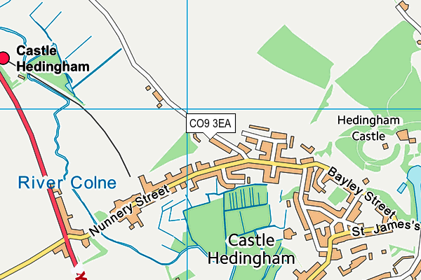
de Vere Primary School is located in Castle Hedingham, Halstead and falls under the local authority of Essex. This mixed-sex primary school has 195 pupils, with a capacity of 210, aged from four up to eleven, and the type of establishment is academy sponsor led. The most recend Ofsted inspection was 4th July 2023 resulting in an good rating.
| Address | de Vere Primary School Kirby Hall Road Castle Hedingham Halstead Essex CO9 3EA |
| Website | http://www.devere.essex.sch.uk |
| Headteacher | Mrs Carolyn White |
GetTheData
Source: Get Information About Schools
Licence: Open Government Licence
| Phase of Education | Primary |
| Type of Establishment | Academy sponsor led |
| Admissions Policy | Not applicable |
| Statutory Low Age | 4 |
| Statutory High Age | 11 |
| Boarders | No boarders |
| Official Sixth Form | Does not have a sixth form |
| Gender | Mixed |
| Religious Character | Does not apply |
| Diocese | Not applicable |
| Special Classes | No Special Classes |
GetTheData
Source: Get Information About Schools
Licence: Open Government Licence
| Census Date | 19th January 2023 | |
| School Capacity | 210 | |
| Number of Pupils | 195 | 93% capacity |
| Number of Boys | 104 | 53% |
| Number of Girls | 91 | 47% |
| Free School Meals (%) | 23.60% |
GetTheData
Source: Get Information About Schools
Licence: Open Government Licence
| Street Address | Kirby Hall Road |
| Locality | Castle Hedingham |
| Town | Halstead |
| County | Essex |
| Postcode | CO9 3EA |
| ➜ More CO9 3EA open data | |
GetTheData
Source: Get Information About Schools
Licence: Open Government Licence

GetTheData
Source: OS VectorMap District (Ordnance Survey)
Licence: Open Government Licence (requires attribution)
| Ofsted Last Inspection | 4th July 2023 |
| Ofsted Rating | Good |
| Ofsted Special Measures | Not applicable |
GetTheData
Source: Get Information About Schools
Licence: Open Government Licence
| Establishment Name | de Vere Primary School |
| Establishment Number | 2187 |
| Unique Reference Number | 148139 |
| Local Authority | Essex |
| Local Authority Code | 881 |
| Previous Local Authority Code | 999 |
| Government Statistical Service Local Authority Code | E10000012 |
| Government Office Region | East of England |
| District | Braintree |
| District Code | E07000067 |
| Ward | Hedingham |
| Parliamentary Constituency | Braintree |
| Urban/Rural Description | (England/Wales) Rural village |
| Middle Super Output Area | Braintree 003 |
| Lower Super Output Area | Braintree 003D |
GetTheData
Source: Get Information About Schools
Licence: Open Government Licence
| Establishment Status | Open |
| Last Changed Date | 4th January 2024 |
| Reason Establishment Opened | New Provision |
| Open Date | 1st September 2020 |
GetTheData
Source: Get Information About Schools
Licence: Open Government Licence
| Teenage Mothers | Not applicable |
| Special Educational Needs (SEN) Provision in Primary Care Unit | Not applicable |
| Pupil Referral Unit (PRU) Provides for Educational and Behavioural Difficulties (EBD) | Not applicable |
GetTheData
Source: Get Information About Schools
Licence: Open Government Licence
| Section 41 Approved | Not applicable |
GetTheData
Source: Get Information About Schools
Licence: Open Government Licence
| Trust flag | Supported by a multi-academy trust |
| Trust | ATTAIN ACADEMY PARTNERSHIP |
| School Sponsor flag | Linked to a sponsor |
| School Sponsor | Attain Academy Partnership |
GetTheData
Source: Get Information About Schools
Licence: Open Government Licence
| Federation flag | Not applicable |
GetTheData
Source: Get Information About Schools
Licence: Open Government Licence
| UK Provider Reference Number | 10086837 |
GetTheData
Source: Get Information About Schools
Licence: Open Government Licence
| Easting | 578132 |
| Northing | 235937 |
| Latitude | 51.99331 |
| Longitude | 0.5931 |
GetTheData
Source: Get Information About Schools
Licence: Open Government Licence
| School | Phase of Education | Distance |
|---|---|---|
| Hedingham School and Sixth Form Yeldham Road, Sible Hedingham, Halstead, CO9 3QH | Secondary | 948m |
| Teaseldown School Sugar Loaves, 175 Swan Street, Sible Hedingham, Halstead, CO9 3PX | Not applicable | 1.4km |
| The Yellow House School 1 Alderford Street, Sible Hedingham, Halstead, CO9 3HX | Not applicable | 2.2km |
| St Peter's Church of England Voluntary Controlled Primary School, Sible Hedingham School Road, Sible Hedingham, Halstead, CO9 3NR | Primary | 2.2km |
| St Giles' Church of England Primary School Church Street, Great Maplestead, Halstead, CO9 2RG | Primary | 2.9km |
| St Andrew's Church of England Primary School, Great Yeldham Church Road, Great Yeldham, Halstead, CO9 4PT | Primary | 3.6km |
| St Margaret's Church of England Voluntary Controlled Primary School Toppesfield Church Lane, Toppesfield, Halstead, CO9 4DS | Primary | 4.4km |
| Gosfield School Cut Hedge Park, Halstead Road, Halstead, CO9 1PF | Not applicable | 5.4km |
| Holy Trinity Church of England Voluntary Controlled Primary School, Halstead Beridge Road, Halstead, CO9 1JH | Primary | 6.1km |
| St Margaret's Preparatory School Gosfield Hall Park, Gosfield, Halstead, CO9 1SE | Not applicable | 6.1km |
GetTheData
Source: Get Information About Schools
Licence: Open Government Licence