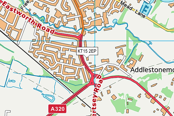
Chertsey High School is located in Addlestone and falls under the local authority of Surrey. This mixed-sex secondary school has 846 pupils, with a capacity of 900, aged from eleven up to sixteen, and the type of establishment is free schools. The most recend Ofsted inspection was 23rd February 2022 resulting in an good rating.
| Address | Chertsey High School Chertsey Road Addlestone KT15 2EP |
| Website | http://www.chertseyhighschool.co.uk |
| Headteacher | Mrs Mary Gould |
GetTheData
Source: Get Information About Schools
Licence: Open Government Licence
| Phase of Education | Secondary |
| Type of Establishment | Free schools |
| Statutory Low Age | 11 |
| Statutory High Age | 16 |
| Official Sixth Form | Does not have a sixth form |
| Gender | Mixed |
| Religious Character | None |
| Special Classes | Not applicable |
GetTheData
Source: Get Information About Schools
Licence: Open Government Licence
| Census Date | 19th January 2023 | |
| School Capacity | 900 | |
| Number of Pupils | 846 | 94% capacity |
| Number of Boys | 437 | 52% |
| Number of Girls | 409 | 48% |
| Free School Meals (%) | 17.10% |
GetTheData
Source: Get Information About Schools
Licence: Open Government Licence
| Street Address | Chertsey Road |
| Town | Addlestone |
| Postcode | KT15 2EP |
| ➜ More KT15 2EP open data | |
GetTheData
Source: Get Information About Schools
Licence: Open Government Licence

GetTheData
Source: OS VectorMap District (Ordnance Survey)
Licence: Open Government Licence (requires attribution)
| LAESTAB | 9364007 |
| Ofsted Region | South East |
GetTheData
Source: Ofsted: State-funded schools inspections and outcomes as at 31 March 2018: most recent inspection data at 31 March 2018
Licence: Open Government Licence
| Ofsted Last Inspection | 23rd February 2022 |
| Ofsted Rating | Good |
| Ofsted Special Measures | Not applicable |
GetTheData
Source: Get Information About Schools
Licence: Open Government Licence
| Establishment Name | Chertsey High School |
| Establishment Number | 4007 |
| Unique Reference Number | 144741 |
| Local Authority | Surrey |
| Local Authority Code | 936 |
| Previous Local Authority Code | 999 |
| Government Statistical Service Local Authority Code | E10000030 |
| Government Office Region | South East |
| District | Runnymede |
| District Code | E07000212 |
| Ward | Chertsey Riverside |
| Parliamentary Constituency | Runnymede and Weybridge |
| Urban/Rural Description | (England/Wales) Urban major conurbation |
| Middle Super Output Area | Runnymede 007 |
| Lower Super Output Area | Runnymede 007E |
GetTheData
Source: Get Information About Schools
Licence: Open Government Licence
| Establishment Status | Open |
| Last Changed Date | 23rd November 2023 |
| Open Date | 1st September 2017 |
GetTheData
Source: Get Information About Schools
Licence: Open Government Licence
| Teenage Mothers | Not applicable |
| Special Educational Needs (SEN) Provision in Primary Care Unit | Not applicable |
| Pupil Referral Unit (PRU) Provides for Educational and Behavioural Difficulties (EBD) | Not applicable |
GetTheData
Source: Get Information About Schools
Licence: Open Government Licence
| Section 41 Approved | Not applicable |
GetTheData
Source: Get Information About Schools
Licence: Open Government Licence
| Trust flag | Supported by a multi-academy trust |
| Trust | BOURNE EDUCATION TRUST |
| School Sponsor flag | Linked to a sponsor |
| School Sponsor | Bourne Education Trust |
GetTheData
Source: Get Information About Schools
Licence: Open Government Licence
| Federation flag | Not applicable |
GetTheData
Source: Get Information About Schools
Licence: Open Government Licence
| UK Provider Reference Number | 10064833 |
GetTheData
Source: Get Information About Schools
Licence: Open Government Licence
| Easting | 504923 |
| Northing | 165952 |
| Latitude | 51.38293 |
| Longitude | -0.49367 |
GetTheData
Source: Get Information About Schools
Licence: Open Government Licence
| School | Phase of Education | Distance |
|---|---|---|
| Philip Southcote School Addlestone Moor, Addlestone, KT15 2QH | Not applicable | 235m |
| Stepgates Community School Stepgates, CHERTSEY, KT16 8HT | Primary | 660m |
| St Anne's Catholic Primary School Free Prae Road, Chertsey, KT16 8ET | Primary | 717m |
| St George's College Weybridge Weybridge Road, Addlestone, KT15 2QS | Not applicable | 1.2km |
| Sir William Perkins's School Guildford Road, Chertsey, Surrey, KT16 9BN | Not applicable | 1.3km |
| Meadowcroft Community Infant School Little Green Lane, Chertsey, KT16 9PT | Primary | 1.5km |
| Darley Dene Primary School Garfield Road, Addlestone, KT15 2NP | Primary | 1.5km |
| St Paul's CofE Primary School School Lane, Addlestone, KT15 1TD | Primary | 1.5km |
| Jubilee High School School Lane, Addlestone, KT15 1TE | Secondary | 1.7km |
| Salesian School, Chertsey Guildford Road, Chertsey, KT16 9LU | Secondary | 1.7km |
GetTheData
Source: Get Information About Schools
Licence: Open Government Licence