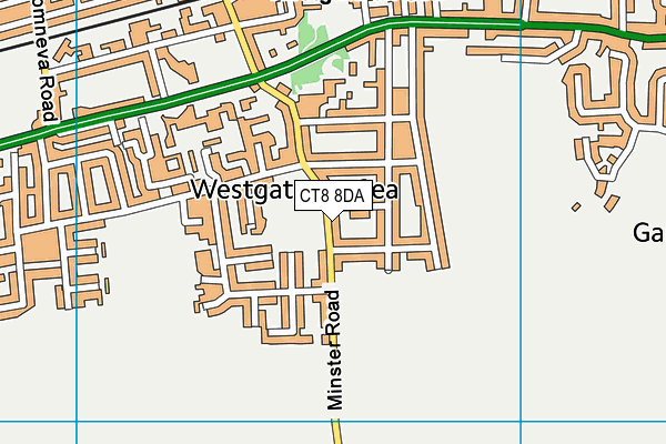
Chartfield School is located in Westgate-on-Sea and falls under the local authority of Kent. This mixed-sex school has 42 pupils, with a capacity of 84, aged from three up to eleven, and the type of establishment is other independent school. The most recend Ofsted inspection was 5th March 2020 resulting in an good rating.
| Address | Chartfield School 45 Minster Road Westgate-on-Sea Kent CT8 8DA |
| Website | http://www.chartfieldschool.org.uk |
| Headteacher | Miss Sarah Neale |
GetTheData
Source: Get Information About Schools
Licence: Open Government Licence
| Phase of Education | Not applicable |
| Type of Establishment | Other independent school |
| Admissions Policy | Non-selective |
| Statutory Low Age | 3 |
| Statutory High Age | 11 |
| Boarders | No boarders |
| Boarding Establishment | Does not have boarders |
| Official Sixth Form | Does not have a sixth form |
| Gender | Mixed |
| Religious Character | None |
| Diocese | Not applicable |
| Special Classes | No Special Classes |
GetTheData
Source: Get Information About Schools
Licence: Open Government Licence
| Census Date | 20th January 2022 | |
| School Capacity | 84 | |
| Number of Pupils | 42 | 50% capacity |
| Number of Boys | 22 | 52% |
| Number of Girls | 20 | 48% |
| Free School Meals (%) | 0.0% |
GetTheData
Source: Get Information About Schools
Licence: Open Government Licence
| Street Address | 45 Minster Road |
| Town | Westgate-on-Sea |
| County | Kent |
| Postcode | CT8 8DA |
| ➜ More CT8 8DA open data | |
GetTheData
Source: Get Information About Schools
Licence: Open Government Licence

GetTheData
Source: OS VectorMap District (Ordnance Survey)
Licence: Open Government Licence (requires attribution)
| Ofsted Last Inspection | 5th March 2020 |
| Ofsted Rating | Good |
| Ofsted Special Measures | Not applicable |
GetTheData
Source: Get Information About Schools
Licence: Open Government Licence
| Establishment Name | Chartfield School |
| Establishment Number | 6035 |
| Previous Establishment Number | 6226 |
| Unique Reference Number | 118977 |
| Local Authority | Kent |
| Local Authority Code | 886 |
| Previous Local Authority | Pre LGR (1998) Kent |
| Previous Local Authority Code | 922 |
| Government Statistical Service Local Authority Code | E10000016 |
| Government Office Region | South East |
| District | Thanet |
| District Code | E07000114 |
| Ward | Westgate-on-Sea |
| Parliamentary Constituency | North Thanet |
| Urban/Rural Description | (England/Wales) Urban city and town |
| Middle Super Output Area | Thanet 007 |
| Lower Super Output Area | Thanet 007E |
GetTheData
Source: Get Information About Schools
Licence: Open Government Licence
| Establishment Status | Open |
| Last Changed Date | 23rd November 2023 |
| Reason Establishment Opened | Not applicable |
| Open Date | 8th October 1957 |
| Reason Establishment Closed | Not applicable |
GetTheData
Source: Get Information About Schools
Licence: Open Government Licence
| Teenage Mothers | Not applicable |
| Child Care Facilities | Not applicable |
| Special Educational Needs (SEN) Provision in Primary Care Unit | Not applicable |
| Pupil Referral Unit (PRU) Provides for Educational and Behavioural Difficulties (EBD) | Not applicable |
| Pupil Referral Unit (PRU) Offers Tuition by Another Provider | Not applicable |
GetTheData
Source: Get Information About Schools
Licence: Open Government Licence
| Section 41 Approved | Not approved |
GetTheData
Source: Get Information About Schools
Licence: Open Government Licence
| Trust flag | Not applicable |
| School Sponsor flag | Not applicable |
GetTheData
Source: Get Information About Schools
Licence: Open Government Licence
| Federation flag | Not applicable |
GetTheData
Source: Get Information About Schools
Licence: Open Government Licence
| UK Provider Reference Number | 10080534 |
| Further Education Type | Not applicable |
GetTheData
Source: Get Information About Schools
Licence: Open Government Licence
| Easting | 632551 |
| Northing | 169556 |
| Latitude | 51.3774 |
| Longitude | 1.34023 |
GetTheData
Source: Get Information About Schools
Licence: Open Government Licence
| School | Phase of Education | Distance |
|---|---|---|
| St Crispin's Community Primary Infant School St Crispin's Road, Westgate-on-Sea, CT8 8EB | Primary | 321m |
| St Saviour's Church of England Junior School Elm Grove, St. Saviour's C.E Junior School Elm Grove, Westgate on Sea, CT8 8LD | Primary | 551m |
| Ursuline College 225 Canterbury Road, Westgate-on-Sea, CT8 8LX | Secondary | 876m |
| King Ethelbert School Canterbury Road, Birchington, CT7 9BL | Secondary | 1.3km |
| Garlinge Primary School and Nursery Westfield Road, Margate, CT9 5PA | Primary | 1.4km |
| Cherry Tree 29 All Saints Avenue, Margate, Kent, CT9 5QN | Not applicable | 1.9km |
| Hartsdown Academy George V Avenue, Margate, CT9 5RE | Secondary | 2km |
| The Llewellyn School and Nursery Quex Park Estate, Birchington, Kent, Margate, CT7 0BB | Not applicable | 2.2km |
| Birchington Church of England Primary School Park Lane, Birchington, CT7 0AS | Primary | 2.4km |
| St Gregory's Catholic Primary School, Margate Nash Road, Margate, CT9 4BU | Primary | 2.7km |
GetTheData
Source: Get Information About Schools
Licence: Open Government Licence