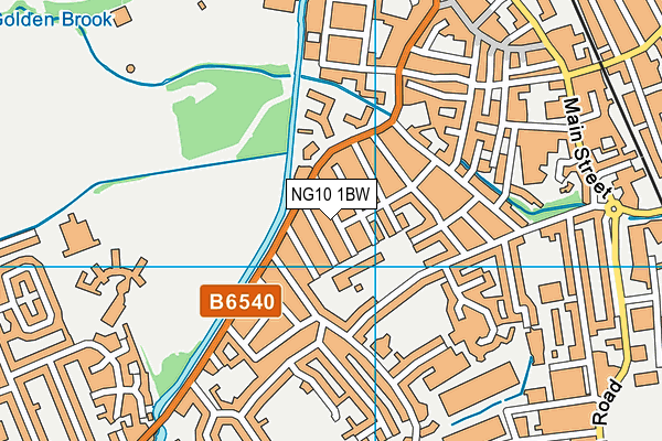
Brooklands Primary School is located in Long Eaton, Nottingham and falls under the local authority of Derbyshire. This mixed-sex primary school has 400 pupils, with a capacity of 447, aged from three up to eleven, and the type of establishment is academy converter. The most recend Ofsted inspection was 8th June 2023 resulting in an good rating.
| Address | Brooklands Primary School 44 St. Johns Street Long Eaton St Johns Street Nottingham NG10 1BW |
| Website | http://www.brooklands.derbyshire.sch.uk/ |
| Headteacher | Mr Tom Daniel |
GetTheData
Source: Get Information About Schools
Licence: Open Government Licence
| Phase of Education | Primary |
| Type of Establishment | Academy converter |
| Admissions Policy | Not applicable |
| Statutory Low Age | 3 |
| Statutory High Age | 11 |
| Boarders | No boarders |
| Official Sixth Form | Does not have a sixth form |
| Gender | Mixed |
| Religious Character | Does not apply |
| Diocese | Not applicable |
| Special Classes | Not applicable |
GetTheData
Source: Get Information About Schools
Licence: Open Government Licence
| Census Date | 19th January 2023 | |
| School Capacity | 447 | |
| Number of Pupils | 400 | 89% capacity |
| Number of Boys | 193 | 48% |
| Number of Girls | 207 | 52% |
| Free School Meals (%) | 47.20% |
GetTheData
Source: Get Information About Schools
Licence: Open Government Licence
| Street Address | 44 St. Johns Street |
| Locality | Long Eaton |
| Address 3 | St Johns Street |
| Town | Nottingham |
| Postcode | NG10 1BW |
| ➜ More NG10 1BW open data | |
GetTheData
Source: Get Information About Schools
Licence: Open Government Licence

GetTheData
Source: OS VectorMap District (Ordnance Survey)
Licence: Open Government Licence (requires attribution)
| Ofsted Last Inspection | 8th June 2023 |
| Ofsted Rating | Good |
| Ofsted Special Measures | Not applicable |
GetTheData
Source: Get Information About Schools
Licence: Open Government Licence
| Establishment Name | Brooklands Primary School |
| Establishment Number | 3546 |
| Unique Reference Number | 147140 |
| Local Authority | Derbyshire |
| Local Authority Code | 830 |
| Previous Local Authority Code | 999 |
| Government Statistical Service Local Authority Code | E10000007 |
| Government Office Region | East Midlands |
| District | Erewash |
| District Code | E07000036 |
| Ward | Long Eaton Central |
| Parliamentary Constituency | Erewash |
| Urban/Rural Description | (England/Wales) Urban minor conurbation |
| Middle Super Output Area | Erewash 014 |
| Lower Super Output Area | Erewash 014A |
GetTheData
Source: Get Information About Schools
Licence: Open Government Licence
| Establishment Status | Open |
| Last Changed Date | 16th January 2024 |
| Reason Establishment Opened | Academy Converter |
| Open Date | 1st July 2019 |
GetTheData
Source: Get Information About Schools
Licence: Open Government Licence
| Teenage Mothers | Not applicable |
| Child Care Facilities | Not applicable |
| Special Educational Needs (SEN) Provision in Primary Care Unit | Not applicable |
| Pupil Referral Unit (PRU) Provides for Educational and Behavioural Difficulties (EBD) | Not applicable |
| Pupil Referral Unit (PRU) Offers Tuition by Another Provider | Not applicable |
GetTheData
Source: Get Information About Schools
Licence: Open Government Licence
| Section 41 Approved | Not applicable |
GetTheData
Source: Get Information About Schools
Licence: Open Government Licence
| Trust flag | Supported by a multi-academy trust |
| Trust | FLYING HIGH TRUST |
| School Sponsor flag | Linked to a sponsor |
| School Sponsor | Flying High Trust |
GetTheData
Source: Get Information About Schools
Licence: Open Government Licence
| Federation flag | Not applicable |
GetTheData
Source: Get Information About Schools
Licence: Open Government Licence
| UK Provider Reference Number | 10083672 |
| Further Education Type | Not applicable |
GetTheData
Source: Get Information About Schools
Licence: Open Government Licence
| Easting | 448979 |
| Northing | 333007 |
| Latitude | 52.89229 |
| Longitude | -1.27344 |
GetTheData
Source: Get Information About Schools
Licence: Open Government Licence
| School | Phase of Education | Distance |
|---|---|---|
| St Laurence CofE Primary School Collingwood Road, Long Eaton, Nottingham, NG10 1DR | Primary | 190m |
| Stanton Vale School Thoresby Road, Long Eaton, Nottingham, NG10 3NP | Not applicable | 666m |
| The Long Eaton School Thoresby Road, Long Eaton, Nottingham, NG10 3NP | Secondary | 883m |
| Grange Primary School Station Road, Long Eaton, Nottingham, NG10 2DU | Primary | 1.2km |
| Trent College Derby Road, Long Eaton, Nottingham, NG10 4AD | Not applicable | 1.3km |
| Dovedale Primary School Dovedale Avenue, Long Eaton, Nottingham, NG10 3HU | Primary | 1.5km |
| Parklands Infant and Nursery School Derby Road, Long Eaton, Nottingham, NG10 4BJ | Primary | 1.5km |
| Harrington Junior School Derby Road, Long Eaton, Nottingham, NG10 4BJ | Primary | 1.6km |
| OneSchool Global Uk Nottingham Campus Wellington Street, Long Eaton, Nottingham, NG10 4HR | Not applicable | 1.7km |
| Wilsthorpe School Derby Road, Long Eaton, Nottingham, NG10 4WT | Secondary | 1.7km |
GetTheData
Source: Get Information About Schools
Licence: Open Government Licence