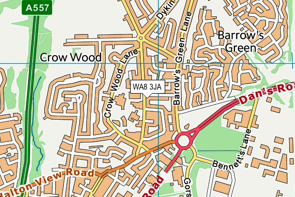
Brookfields School is located in Widnes and falls under the local authority of Halton. This mixed-sex school has 119 pupils, with a capacity of 92, aged from two up to eleven, and the type of establishment is academy special converter. The most recend Ofsted inspection was 12th January 2023 resulting in an outstanding rating.
| Address | Brookfields School Moorfield Road Widnes Cheshire WA8 3JA |
| Website | http://www.brookfieldsschool.com |
| Headteacher | Mrs Sara Ainsworth |
GetTheData
Source: Get Information About Schools
Licence: Open Government Licence
| Phase of Education | Not applicable |
| Type of Establishment | Academy special converter |
| Admissions Policy | Not applicable |
| Statutory Low Age | 2 |
| Statutory High Age | 11 |
| Boarders | No boarders |
| Official Sixth Form | Not applicable |
| Gender | Mixed |
| Religious Character | Does not apply |
| Diocese | Not applicable |
| Special Classes | Has Special Classes |
GetTheData
Source: Get Information About Schools
Licence: Open Government Licence
| Census Date | 19th January 2023 | |
| School Capacity | 92 | |
| Number of Pupils | 119 | 129% capacity |
| Number of Boys | 94 | 79% |
| Number of Girls | 25 | 21% |
| Free School Meals (%) | 58.00% |
GetTheData
Source: Get Information About Schools
Licence: Open Government Licence
| Street Address | Moorfield Road |
| Town | Widnes |
| County | Cheshire |
| Postcode | WA8 3JA |
| ➜ More WA8 3JA open data | |
GetTheData
Source: Get Information About Schools
Licence: Open Government Licence

GetTheData
Source: OS VectorMap District (Ordnance Survey)
Licence: Open Government Licence (requires attribution)
| Ofsted Last Inspection | 12th January 2023 |
| Ofsted Rating | Outstanding |
| Ofsted Special Measures | Not applicable |
GetTheData
Source: Get Information About Schools
Licence: Open Government Licence
| Establishment Name | Brookfields School |
| Establishment Number | 7206 |
| Previous Establishment Number | 7206 |
| Unique Reference Number | 146110 |
| Local Authority | Halton |
| Local Authority Code | 876 |
| Previous Local Authority | Pre LGR (1998) Cheshire |
| Previous Local Authority Code | 906 |
| Government Statistical Service Local Authority Code | E06000006 |
| Government Office Region | North West |
| District | Halton |
| District Code | E06000006 |
| Ward | Halton View |
| Parliamentary Constituency | Halton |
| Urban/Rural Description | (England/Wales) Urban city and town |
| Middle Super Output Area | Halton 003 |
| Lower Super Output Area | Halton 003D |
GetTheData
Source: Get Information About Schools
Licence: Open Government Licence
| Establishment Status | Open |
| Last Changed Date | 12th December 2023 |
| Reason Establishment Opened | Academy Converter |
| Open Date | 1st September 2018 |
GetTheData
Source: Get Information About Schools
Licence: Open Government Licence
| Teenage Mothers | Not applicable |
| Child Care Facilities | Not applicable |
| Special Educational Needs (SEN) Provision in Primary Care Unit | Not applicable |
| Pupil Referral Unit (PRU) Provides for Educational and Behavioural Difficulties (EBD) | Not applicable |
| Pupil Referral Unit (PRU) Offers Tuition by Another Provider | Not applicable |
GetTheData
Source: Get Information About Schools
Licence: Open Government Licence
| Section 41 Approved | Not applicable |
| Special Educational Needs (SEN) Priority 1 | ASD - Autistic Spectrum Disorder |
| Special Educational Needs (SEN) Priority 2 | SLD - Severe Learning Difficulty |
GetTheData
Source: Get Information About Schools
Licence: Open Government Licence
| Trust flag | Supported by a multi-academy trust |
| Trust | THE SHAW EDUCATION TRUST |
| School Sponsor flag | Linked to a sponsor |
| School Sponsor | The Shaw Education Trust |
GetTheData
Source: Get Information About Schools
Licence: Open Government Licence
| Federation flag | Not applicable |
GetTheData
Source: Get Information About Schools
Licence: Open Government Licence
| UK Provider Reference Number | 10080978 |
| Further Education Type | Not applicable |
GetTheData
Source: Get Information About Schools
Licence: Open Government Licence
| Easting | 352876 |
| Northing | 386737 |
| Latitude | 53.37537 |
| Longitude | -2.70979 |
GetTheData
Source: Get Information About Schools
Licence: Open Government Licence
| School | Phase of Education | Distance |
|---|---|---|
| St John Fisher Catholic Primary School Edward Street, Widnes, WA8 0BW | Primary | 408m |
| Aspiring Foundations Federated Nursery Schools - Warrington Road Nursery School Naylor Road, Warrington Road Childrens Centre, Widnes, WA8 0BS | Nursery | 619m |
| Moorfield Primary School School Way, Moorfield Road, Widnes, WA8 3HJ | Primary | 682m |
| Fairfield Primary School Peelhouse Lane, Widnes, WA8 6TH | Primary | 1.1km |
| St Bede's Catholic Infant School Leigh Avenue, Widnes, WA8 6EL | Primary | 1.5km |
| St Bede's Catholic Junior School Appleton Village, St Bede's Junior School, WIDNES, WA8 6EL | Primary | 1.6km |
| Wade Deacon High School Birchfield Road, Widnes, WA8 7TD | Secondary | 1.7km |
| Birchfield Nursery School Victoria Avenue, Victoria Avenue, widnes, WA8 7TH | Nursery | 1.7km |
| Farnworth Church of England Controlled Primary School Pit Lane, Widnes, WA8 9HS | Primary | 1.7km |
| Lunts Heath Primary School Wedgewood Drive, Widnes, WA8 9RJ | Primary | 1.8km |
GetTheData
Source: Get Information About Schools
Licence: Open Government Licence