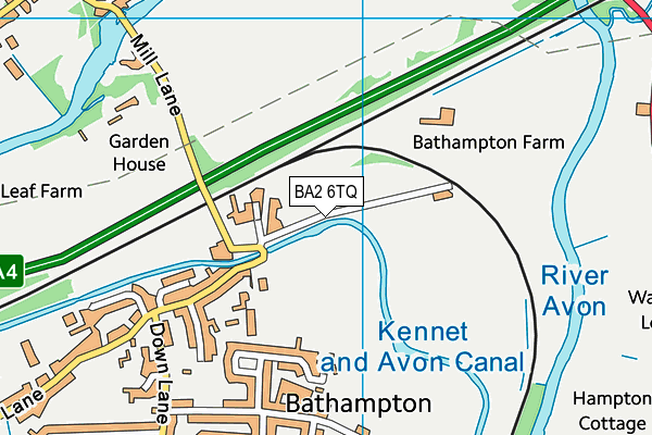
Bathampton Primary School is located in Bathampton, Bath and falls under the local authority of Bath and North East Somerset. This mixed-sex primary school has 191 pupils, with a capacity of 210, aged from four up to eleven, and the type of establishment is academy converter. The most recend Ofsted inspection was 18th January 2023 resulting in an good rating.
| Address | Bathampton Primary School Tyning Road Bathampton Bath Somerset BA2 6TQ |
| Website | https://www.bathamptonprimary.org/ |
| Headteacher | Mrs Naomi Boyce |
GetTheData
Source: Get Information About Schools
Licence: Open Government Licence
| Phase of Education | Primary |
| Type of Establishment | Academy converter |
| Admissions Policy | Not applicable |
| Statutory Low Age | 4 |
| Statutory High Age | 11 |
| Boarders | No boarders |
| Official Sixth Form | Does not have a sixth form |
| Gender | Mixed |
| Religious Character | Does not apply |
| Diocese | Not applicable |
| Special Classes | No Special Classes |
GetTheData
Source: Get Information About Schools
Licence: Open Government Licence
| Census Date | 19th January 2023 | |
| School Capacity | 210 | |
| Number of Pupils | 191 | 91% capacity |
| Number of Boys | 98 | 51% |
| Number of Girls | 93 | 49% |
| Free School Meals (%) | 2.60% |
GetTheData
Source: Get Information About Schools
Licence: Open Government Licence
| Street Address | Tyning Road |
| Locality | Bathampton |
| Town | Bath |
| County | Somerset |
| Postcode | BA2 6TQ |
| ➜ More BA2 6TQ open data | |
GetTheData
Source: Get Information About Schools
Licence: Open Government Licence

GetTheData
Source: OS VectorMap District (Ordnance Survey)
Licence: Open Government Licence (requires attribution)
| Ofsted Last Inspection | 18th January 2023 |
| Ofsted Rating | Good |
| Ofsted Special Measures | Not applicable |
GetTheData
Source: Get Information About Schools
Licence: Open Government Licence
| Establishment Name | Bathampton Primary School |
| Establishment Number | 2236 |
| Unique Reference Number | 145511 |
| Local Authority | Bath and North East Somerset |
| Local Authority Code | 800 |
| Previous Local Authority | Pre LGR (1996) Avon |
| Previous Local Authority Code | 901 |
| Government Statistical Service Local Authority Code | E06000022 |
| Government Office Region | South West |
| District | Bath and North East Somerset |
| District Code | E06000022 |
| Ward | Bathavon North |
| Parliamentary Constituency | North East Somerset |
| Urban/Rural Description | (England/Wales) Urban city and town |
| Middle Super Output Area | Bath and North East Somerset 010 |
| Lower Super Output Area | Bath and North East Somerset 010B |
GetTheData
Source: Get Information About Schools
Licence: Open Government Licence
| Establishment Status | Open |
| Last Changed Date | 23rd November 2023 |
| Reason Establishment Opened | Academy Converter |
| Open Date | 1st March 2018 |
GetTheData
Source: Get Information About Schools
Licence: Open Government Licence
| Teenage Mothers | Not applicable |
| Child Care Facilities | Not applicable |
| Special Educational Needs (SEN) Provision in Primary Care Unit | Not applicable |
| Pupil Referral Unit (PRU) Provides for Educational and Behavioural Difficulties (EBD) | Not applicable |
| Pupil Referral Unit (PRU) Offers Tuition by Another Provider | Not applicable |
GetTheData
Source: Get Information About Schools
Licence: Open Government Licence
| Section 41 Approved | Not applicable |
GetTheData
Source: Get Information About Schools
Licence: Open Government Licence
| Trust flag | Supported by a multi-academy trust |
| Trust | THE BATH AND WELLS DIOCESAN ACADEMIES TRUST |
| School Sponsor flag | Linked to a sponsor |
| School Sponsor | Diocese of Bath and Wells Multi Academy Trust |
GetTheData
Source: Get Information About Schools
Licence: Open Government Licence
| Federation flag | Not applicable |
GetTheData
Source: Get Information About Schools
Licence: Open Government Licence
| UK Provider Reference Number | 10066956 |
| Further Education Type | Not applicable |
GetTheData
Source: Get Information About Schools
Licence: Open Government Licence
| Easting | 377804 |
| Northing | 166522 |
| Latitude | 51.39729 |
| Longitude | -2.32043 |
GetTheData
Source: Get Information About Schools
Licence: Open Government Licence
| School | Phase of Education | Distance |
|---|---|---|
| Batheaston Church School School Lane, Northend, Bath, BA1 7EP | Primary | 1.3km |
| Bathford Church School Dovers Park, Bathford, Bath, BA1 7UB | Primary | 1.4km |
| St Saviours Junior Church School Eldon Place, Larkhall, Bath, BA1 6TG | Primary | 1.9km |
| St Saviours Infant Church School Spring Lane, Larkhall, Bath, BA1 6NY | Primary | 2km |
| Bathwick St Mary Church School Darlington Road, Bath, BA2 6NN | Primary | 2km |
| University of Bath Claverton Down, Bath, BA2 7AY | Not applicable | 2km |
| King Edward's School North Road, Bath, BA2 6HU | Not applicable | 2km |
| St Mark's CofE School Bay Tree Road, Bath, BA1 6ND | Secondary | 2.1km |
| Swainswick Church School Innox Lane, Upper Swainswick, Bath, BA1 8DB | Primary | 2.8km |
| St Stephens Church School Richmond Place, Lansdown, Bath, BA1 5PZ | Primary | 2.8km |
GetTheData
Source: Get Information About Schools
Licence: Open Government Licence