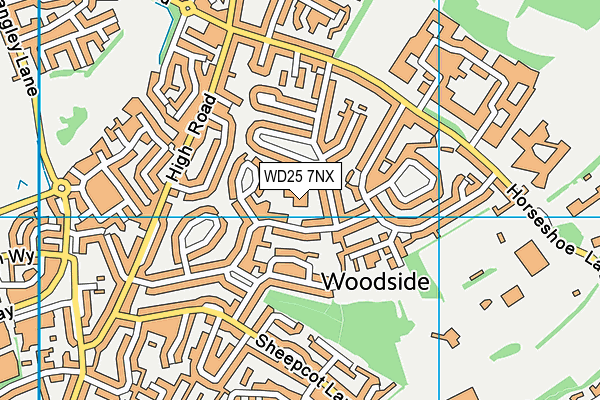
Alban Wood Primary School and Nursery is located in Watford and falls under the local authority of Hertfordshire. This mixed-sex primary school has 240 pupils, with a capacity of 243, aged from three up to eleven, and the type of establishment is academy converter. The most recend Ofsted inspection was 29th June 2022 resulting in an outstanding rating.
| Address | Alban Wood Primary School and Nursery The Brow Watford Hertfordshire WD25 7NX |
| Website | http://www.albanwood.herts.sch.uk/ |
| Headteacher | Mr Jonny Spector |
GetTheData
Source: Get Information About Schools
Licence: Open Government Licence
| Phase of Education | Primary |
| Type of Establishment | Academy converter |
| Admissions Policy | Not applicable |
| Statutory Low Age | 3 |
| Statutory High Age | 11 |
| Boarders | No boarders |
| Official Sixth Form | Does not have a sixth form |
| Gender | Mixed |
| Religious Character | Does not apply |
| Diocese | Not applicable |
| Special Classes | Not applicable |
GetTheData
Source: Get Information About Schools
Licence: Open Government Licence
| Census Date | 19th January 2023 | |
| School Capacity | 243 | |
| Number of Pupils | 240 | 99% capacity |
| Number of Boys | 124 | 52% |
| Number of Girls | 116 | 48% |
| Free School Meals (%) | 22.20% |
GetTheData
Source: Get Information About Schools
Licence: Open Government Licence
| Street Address | The Brow |
| Town | Watford |
| County | Hertfordshire |
| Postcode | WD25 7NX |
| ➜ More WD25 7NX open data | |
GetTheData
Source: Get Information About Schools
Licence: Open Government Licence

GetTheData
Source: OS VectorMap District (Ordnance Survey)
Licence: Open Government Licence (requires attribution)
| Ofsted Last Inspection | 29th June 2022 |
| Ofsted Rating | Outstanding |
| Ofsted Special Measures | Not applicable |
GetTheData
Source: Get Information About Schools
Licence: Open Government Licence
| Establishment Name | Alban Wood Primary School and Nursery |
| Establishment Number | 3981 |
| Unique Reference Number | 144907 |
| Local Authority | Hertfordshire |
| Local Authority Code | 919 |
| Previous Local Authority Code | 999 |
| Government Statistical Service Local Authority Code | E10000015 |
| Government Office Region | East of England |
| District | Watford |
| District Code | E07000103 |
| Ward | Woodside |
| Parliamentary Constituency | Watford |
| Urban/Rural Description | (England/Wales) Urban major conurbation |
| Middle Super Output Area | Watford 001 |
| Lower Super Output Area | Watford 001A |
GetTheData
Source: Get Information About Schools
Licence: Open Government Licence
| Establishment Status | Open |
| Last Changed Date | 28th November 2023 |
| Reason Establishment Opened | Academy Converter |
| Open Date | 1st September 2017 |
GetTheData
Source: Get Information About Schools
Licence: Open Government Licence
| Teenage Mothers | Not applicable |
| Child Care Facilities | Not applicable |
| Special Educational Needs (SEN) Provision in Primary Care Unit | Not applicable |
| Pupil Referral Unit (PRU) Provides for Educational and Behavioural Difficulties (EBD) | Not applicable |
| Pupil Referral Unit (PRU) Offers Tuition by Another Provider | Not applicable |
GetTheData
Source: Get Information About Schools
Licence: Open Government Licence
| Section 41 Approved | Not applicable |
GetTheData
Source: Get Information About Schools
Licence: Open Government Licence
| Trust flag | Supported by a multi-academy trust |
| Trust | AGORA LEARNING PARTNERSHIP |
| School Sponsor flag | Linked to a sponsor |
| School Sponsor | Agora Learning Partnership |
GetTheData
Source: Get Information About Schools
Licence: Open Government Licence
| Federation flag | Not applicable |
GetTheData
Source: Get Information About Schools
Licence: Open Government Licence
| UK Provider Reference Number | 10065027 |
| Further Education Type | Not applicable |
GetTheData
Source: Get Information About Schools
Licence: Open Government Licence
| Easting | 510655 |
| Northing | 201041 |
| Latitude | 51.69721 |
| Longitude | -0.40032 |
GetTheData
Source: Get Information About Schools
Licence: Open Government Licence
| School | Phase of Education | Distance |
|---|---|---|
| Future Academies Watford Horseshoe Lane, Garston, Watford, WD25 7HW | Secondary | 571m |
| Garston Manor School Horseshoe Lane, Garston, Watford, WD25 7HR | Not applicable | 694m |
| Leavesden JMI School High Road, Leavesden, Watford, WD25 7QZ | Primary | 805m |
| Kingsway Infants' School North Approach, Watford, WD25 0ES | Primary | 961m |
| Kingswood Nursery School Briar Road, Watford, WD25 0DX | Nursery | 974m |
| Kingsway Junior School Briar Road, Watford, WD25 0JH | Primary | 1km |
| Parmiter's School High Elms Lane, Garston, Watford, WD25 0UU | Secondary | 1km |
| St Catherine of Siena Catholic Primary School Horseshoe Lane, Garston, Watford, WD25 7HP | Primary | 1km |
| Saint Michael's Catholic High School High Elms Lane, Garston, Watford, WD25 0SS | Secondary | 1km |
| Stanborough Primary School Appletree Walk, Watford, WD25 0DQ | Not applicable | 1.2km |
GetTheData
Source: Get Information About Schools
Licence: Open Government Licence