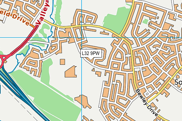
Activate is located in Kirby and falls under the local authority of Knowsley. This mixed-sex school accepts pupils aged from sixteen up to twenty-five, and the type of establishment is special post 16 institution.
| Address | Activate The Bracknell Centre Bracknell Avenue Kirby Merseyside L32 9PW |
| Website | http://www.activatearts.com |
| Principal | Mrs Vivienne Guy |
GetTheData
Source: Get Information About Schools
Licence: Open Government Licence
| Phase of Education | Not applicable |
| Type of Establishment | Special post 16 institution |
| Statutory Low Age | 16 |
| Statutory High Age | 25 |
| Boarders | No boarders |
| Official Sixth Form | Not applicable |
| Gender | Mixed |
| Religious Character | Does not apply |
| Diocese | Not applicable |
| Special Classes | Not applicable |
GetTheData
Source: Get Information About Schools
Licence: Open Government Licence
| Street Address | The Bracknell Centre |
| Address 3 | Bracknell Avenue |
| Town | Kirby |
| County | Merseyside |
| Postcode | L32 9PW |
| ➜ More L32 9PW open data | |
GetTheData
Source: Get Information About Schools
Licence: Open Government Licence

GetTheData
Source: OS VectorMap District (Ordnance Survey)
Licence: Open Government Licence (requires attribution)
| Ofsted Special Measures | Not applicable |
GetTheData
Source: Get Information About Schools
Licence: Open Government Licence
| Establishment Name | Activate |
| Establishment Number | 7017 |
| Unique Reference Number | 142457 |
| Local Authority | Knowsley |
| Local Authority Code | 340 |
| Previous Local Authority Code | 999 |
| Government Statistical Service Local Authority Code | E08000011 |
| Government Office Region | North West |
| District | Knowsley |
| District Code | E08000011 |
| Ward | Cherryfield |
| Parliamentary Constituency | Knowsley |
| Urban/Rural Description | (England/Wales) Urban major conurbation |
| Middle Super Output Area | Knowsley 003 |
| Lower Super Output Area | Knowsley 003A |
GetTheData
Source: Get Information About Schools
Licence: Open Government Licence
| Establishment Status | Open |
| Last Changed Date | 29th April 2019 |
GetTheData
Source: Get Information About Schools
Licence: Open Government Licence
| Teenage Mothers | Not applicable |
| Special Educational Needs (SEN) Provision in Primary Care Unit | Not applicable |
| Pupil Referral Unit (PRU) Provides for Educational and Behavioural Difficulties (EBD) | Not applicable |
GetTheData
Source: Get Information About Schools
Licence: Open Government Licence
| Section 41 Approved | Approved |
GetTheData
Source: Get Information About Schools
Licence: Open Government Licence
| Trust flag | Not applicable |
| School Sponsor flag | Not applicable |
GetTheData
Source: Get Information About Schools
Licence: Open Government Licence
| Federation flag | Not applicable |
GetTheData
Source: Get Information About Schools
Licence: Open Government Licence
| UK Provider Reference Number | 10019237 |
GetTheData
Source: Get Information About Schools
Licence: Open Government Licence
| Easting | 341150 |
| Northing | 397706 |
| Latitude | 53.47278 |
| Longitude | -2.88808 |
GetTheData
Source: Get Information About Schools
Licence: Open Government Licence
| School | Phase of Education | Distance |
|---|---|---|
| Kirkby High School Bracknell Avenue, Kirkby, Liverpool, L32 9PP | Secondary | 152m |
| Bluebell Park School Cawthorne Walk, Southdene, Kirkby, Liverpool, L32 3XP | Not applicable | 224m |
| St Joseph the Worker Catholic Primary School Bewley Drive, Southdene, Kirkby, Liverpool, L32 9PF | Primary | 356m |
| St Laurence's Catholic Primary School Leeside Avenue, Southdene, Kirkby, Liverpool, L32 9QX | Primary | 758m |
| Park Brow Community Primary School Broad Lane, Southdene, Kirkby, Liverpool, L32 6QH | Primary | 920m |
| Kirkby CofE Primary School Hall Lane, Kirkby, Liverpool, L32 1TZ | Primary | 1.3km |
| Northwood Community Primary School (With Designated Special Provision) Roughwood Drive, Northwood, Kirkby, L33 8XD | Primary | 1.4km |
| All Saints Catholic High School Roughwood Drive, Kirkby, Knowsley, L33 8XF | Secondary | 1.5km |
| Millbrook Community Primary School Kirkby Row, Westvale, Millbrook Community Primary School, Liverpool, L32 0TG | Primary | 1.5km |
| St Michael and All Angels Catholic Primary School Sidney Powell Avenue, Westvale, Kirkby, Liverpool, L32 0TP | Primary | 1.5km |
GetTheData
Source: Get Information About Schools
Licence: Open Government Licence