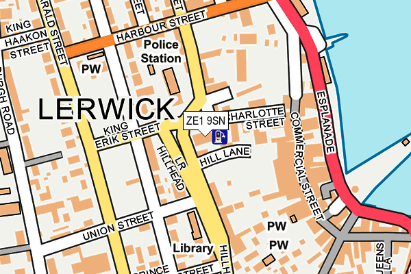
ZE1 9SN is located in the Lerwick North and Bressay electoral ward, within the council area of Shetland Islands and the Scottish Parliamentary constituency of Orkney and Shetland. The Community Health Partnership is Shetland Community Health Partnership and the police force is Scotland. This postcode has been in use since March 2005.


GetTheData
Source: OS OpenMap – Local (Ordnance Survey)
Source: OS VectorMap District (Ordnance Survey)
Licence: Open Government Licence (requires attribution)
| Easting | 447500 |
| Northing | 1141412 |
| Latitude | 60.154437 |
| Longitude | -1.146229 |
GetTheData
Source: Open Postcode Geo
Licence: Open Government Licence
| Country | Scotland |
| Postcode District | ZE1 |
| ➜ ZE1 open data dashboard ➜ See where ZE1 is on a map ➜ Where is Lerwick? | |
GetTheData
Source: Land Registry Price Paid Data
Licence: Open Government Licence
| Ward | Lerwick North And Bressay |
| Constituency | Orkney And Shetland |
GetTheData
Source: ONS Postcode Database
Licence: Open Government Licence
| Ferry Terminal (Esplanade) | Lerwick | 167m |
| Isleburgh House (King Harald St) | Lerwick | 181m |
| Ferry Terminal (Esplanade) | Lerwick | 185m |
| Harbour Street (Commercial Rd) | Lerwick | 256m |
| Funeral Director (Scalloway Rd) | Lerwick | 321m |
GetTheData
Source: NaPTAN
Licence: Open Government Licence
GetTheData
Source: ONS Postcode Database
Licence: Open Government Licence


➜ Get more ratings from the Food Standards Agency
GetTheData
Source: Food Standards Agency
Licence: FSA terms & conditions
| Last Collection | |||
|---|---|---|---|
| Location | Mon-Fri | Sat | Distance |
| Commercial Street | 17:15 | 15:15 | 147m |
| Market Street | 17:15 | 15:15 | 160m |
| King Harold Street | 17:15 | 15:15 | 174m |
GetTheData
Source: Dracos
Licence: Creative Commons Attribution-ShareAlike
The below table lists the International Territorial Level (ITL) codes (formerly Nomenclature of Territorial Units for Statistics (NUTS) codes) and Local Administrative Units (LAU) codes for ZE1 9SN:
| ITL 1 Code | Name |
|---|---|
| TLM | Scotland |
| ITL 2 Code | Name |
| TLM6 | Highlands and Islands |
| ITL 3 Code | Name |
| TLM66 | Shetland Islands |
| LAU 1 Code | Name |
| S30000041 | Shetland Islands |
GetTheData
Source: ONS Postcode Directory
Licence: Open Government Licence
The below table lists the Census Output Area (OA), Lower Layer Super Output Area (LSOA), and Middle Layer Super Output Area (MSOA) for ZE1 9SN:
| Code | Name | |
|---|---|---|
| OA | S00129059 | |
| LSOA | S01012398 | Lerwick North - 04 |
| MSOA | S02002324 | Lerwick North |
GetTheData
Source: ONS Postcode Directory
Licence: Open Government Licence