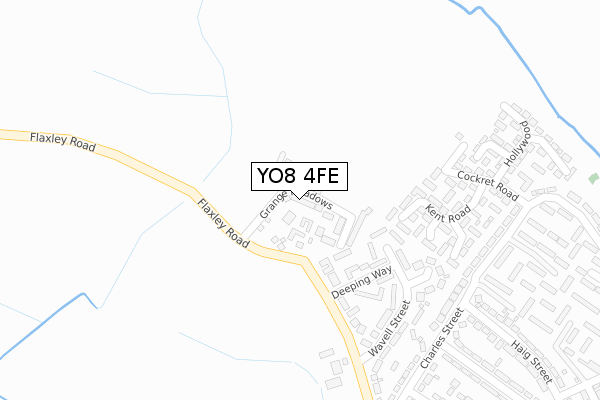
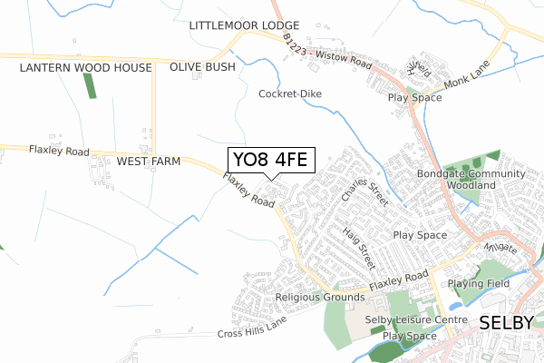
YO8 4FE is located in the Selby West electoral ward, within the unitary authority of North Yorkshire and the English Parliamentary constituency of Selby and Ainsty. The Sub Integrated Care Board (ICB) Location is NHS Humber and North Yorkshire ICB - 03Q and the police force is North Yorkshire. This postcode has been in use since May 2019.


GetTheData
Source: OS Open Zoomstack (Ordnance Survey)
Licence: Open Government Licence (requires attribution)
Attribution: Contains OS data © Crown copyright and database right 2024
Source: Open Postcode Geo
Licence: Open Government Licence (requires attribution)
Attribution: Contains OS data © Crown copyright and database right 2024; Contains Royal Mail data © Royal Mail copyright and database right 2024; Source: Office for National Statistics licensed under the Open Government Licence v.3.0
| Easting | 460440 |
| Northing | 433010 |
| Latitude | 53.789925 |
| Longitude | -1.084064 |
GetTheData
Source: Open Postcode Geo
Licence: Open Government Licence
| Country | England |
| Postcode District | YO8 |
| ➜ YO8 open data dashboard ➜ See where YO8 is on a map ➜ Where is Selby? | |
GetTheData
Source: Land Registry Price Paid Data
Licence: Open Government Licence
| Ward | Selby West |
| Constituency | Selby And Ainsty |
GetTheData
Source: ONS Postcode Database
Licence: Open Government Licence
44, GRANGE MEADOWS, SELBY, YO8 4FE 2023 21 NOV £310,000 |
20, GRANGE MEADOWS, SELBY, YO8 4FE 2023 31 JUL £302,500 |
8, GRANGE MEADOWS, SELBY, YO8 4FE 2022 27 MAY £324,895 |
4, GRANGE MEADOWS, SELBY, YO8 4FE 2021 23 DEC £279,995 |
6, GRANGE MEADOWS, SELBY, YO8 4FE 2021 17 DEC £330,596 |
40, GRANGE MEADOWS, SELBY, YO8 4FE 2021 17 DEC £380,000 |
26, GRANGE MEADOWS, SELBY, YO8 4FE 2021 3 DEC £318,995 |
24, GRANGE MEADOWS, SELBY, YO8 4FE 2021 30 NOV £362,995 |
22, GRANGE MEADOWS, SELBY, YO8 4FE 2021 26 NOV £444,995 |
20, GRANGE MEADOWS, SELBY, YO8 4FE 2021 30 JUN £201,995 |
GetTheData
Source: HM Land Registry Price Paid Data
Licence: Contains HM Land Registry data © Crown copyright and database right 2024. This data is licensed under the Open Government Licence v3.0.
| December 2023 | Other theft | On or near Charles Street | 417m |
| November 2023 | Violence and sexual offences | On or near Charles Street | 417m |
| October 2023 | Bicycle theft | On or near Charles Street | 417m |
| ➜ Get more crime data in our Crime section | |||
GetTheData
Source: data.police.uk
Licence: Open Government Licence
| Haig Street (Charles Street) | Selby | 233m |
| Cockret Road (Charles Street) | Selby | 234m |
| Cockret Road (Charles Street) | Selby | 244m |
| Haig Street (Charles Street) | Selby | 249m |
| Hutchinson Street (Charles Street) | Selby | 337m |
| Selby Station | 1.6km |
GetTheData
Source: NaPTAN
Licence: Open Government Licence
| Percentage of properties with Next Generation Access | 100.0% |
| Percentage of properties with Superfast Broadband | 100.0% |
| Percentage of properties with Ultrafast Broadband | 100.0% |
| Percentage of properties with Full Fibre Broadband | 100.0% |
Superfast Broadband is between 30Mbps and 300Mbps
Ultrafast Broadband is > 300Mbps
| Percentage of properties unable to receive 2Mbps | 0.0% |
| Percentage of properties unable to receive 5Mbps | 0.0% |
| Percentage of properties unable to receive 10Mbps | 0.0% |
| Percentage of properties unable to receive 30Mbps | 0.0% |
GetTheData
Source: Ofcom
Licence: Ofcom Terms of Use (requires attribution)
GetTheData
Source: ONS Postcode Database
Licence: Open Government Licence


➜ Get more ratings from the Food Standards Agency
GetTheData
Source: Food Standards Agency
Licence: FSA terms & conditions
| Last Collection | |||
|---|---|---|---|
| Location | Mon-Fri | Sat | Distance |
| 27 Charles Street Selby | 18:20 | 11:45 | 261m |
| Bondgate | 18:40 | 11:45 | 605m |
| Flaxley Road Post Office | 18:20 | 11:45 | 650m |
GetTheData
Source: Dracos
Licence: Creative Commons Attribution-ShareAlike
| Facility | Distance |
|---|---|
| Selby Community Primary School Flaxley Road, Selby Grass Pitches | 641m |
| Selby Squash Club (Closed) Flaxley Road, Selby Health and Fitness Gym, Squash Courts | 729m |
| Selby Town Fc Richard Street, Selby Grass Pitches | 753m |
GetTheData
Source: Active Places
Licence: Open Government Licence
| School | Phase of Education | Distance |
|---|---|---|
| Selby Community Primary School Flaxley Road, Selby, YO8 4DL | Primary | 623m |
| Selby High School Specialist School for the Arts and Science Leeds Road, Selby, YO8 4HT | Secondary | 1.1km |
| The Rubicon Centre Raincliffe Street, Selby, YO8 4AN | Not applicable | 1.1km |
GetTheData
Source: Edubase
Licence: Open Government Licence
The below table lists the International Territorial Level (ITL) codes (formerly Nomenclature of Territorial Units for Statistics (NUTS) codes) and Local Administrative Units (LAU) codes for YO8 4FE:
| ITL 1 Code | Name |
|---|---|
| TLE | Yorkshire and The Humber |
| ITL 2 Code | Name |
| TLE2 | North Yorkshire |
| ITL 3 Code | Name |
| TLE22 | North Yorkshire CC |
| LAU 1 Code | Name |
| E07000169 | Selby |
GetTheData
Source: ONS Postcode Directory
Licence: Open Government Licence
The below table lists the Census Output Area (OA), Lower Layer Super Output Area (LSOA), and Middle Layer Super Output Area (MSOA) for YO8 4FE:
| Code | Name | |
|---|---|---|
| OA | E00142175 | |
| LSOA | E01027906 | Selby 006B |
| MSOA | E02005814 | Selby 006 |
GetTheData
Source: ONS Postcode Directory
Licence: Open Government Licence
| YO8 4YF | Kent Road | 107m |
| YO8 4YA | Cockret Road | 142m |
| YO8 4YL | Farm Way | 149m |
| YO8 4DE | Wavell Street | 153m |
| YO8 4YD | Buckle Court | 199m |
| YO8 4DB | Flaxley Road | 212m |
| YO8 4YB | Hollywood | 253m |
| YO8 4DA | Charles Street | 262m |
| YO8 4DW | Bright Walk | 281m |
| YO8 4YE | St John Mews | 292m |
GetTheData
Source: Open Postcode Geo; Land Registry Price Paid Data
Licence: Open Government Licence