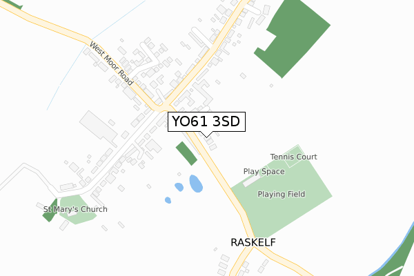
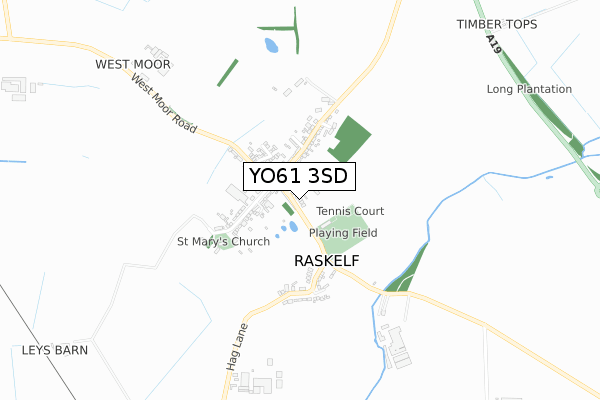
YO61 3SD is located in the Hillside & Raskelf electoral ward, within the unitary authority of North Yorkshire and the English Parliamentary constituency of Thirsk and Malton. The Sub Integrated Care Board (ICB) Location is NHS Humber and North Yorkshire ICB - 03Q and the police force is North Yorkshire. This postcode has been in use since February 2020.


GetTheData
Source: OS Open Zoomstack (Ordnance Survey)
Licence: Open Government Licence (requires attribution)
Attribution: Contains OS data © Crown copyright and database right 2024
Source: Open Postcode Geo
Licence: Open Government Licence (requires attribution)
Attribution: Contains OS data © Crown copyright and database right 2024; Contains Royal Mail data © Royal Mail copyright and database right 2024; Source: Office for National Statistics licensed under the Open Government Licence v.3.0
| Easting | 449288 |
| Northing | 470928 |
| Latitude | 54.131861 |
| Longitude | -1.247214 |
GetTheData
Source: Open Postcode Geo
Licence: Open Government Licence
| Country | England |
| Postcode District | YO61 |
| ➜ YO61 open data dashboard ➜ See where YO61 is on a map ➜ Where is Raskelf? | |
GetTheData
Source: Land Registry Price Paid Data
Licence: Open Government Licence
| Ward | Hillside & Raskelf |
| Constituency | Thirsk And Malton |
GetTheData
Source: ONS Postcode Database
Licence: Open Government Licence
2020 1 SEP £399,995 |
LITTLE COPSE, RASKELF, YORK, YO61 3SD 2020 8 APR £425,000 |
THE BIRCHES, RASKELF, YORK, YO61 3SD 2020 2 APR £340,000 |
GetTheData
Source: HM Land Registry Price Paid Data
Licence: Contains HM Land Registry data © Crown copyright and database right 2024. This data is licensed under the Open Government Licence v3.0.
| June 2022 | Public order | On or near Somerset Pastures | 346m |
| February 2022 | Anti-social behaviour | On or near Back Lane | 83m |
| February 2022 | Violence and sexual offences | On or near Back Lane | 83m |
| ➜ Get more crime data in our Crime section | |||
GetTheData
Source: data.police.uk
Licence: Open Government Licence
| Back Lane (Main Street) | Raskelf | 94m |
| Pinfold Cottage (Back Lane) | Raskelf | 110m |
| Black Bull Inn (Main Street) | Raskelf | 159m |
| Methodist Church (Main Street) | Raskelf | 167m |
GetTheData
Source: NaPTAN
Licence: Open Government Licence
GetTheData
Source: ONS Postcode Database
Licence: Open Government Licence


➜ Get more ratings from the Food Standards Agency
GetTheData
Source: Food Standards Agency
Licence: FSA terms & conditions
| Last Collection | |||
|---|---|---|---|
| Location | Mon-Fri | Sat | Distance |
| Raskelf Village | 16:45 | 09:00 | 158m |
| Raskelf Road Easingwold | 17:05 | 09:30 | 3,062m |
| Long Street Easingwold | 17:15 | 09:45 | 3,591m |
GetTheData
Source: Dracos
Licence: Creative Commons Attribution-ShareAlike
| Facility | Distance |
|---|---|
| Raskelf Recreation And Leisure Raskelf Sports Hall, Grass Pitches, Outdoor Tennis Courts | 195m |
| Galtres Centre Market Place, Easingwold, York Sports Hall, Health and Fitness Gym, Outdoor Tennis Courts | 3.9km |
| Easingwold Cricket Club Back Lane, Easingwold Grass Pitches, Outdoor Tennis Courts | 3.9km |
GetTheData
Source: Active Places
Licence: Open Government Licence
| School | Phase of Education | Distance |
|---|---|---|
| Easingwold Community Primary School Thirsk Road, Easingwold, York, YO61 3HJ | Primary | 3.1km |
| Outwood Academy Easingwold York Road, Easingwold, York, YO61 3EF | Secondary | 4.1km |
| Husthwaite Church of England Voluntary Controlled Primary School Low Street, Husthwaite, York, YO61 4QA | Primary | 4.6km |
GetTheData
Source: Edubase
Licence: Open Government Licence
The below table lists the International Territorial Level (ITL) codes (formerly Nomenclature of Territorial Units for Statistics (NUTS) codes) and Local Administrative Units (LAU) codes for YO61 3SD:
| ITL 1 Code | Name |
|---|---|
| TLE | Yorkshire and The Humber |
| ITL 2 Code | Name |
| TLE2 | North Yorkshire |
| ITL 3 Code | Name |
| TLE22 | North Yorkshire CC |
| LAU 1 Code | Name |
| E07000164 | Hambleton |
GetTheData
Source: ONS Postcode Directory
Licence: Open Government Licence
The below table lists the Census Output Area (OA), Lower Layer Super Output Area (LSOA), and Middle Layer Super Output Area (MSOA) for YO61 3SD:
| Code | Name | |
|---|---|---|
| OA | E00140525 | |
| LSOA | E01027600 | Hambleton 011A |
| MSOA | E02005760 | Hambleton 011 |
GetTheData
Source: ONS Postcode Directory
Licence: Open Government Licence
| YO61 3UY | Roedeer Cottages | 68m |
| YO61 3LT | Back Lane | 93m |
| YO61 3LF | North End | 225m |
| YO61 3UZ | Moorfields | 237m |
| YO61 3LG | 252m | |
| YO61 3LU | West Moor Lane | 292m |
| YO61 3LE | The Green | 322m |
| YO61 3LD | The Green | 347m |
| YO61 3UF | Somerset Pastures | 358m |
| YO61 3LQ | The Green | 396m |
GetTheData
Source: Open Postcode Geo; Land Registry Price Paid Data
Licence: Open Government Licence