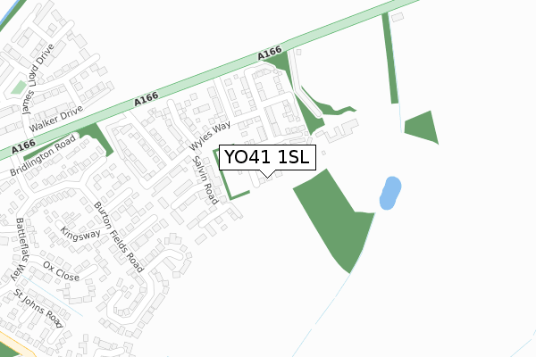
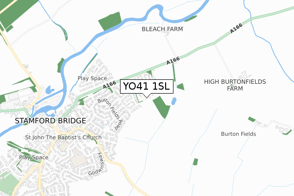
YO41 1SL is located in the Pocklington Provincial electoral ward, within the unitary authority of East Riding of Yorkshire and the English Parliamentary constituency of East Yorkshire. The Sub Integrated Care Board (ICB) Location is NHS Humber and North Yorkshire ICB - 03Q and the police force is Humberside. This postcode has been in use since January 2020.


GetTheData
Source: OS Open Zoomstack (Ordnance Survey)
Licence: Open Government Licence (requires attribution)
Attribution: Contains OS data © Crown copyright and database right 2024
Source: Open Postcode Geo
Licence: Open Government Licence (requires attribution)
Attribution: Contains OS data © Crown copyright and database right 2024; Contains Royal Mail data © Royal Mail copyright and database right 2024; Source: Office for National Statistics licensed under the Open Government Licence v.3.0
| Easting | 472163 |
| Northing | 455754 |
| Latitude | 53.992815 |
| Longitude | -0.900807 |
GetTheData
Source: Open Postcode Geo
Licence: Open Government Licence
| Country | England |
| Postcode District | YO41 |
| ➜ YO41 open data dashboard ➜ See where YO41 is on a map ➜ Where is Stamford Bridge? | |
GetTheData
Source: Land Registry Price Paid Data
Licence: Open Government Licence
| Ward | Pocklington Provincial |
| Constituency | East Yorkshire |
GetTheData
Source: ONS Postcode Database
Licence: Open Government Licence
| August 2022 | Vehicle crime | On or near Egremont Close | 468m |
| June 2022 | Vehicle crime | On or near Derwent Close | 355m |
| May 2022 | Criminal damage and arson | On or near Darley Close | 288m |
| ➜ Get more crime data in our Crime section | |||
GetTheData
Source: data.police.uk
Licence: Open Government Licence
| Stamford Bridge Battle Flats (Battle Flats Way) | Stamford Bridge | 482m |
| Stamford Bridge Battleflats Way (Battleflats Way) | Stamford Bridge | 492m |
| Stamford Bridge Battleflats (Battleflats Way) | Stamford Bridge | 512m |
| Stamford Bridge Battleflats Way (Battleflats Way) | Stamford Bridge | 520m |
| Stamford Bridge Moor Road (Moor Road) | Stamford Bridge | 722m |
GetTheData
Source: NaPTAN
Licence: Open Government Licence
GetTheData
Source: ONS Postcode Database
Licence: Open Government Licence


➜ Get more ratings from the Food Standards Agency
GetTheData
Source: Food Standards Agency
Licence: FSA terms & conditions
| Last Collection | |||
|---|---|---|---|
| Location | Mon-Fri | Sat | Distance |
| 8 Battleflats Way Stamford Bdg | 17:20 | 09:30 | 651m |
| Stamford Bridge Post Office | 17:30 | 11:25 | 878m |
| Full Sutton Village | 17:10 | 09:10 | 2,353m |
GetTheData
Source: Dracos
Licence: Creative Commons Attribution-ShareAlike
| Facility | Distance |
|---|---|
| Stamford Bridge Community Pool Church Road, Stamford Bridge, York Swimming Pool | 864m |
| Brown Moor Field Roman Avenue South, Stamford Bridge, York Grass Pitches | 965m |
| Low Catton Road Playing Field Low Catton Road, Stamford Bridge, York Grass Pitches, Outdoor Tennis Courts | 1.4km |
GetTheData
Source: Active Places
Licence: Open Government Licence
| School | Phase of Education | Distance |
|---|---|---|
| Stamford Bridge Primary School Church Road, Stamford Bridge, York, YO41 1BP | Primary | 850m |
| Sand Hutton Church of England Voluntary Controlled Primary School Sand Hutton, York, YO41 1LB | Primary | 3.7km |
| Wilberfoss Church of England Primary School Storking Lane, Wilberfoss, York, YO41 5ND | Primary | 4.7km |
GetTheData
Source: Edubase
Licence: Open Government Licence
The below table lists the International Territorial Level (ITL) codes (formerly Nomenclature of Territorial Units for Statistics (NUTS) codes) and Local Administrative Units (LAU) codes for YO41 1SL:
| ITL 1 Code | Name |
|---|---|
| TLE | Yorkshire and The Humber |
| ITL 2 Code | Name |
| TLE1 | East Yorkshire and Northern Lincolnshire |
| ITL 3 Code | Name |
| TLE12 | East Riding of Yorkshire |
| LAU 1 Code | Name |
| E06000011 | East Riding of Yorkshire |
GetTheData
Source: ONS Postcode Directory
Licence: Open Government Licence
The below table lists the Census Output Area (OA), Lower Layer Super Output Area (LSOA), and Middle Layer Super Output Area (MSOA) for YO41 1SL:
| Code | Name | |
|---|---|---|
| OA | E00065894 | |
| LSOA | E01013060 | East Riding of Yorkshire 009C |
| MSOA | E02002692 | East Riding of Yorkshire 009 |
GetTheData
Source: ONS Postcode Directory
Licence: Open Government Licence
| YO41 1LQ | Burton Fields Close | 268m |
| YO41 1JR | Darley Close | 281m |
| YO41 1LP | Garrowby View | 318m |
| YO41 1JJ | Burton Fields Road | 338m |
| YO41 1LR | Derwent Close | 360m |
| YO41 1SA | Bridlington Road | 361m |
| YO41 1JP | Kingsway | 402m |
| YO41 1JW | Ox Close | 434m |
| YO41 1HA | Bridlington Road | 450m |
| YO41 1QW | Egremont Close | 455m |
GetTheData
Source: Open Postcode Geo; Land Registry Price Paid Data
Licence: Open Government Licence