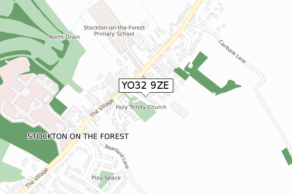
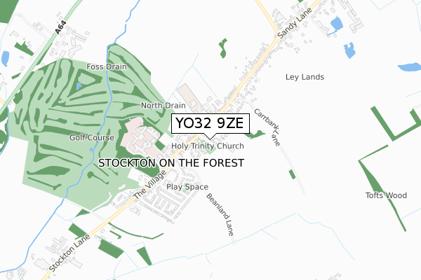
YO32 9ZE is located in the Strensall electoral ward, within the unitary authority of York and the English Parliamentary constituency of York Outer. The Sub Integrated Care Board (ICB) Location is NHS Humber and North Yorkshire ICB - 03Q and the police force is North Yorkshire. This postcode has been in use since August 2018.


GetTheData
Source: OS Open Zoomstack (Ordnance Survey)
Licence: Open Government Licence (requires attribution)
Attribution: Contains OS data © Crown copyright and database right 2024
Source: Open Postcode Geo
Licence: Open Government Licence (requires attribution)
Attribution: Contains OS data © Crown copyright and database right 2024; Contains Royal Mail data © Royal Mail copyright and database right 2024; Source: Office for National Statistics licensed under the Open Government Licence v.3.0
| Easting | 465724 |
| Northing | 456032 |
| Latitude | 53.996170 |
| Longitude | -0.998944 |
GetTheData
Source: Open Postcode Geo
Licence: Open Government Licence
| Country | England |
| Postcode District | YO32 |
| ➜ YO32 open data dashboard ➜ See where YO32 is on a map ➜ Where is Stockton on the Forest? | |
GetTheData
Source: Land Registry Price Paid Data
Licence: Open Government Licence
| Ward | Strensall |
| Constituency | York Outer |
GetTheData
Source: ONS Postcode Database
Licence: Open Government Licence
| June 2022 | Criminal damage and arson | On or near Cleveland Gardens | 157m |
| June 2022 | Violence and sexual offences | On or near The Village | 274m |
| June 2022 | Anti-social behaviour | On or near Stone Riggs | 303m |
| ➜ Get more crime data in our Crime section | |||
GetTheData
Source: data.police.uk
Licence: Open Government Licence
| Stockton Primary School (The Village) | Stockton-on-the-forest | 108m |
| Stockton Primary School (The Village) | Stockton-on-the-forest | 154m |
| Stockton Hall (The Village) | Stockton-on-the-forest | 363m |
| Stockton Hall (The Village) | Stockton-on-the-forest | 376m |
| Village Hall (Sandy Lane) | Stockton-on-the-forest | 427m |
GetTheData
Source: NaPTAN
Licence: Open Government Licence
| Percentage of properties with Next Generation Access | 100.0% |
| Percentage of properties with Superfast Broadband | 100.0% |
| Percentage of properties with Ultrafast Broadband | 0.0% |
| Percentage of properties with Full Fibre Broadband | 0.0% |
Superfast Broadband is between 30Mbps and 300Mbps
Ultrafast Broadband is > 300Mbps
| Percentage of properties unable to receive 2Mbps | 0.0% |
| Percentage of properties unable to receive 5Mbps | 0.0% |
| Percentage of properties unable to receive 10Mbps | 0.0% |
| Percentage of properties unable to receive 30Mbps | 0.0% |
GetTheData
Source: Ofcom
Licence: Ofcom Terms of Use (requires attribution)
GetTheData
Source: ONS Postcode Database
Licence: Open Government Licence


➜ Get more ratings from the Food Standards Agency
GetTheData
Source: Food Standards Agency
Licence: FSA terms & conditions
| Last Collection | |||
|---|---|---|---|
| Location | Mon-Fri | Sat | Distance |
| Stockton On Forest Post Office | 16:00 | 11:45 | 442m |
| Station Road Stockton On Forest | 16:00 | 11:45 | 789m |
| Off Malton Road Hazelbush | 17:30 | 11:30 | 1,901m |
GetTheData
Source: Dracos
Licence: Creative Commons Attribution-ShareAlike
| Facility | Distance |
|---|---|
| Forest Park Golf Club The Village, Stockton On The Forest, York Golf | 594m |
| York Golf Range Towthorpe Lane, Towthorpe, York Golf | 2.5km |
| Hopgrove Playing Fields Malton Road, York Grass Pitches, Outdoor Tennis Courts | 2.5km |
GetTheData
Source: Active Places
Licence: Open Government Licence
| School | Phase of Education | Distance |
|---|---|---|
| Stockton-on-the-Forest Primary School The Village, Stockton-on-the-Forest, York, YO32 9UP | Primary | 240m |
| Warthill Church of England Voluntary Controlled Primary School Warthill, York, YO19 5XL | Primary | 1.8km |
| Dunnington Church of England Primary School Pear Tree Lane, Dunnington, York, YO19 5QG | Primary | 3.6km |
GetTheData
Source: Edubase
Licence: Open Government Licence
The below table lists the International Territorial Level (ITL) codes (formerly Nomenclature of Territorial Units for Statistics (NUTS) codes) and Local Administrative Units (LAU) codes for YO32 9ZE:
| ITL 1 Code | Name |
|---|---|
| TLE | Yorkshire and The Humber |
| ITL 2 Code | Name |
| TLE2 | North Yorkshire |
| ITL 3 Code | Name |
| TLE21 | York |
| LAU 1 Code | Name |
| E06000014 | York |
GetTheData
Source: ONS Postcode Directory
Licence: Open Government Licence
The below table lists the Census Output Area (OA), Lower Layer Super Output Area (LSOA), and Middle Layer Super Output Area (MSOA) for YO32 9ZE:
| Code | Name | |
|---|---|---|
| OA | E00067835 | |
| LSOA | E01013437 | York 008G |
| MSOA | E02002779 | York 008 |
GetTheData
Source: ONS Postcode Directory
Licence: Open Government Licence
| YO32 9UW | The Village | 77m |
| YO32 9WA | Trinity Meadows | 81m |
| YO32 9UP | The Village | 95m |
| YO32 9AD | Huntsmans Court | 95m |
| YO32 9HX | Maple Court | 124m |
| YO32 9WF | The Elms | 125m |
| YO32 9HW | The Village | 129m |
| YO32 9WE | Cleveland Gardens | 141m |
| YO32 9UN | De Mauley Place | 252m |
| YO32 9UH | Stoneriggs | 254m |
GetTheData
Source: Open Postcode Geo; Land Registry Price Paid Data
Licence: Open Government Licence