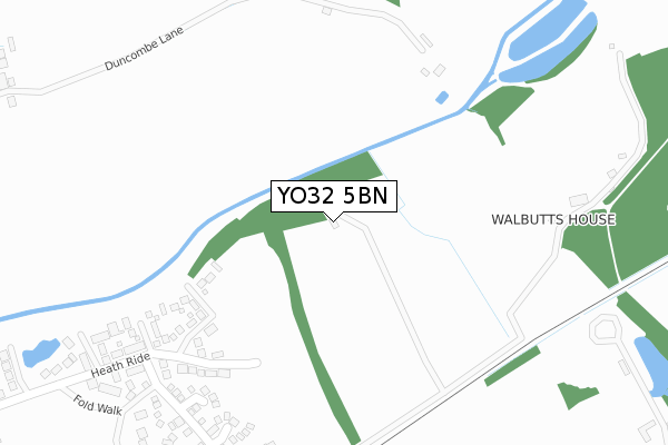
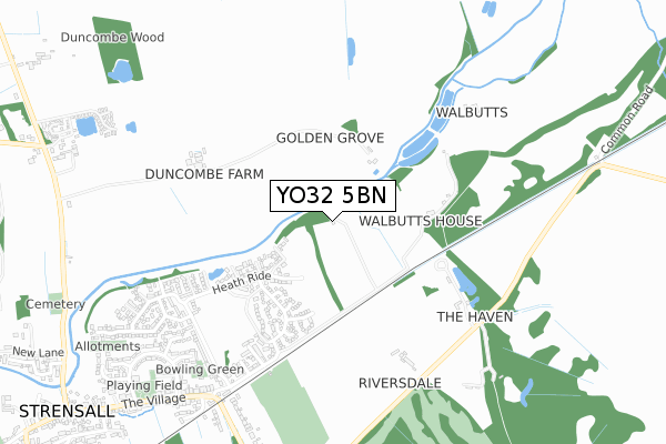
YO32 5BN is located in the Strensall electoral ward, within the unitary authority of York and the English Parliamentary constituency of York Outer. The Sub Integrated Care Board (ICB) Location is NHS Humber and North Yorkshire ICB - 03Q and the police force is North Yorkshire. This postcode has been in use since September 2019.


GetTheData
Source: OS Open Zoomstack (Ordnance Survey)
Licence: Open Government Licence (requires attribution)
Attribution: Contains OS data © Crown copyright and database right 2024
Source: Open Postcode Geo
Licence: Open Government Licence (requires attribution)
Attribution: Contains OS data © Crown copyright and database right 2024; Contains Royal Mail data © Royal Mail copyright and database right 2024; Source: Office for National Statistics licensed under the Open Government Licence v.3.0
| Easting | 464289 |
| Northing | 461588 |
| Latitude | 54.046278 |
| Longitude | -1.019657 |
GetTheData
Source: Open Postcode Geo
Licence: Open Government Licence
| Country | England |
| Postcode District | YO32 |
| ➜ YO32 open data dashboard ➜ See where YO32 is on a map | |
GetTheData
Source: Land Registry Price Paid Data
Licence: Open Government Licence
| Ward | Strensall |
| Constituency | York Outer |
GetTheData
Source: ONS Postcode Database
Licence: Open Government Licence
| July 2022 | Violence and sexual offences | On or near Cundall Close | 452m |
| June 2022 | Anti-social behaviour | On or near Moray Close | 232m |
| May 2022 | Vehicle crime | On or near Stuart Close | 455m |
| ➜ Get more crime data in our Crime section | |||
GetTheData
Source: data.police.uk
Licence: Open Government Licence
| Brecks Lane (Park Gate) | Strensall | 703m |
| The Old Station (The Village) | Strensall | 816m |
| Northfields (The Village) | Strensall | 952m |
| Northfields (The Village) | Strensall | 976m |
| Strensall Library (The Village) | Strensall | 1,273m |
GetTheData
Source: NaPTAN
Licence: Open Government Licence
GetTheData
Source: ONS Postcode Database
Licence: Open Government Licence


➜ Get more ratings from the Food Standards Agency
GetTheData
Source: Food Standards Agency
Licence: FSA terms & conditions
| Last Collection | |||
|---|---|---|---|
| Location | Mon-Fri | Sat | Distance |
| Station Strensall | 18:00 | 10:35 | 803m |
| Strensall Post Office | 18:00 | 11:10 | 1,129m |
| 69 Moor Lane Strensall | 18:00 | 10:35 | 1,720m |
GetTheData
Source: Dracos
Licence: Creative Commons Attribution-ShareAlike
| Facility | Distance |
|---|---|
| York Golf Club Ltd Lords Moor Lane, Strensall, York Golf | 1km |
| Robert Wilkinson Primary Academy West End, Strensall, York Swimming Pool, Sports Hall, Grass Pitches | 1.8km |
| Strensall Sports Field Durlston Drive, Strensall, York Grass Pitches, Outdoor Tennis Courts | 2.2km |
GetTheData
Source: Active Places
Licence: Open Government Licence
| School | Phase of Education | Distance |
|---|---|---|
| Robert Wilkinson Primary Academy West End, Strensall, York, YO32 5UH | Primary | 1.8km |
| Ralph Butterfield Primary School Station Road, Haxby, York, YO32 3LS | Primary | 4.6km |
| Sheriff Hutton Primary School West End, Sheriff Hutton, York, YO60 6SH | Primary | 4.9km |
GetTheData
Source: Edubase
Licence: Open Government Licence
The below table lists the International Territorial Level (ITL) codes (formerly Nomenclature of Territorial Units for Statistics (NUTS) codes) and Local Administrative Units (LAU) codes for YO32 5BN:
| ITL 1 Code | Name |
|---|---|
| TLE | Yorkshire and The Humber |
| ITL 2 Code | Name |
| TLE2 | North Yorkshire |
| ITL 3 Code | Name |
| TLE21 | York |
| LAU 1 Code | Name |
| E06000014 | York |
GetTheData
Source: ONS Postcode Directory
Licence: Open Government Licence
The below table lists the Census Output Area (OA), Lower Layer Super Output Area (LSOA), and Middle Layer Super Output Area (MSOA) for YO32 5BN:
| Code | Name | |
|---|---|---|
| OA | E00067850 | |
| LSOA | E01013439 | York 001C |
| MSOA | E02002772 | York 001 |
GetTheData
Source: ONS Postcode Directory
Licence: Open Government Licence
| YO32 5SZ | Moray Close | 251m |
| YO32 5SY | Green Lane | 282m |
| YO32 5YU | Heath Ride | 317m |
| YO32 5ZY | Chapman Close | 319m |
| YO32 5ZS | Pulleyn Close | 335m |
| YO32 5SX | Waltham Close | 343m |
| YO32 5ZR | Tudor Way | 361m |
| YO32 5YB | Flaxton Road | 371m |
| YO32 5YW | Heath Ride | 377m |
| YO32 5ZN | Thompson Drive | 385m |
GetTheData
Source: Open Postcode Geo; Land Registry Price Paid Data
Licence: Open Government Licence