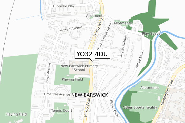
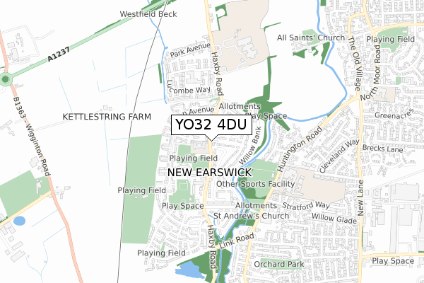
YO32 4DU is located in the Huntington & New Earswick electoral ward, within the unitary authority of York and the English Parliamentary constituency of York Outer. The Sub Integrated Care Board (ICB) Location is NHS Humber and North Yorkshire ICB - 03Q and the police force is North Yorkshire. This postcode has been in use since February 2020.


GetTheData
Source: OS Open Zoomstack (Ordnance Survey)
Licence: Open Government Licence (requires attribution)
Attribution: Contains OS data © Crown copyright and database right 2024
Source: Open Postcode Geo
Licence: Open Government Licence (requires attribution)
Attribution: Contains OS data © Crown copyright and database right 2024; Contains Royal Mail data © Royal Mail copyright and database right 2024; Source: Office for National Statistics licensed under the Open Government Licence v.3.0
| Easting | 460736 |
| Northing | 455320 |
| Latitude | 53.990381 |
| Longitude | -1.075161 |
GetTheData
Source: Open Postcode Geo
Licence: Open Government Licence
| Country | England |
| Postcode District | YO32 |
| ➜ YO32 open data dashboard ➜ See where YO32 is on a map ➜ Where is New Earswick? | |
GetTheData
Source: Land Registry Price Paid Data
Licence: Open Government Licence
| Ward | Huntington & New Earswick |
| Constituency | York Outer |
GetTheData
Source: ONS Postcode Database
Licence: Open Government Licence
| June 2022 | Criminal damage and arson | On or near Crabtree Grove | 162m |
| June 2022 | Public order | On or near Sports/Recreation Area | 169m |
| June 2022 | Public order | On or near Sports/Recreation Area | 169m |
| ➜ Get more crime data in our Crime section | |||
GetTheData
Source: data.police.uk
Licence: Open Government Licence
| Folk Hall (Haxby Road) | New Earswick | 185m |
| New Earswick Shops (Haxby Road) | New Earswick | 185m |
| New Earswick Shops (Haxby Road) | New Earswick | 198m |
| Folk Hall (Haxby Road) | New Earswick | 254m |
| Rowan Avenue (Haxby Road) | New Earswick | 464m |
| York Station | 3.8km |
| Poppleton Station | 5.1km |
GetTheData
Source: NaPTAN
Licence: Open Government Licence
GetTheData
Source: ONS Postcode Database
Licence: Open Government Licence


➜ Get more ratings from the Food Standards Agency
GetTheData
Source: Food Standards Agency
Licence: FSA terms & conditions
| Last Collection | |||
|---|---|---|---|
| Location | Mon-Fri | Sat | Distance |
| White Rose Avenue | 18:00 | 08:15 | 202m |
| New Earswick Post Office | 17:30 | 12:00 | 215m |
| Cherry Tree Avenue | 18:00 | 08:15 | 345m |
GetTheData
Source: Dracos
Licence: Creative Commons Attribution-ShareAlike
| Facility | Distance |
|---|---|
| New Earswick Swimming Pool Hawthorn Terrace, New Earswick, York Swimming Pool | 146m |
| New Earswick Folk Hall Hawthorn Terrace, New Earswick, York Sports Hall | 163m |
| New Earswick Sports And Social Club White Rose Avenue, New Earswick, York Grass Pitches, Outdoor Tennis Courts | 223m |
GetTheData
Source: Active Places
Licence: Open Government Licence
| School | Phase of Education | Distance |
|---|---|---|
| New Earswick Primary School Hawthorn Terrace, New Earswick, York, YO32 4BY | Primary | 242m |
| Huntington School Huntington Road, Huntington, York, YO32 9WT | Secondary | 611m |
| Joseph Rowntree School Haxby Road, New Earswick, York, YO32 4BZ | Secondary | 890m |
GetTheData
Source: Edubase
Licence: Open Government Licence
The below table lists the International Territorial Level (ITL) codes (formerly Nomenclature of Territorial Units for Statistics (NUTS) codes) and Local Administrative Units (LAU) codes for YO32 4DU:
| ITL 1 Code | Name |
|---|---|
| TLE | Yorkshire and The Humber |
| ITL 2 Code | Name |
| TLE2 | North Yorkshire |
| ITL 3 Code | Name |
| TLE21 | York |
| LAU 1 Code | Name |
| E06000014 | York |
GetTheData
Source: ONS Postcode Directory
Licence: Open Government Licence
The below table lists the Census Output Area (OA), Lower Layer Super Output Area (LSOA), and Middle Layer Super Output Area (MSOA) for YO32 4DU:
| Code | Name | |
|---|---|---|
| OA | E00067697 | |
| LSOA | E01013410 | York 004D |
| MSOA | E02002775 | York 004 |
GetTheData
Source: ONS Postcode Directory
Licence: Open Government Licence
| YO32 4BE | Lime Tree Avenue | 51m |
| YO32 4AG | White Rose Avenue | 114m |
| YO32 4BD | Lime Tree Avenue | 116m |
| YO32 4AZ | Rowan Avenue | 174m |
| YO32 4BL | Hawthorn Terrace | 194m |
| YO32 4BA | Lilac Grove | 217m |
| YO32 4DX | Elm Tree Mews | 218m |
| YO32 4AD | White Rose Avenue | 219m |
| YO32 4AE | White Rose Grove | 223m |
| YO32 4BT | Chestnut Grove | 262m |
GetTheData
Source: Open Postcode Geo; Land Registry Price Paid Data
Licence: Open Government Licence