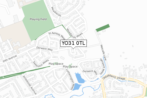
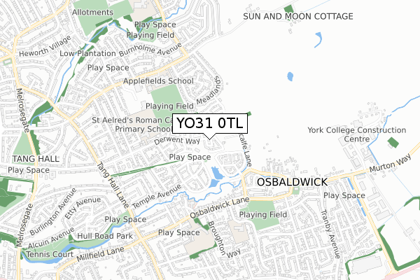
YO31 0TL is located in the Osbaldwick & Derwent electoral ward, within the unitary authority of York and the English Parliamentary constituency of York Outer. The Sub Integrated Care Board (ICB) Location is NHS Humber and North Yorkshire ICB - 03Q and the police force is North Yorkshire. This postcode has been in use since December 2018.


GetTheData
Source: OS Open Zoomstack (Ordnance Survey)
Licence: Open Government Licence (requires attribution)
Attribution: Contains OS data © Crown copyright and database right 2024
Source: Open Postcode Geo
Licence: Open Government Licence (requires attribution)
Attribution: Contains OS data © Crown copyright and database right 2024; Contains Royal Mail data © Royal Mail copyright and database right 2024; Source: Office for National Statistics licensed under the Open Government Licence v.3.0
| Easting | 462986 |
| Northing | 452156 |
| Latitude | 53.961680 |
| Longitude | -1.041502 |
GetTheData
Source: Open Postcode Geo
Licence: Open Government Licence
| Country | England |
| Postcode District | YO31 |
| ➜ YO31 open data dashboard ➜ See where YO31 is on a map ➜ Where is York? | |
GetTheData
Source: Land Registry Price Paid Data
Licence: Open Government Licence
| Ward | Osbaldwick & Derwent |
| Constituency | York Outer |
GetTheData
Source: ONS Postcode Database
Licence: Open Government Licence
| January 2024 | Criminal damage and arson | On or near Ennerdale Avenue | 406m |
| February 2023 | Violence and sexual offences | On or near Ennerdale Avenue | 406m |
| October 2022 | Violence and sexual offences | On or near Ennerdale Avenue | 406m |
| ➜ Get more crime data in our Crime section | |||
GetTheData
Source: data.police.uk
Licence: Open Government Licence
| Derwenthorpe (Derwent Way) | Osbaldwick | 170m |
| Seebohm Mews | Osbaldwick | 230m |
| Moorlands Close (Osbaldwick Lane) | Osbaldwick | 389m |
| Moorlands Close (Osbaldwick Lane) | Osbaldwick | 399m |
| The Magnet (Osbaldwick Lane) | Osbaldwick | 502m |
| York Station | 3.4km |
GetTheData
Source: NaPTAN
Licence: Open Government Licence
| Percentage of properties with Next Generation Access | 100.0% |
| Percentage of properties with Superfast Broadband | 100.0% |
| Percentage of properties with Ultrafast Broadband | 0.0% |
| Percentage of properties with Full Fibre Broadband | 0.0% |
Superfast Broadband is between 30Mbps and 300Mbps
Ultrafast Broadband is > 300Mbps
| Percentage of properties unable to receive 2Mbps | 0.0% |
| Percentage of properties unable to receive 5Mbps | 0.0% |
| Percentage of properties unable to receive 10Mbps | 0.0% |
| Percentage of properties unable to receive 30Mbps | 0.0% |
GetTheData
Source: Ofcom
Licence: Ofcom Terms of Use (requires attribution)
GetTheData
Source: ONS Postcode Database
Licence: Open Government Licence


➜ Get more ratings from the Food Standards Agency
GetTheData
Source: Food Standards Agency
Licence: FSA terms & conditions
| Last Collection | |||
|---|---|---|---|
| Location | Mon-Fri | Sat | Distance |
| 55 Osbaldwick Village | 18:00 | 08:15 | 470m |
| Burnholme | 17:30 | 12:15 | 621m |
| 275 Fifth Avenue York | 17:30 | 12:15 | 686m |
GetTheData
Source: Dracos
Licence: Creative Commons Attribution-ShareAlike
| Facility | Distance |
|---|---|
| St Aelreds Rc Primary School Fifth Avenue, York Grass Pitches | 395m |
| City Of York Sports Centre (Closed) Mossdale Avenue, York Sports Hall | 444m |
| Applefields School Bad Bargain Lane, York Grass Pitches, Artificial Grass Pitch | 460m |
GetTheData
Source: Active Places
Licence: Open Government Licence
| School | Phase of Education | Distance |
|---|---|---|
| St Aelred's Catholic Primary School - a Catholic Voluntary Academy Fifth Avenue, York, YO31 0QQ | Primary | 395m |
| Applefields School Bad Bargain Lane, Burnholme, York, YO31 0LW | Not applicable | 460m |
| Osbaldwick Primary Academy The Leyes/The Lane, Osbaldwick, York, YO10 3AX | Primary | 556m |
GetTheData
Source: Edubase
Licence: Open Government Licence
The below table lists the International Territorial Level (ITL) codes (formerly Nomenclature of Territorial Units for Statistics (NUTS) codes) and Local Administrative Units (LAU) codes for YO31 0TL:
| ITL 1 Code | Name |
|---|---|
| TLE | Yorkshire and The Humber |
| ITL 2 Code | Name |
| TLE2 | North Yorkshire |
| ITL 3 Code | Name |
| TLE21 | York |
| LAU 1 Code | Name |
| E06000014 | York |
GetTheData
Source: ONS Postcode Directory
Licence: Open Government Licence
The below table lists the Census Output Area (OA), Lower Layer Super Output Area (LSOA), and Middle Layer Super Output Area (MSOA) for YO31 0TL:
| Code | Name | |
|---|---|---|
| OA | E00067752 | |
| LSOA | E01013419 | York 014C |
| MSOA | E02002785 | York 014 |
GetTheData
Source: ONS Postcode Directory
Licence: Open Government Licence
| YO31 0RW | St Aelreds Mews | 121m |
| YO31 0RQ | Derwent Way | 160m |
| YO10 3BF | Derwent Way | 177m |
| YO10 3DN | Derwent Mews | 184m |
| YO31 0PD | Russet Drive | 202m |
| YO31 0RJ | Derwent Way | 215m |
| YO10 3TU | Lotherington Avenue | 218m |
| YO31 0SJ | Seebohm Mews | 228m |
| YO19 5UR | Metcalfe Lane | 236m |
| YO10 3SQ | Lotherington Avenue | 243m |
GetTheData
Source: Open Postcode Geo; Land Registry Price Paid Data
Licence: Open Government Licence