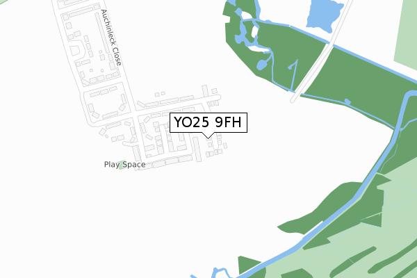
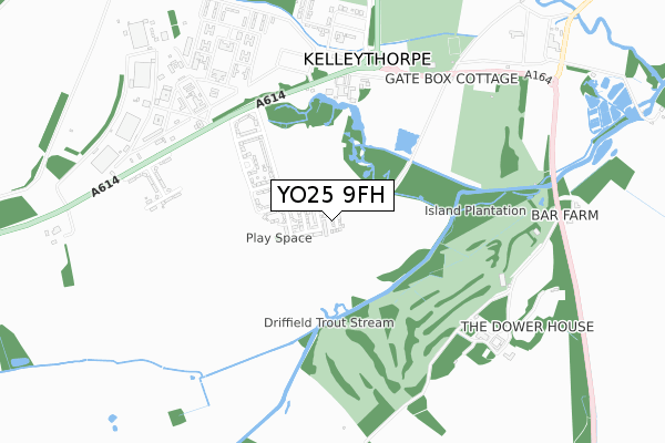
YO25 9FH is located in the Driffield and Rural electoral ward, within the unitary authority of East Riding of Yorkshire and the English Parliamentary constituency of East Yorkshire. The Sub Integrated Care Board (ICB) Location is NHS Humber and North Yorkshire ICB - 02Y and the police force is Humberside. This postcode has been in use since August 2019.


GetTheData
Source: OS Open Zoomstack (Ordnance Survey)
Licence: Open Government Licence (requires attribution)
Attribution: Contains OS data © Crown copyright and database right 2024
Source: Open Postcode Geo
Licence: Open Government Licence (requires attribution)
Attribution: Contains OS data © Crown copyright and database right 2024; Contains Royal Mail data © Royal Mail copyright and database right 2024; Source: Office for National Statistics licensed under the Open Government Licence v.3.0
| Easting | 501099 |
| Northing | 455953 |
| Latitude | 53.989760 |
| Longitude | -0.459538 |
GetTheData
Source: Open Postcode Geo
Licence: Open Government Licence
| Country | England |
| Postcode District | YO25 |
| ➜ YO25 open data dashboard ➜ See where YO25 is on a map ➜ Where is Kelleythorpe? | |
GetTheData
Source: Land Registry Price Paid Data
Licence: Open Government Licence
| Ward | Driffield And Rural |
| Constituency | East Yorkshire |
GetTheData
Source: ONS Postcode Database
Licence: Open Government Licence
2022 18 NOV £262,500 |
20, POLAR BEAR DRIVE, DRIFFIELD, YO25 9FH 2020 10 JUL £210,000 |
5, POLAR BEAR DRIVE, DRIFFIELD, YO25 9FH 2020 31 JAN £225,000 |
2019 20 DEC £225,000 |
7, POLAR BEAR DRIVE, DRIFFIELD, YO25 9FH 2019 29 NOV £197,000 |
8, POLAR BEAR DRIVE, DRIFFIELD, YO25 9FH 2019 15 NOV £270,000 |
9, POLAR BEAR DRIVE, DRIFFIELD, YO25 9FH 2019 1 NOV £270,000 |
10, POLAR BEAR DRIVE, DRIFFIELD, YO25 9FH 2019 18 OCT £197,000 |
11, POLAR BEAR DRIVE, DRIFFIELD, YO25 9FH 2019 4 OCT £225,000 |
12, POLAR BEAR DRIVE, DRIFFIELD, YO25 9FH 2019 20 SEP £245,000 |
GetTheData
Source: HM Land Registry Price Paid Data
Licence: Contains HM Land Registry data © Crown copyright and database right 2024. This data is licensed under the Open Government Licence v3.0.
| June 2022 | Vehicle crime | On or near Southwood Park | 105m |
| June 2022 | Public order | On or near Auchinleck Close | 283m |
| May 2022 | Other theft | On or near Southwood Park | 105m |
| ➜ Get more crime data in our Crime section | |||
GetTheData
Source: data.police.uk
Licence: Open Government Licence
| Driffield A614 (A614 Alamein Barracks) | Driffield | 553m |
| Driffield A614 (A614 Alamein Barracks) | Driffield | 626m |
| Driffield Beverley Road (Beverley Road) | Driffield | 1,124m |
| Driffield Bracken Road (Bracken Road) | Driffield | 1,468m |
| Driffield Beverley Road (Beverley Road) | Driffield | 1,599m |
| Driffield Station | 2.1km |
| Hutton Cranswick Station | 4.1km |
| Nafferton Station | 5.4km |
GetTheData
Source: NaPTAN
Licence: Open Government Licence
GetTheData
Source: ONS Postcode Database
Licence: Open Government Licence


➜ Get more ratings from the Food Standards Agency
GetTheData
Source: Food Standards Agency
Licence: FSA terms & conditions
| Last Collection | |||
|---|---|---|---|
| Location | Mon-Fri | Sat | Distance |
| Driffield Delivery Office | 18:00 | 12:30 | 900m |
| Duncombe Drive | 17:30 | 13:00 | 1,445m |
| Malton Gates Beverley Road Drf/D | 17:30 | 13:00 | 1,467m |
GetTheData
Source: Dracos
Licence: Creative Commons Attribution-ShareAlike
| Facility | Distance |
|---|---|
| Driffield Golf Club Sunderlandwick, Driffield Golf | 683m |
| Driffield Rugby Union Football Club Kelleythorpe, Driffield Grass Pitches, Artificial Grass Pitch | 692m |
| Driffield Town Cricket And Recreation Club Kings Mill Road, Driffield Grass Pitches, Outdoor Tennis Courts | 1.8km |
GetTheData
Source: Active Places
Licence: Open Government Licence
| School | Phase of Education | Distance |
|---|---|---|
| Driffield Church of England Voluntary Controlled Infant School St John's Road, Crosshill, Driffield, YO25 6RS | Primary | 1.8km |
| Kings Mill School Victoria Road, Driffield, YO25 6UG | Not applicable | 2.2km |
| Driffield Junior School Bridlington Road, Driffield, YO25 5HN | Primary | 2.6km |
GetTheData
Source: Edubase
Licence: Open Government Licence
The below table lists the International Territorial Level (ITL) codes (formerly Nomenclature of Territorial Units for Statistics (NUTS) codes) and Local Administrative Units (LAU) codes for YO25 9FH:
| ITL 1 Code | Name |
|---|---|
| TLE | Yorkshire and The Humber |
| ITL 2 Code | Name |
| TLE1 | East Yorkshire and Northern Lincolnshire |
| ITL 3 Code | Name |
| TLE12 | East Riding of Yorkshire |
| LAU 1 Code | Name |
| E06000011 | East Riding of Yorkshire |
GetTheData
Source: ONS Postcode Directory
Licence: Open Government Licence
The below table lists the Census Output Area (OA), Lower Layer Super Output Area (LSOA), and Middle Layer Super Output Area (MSOA) for YO25 9FH:
| Code | Name | |
|---|---|---|
| OA | E00175353 | |
| LSOA | E01012983 | East Riding of Yorkshire 008C |
| MSOA | E02002691 | East Riding of Yorkshire 008 |
GetTheData
Source: ONS Postcode Directory
Licence: Open Government Licence
| YO25 9HJ | Southwood Park | 93m |
| YO25 9HG | Auchinleck Close | 129m |
| YO25 9HL | Southwood Mews | 214m |
| YO25 9HF | Auchinleck Close | 238m |
| YO25 9HE | Auchinleck Close | 380m |
| YO25 9EY | Montgomery Square | 615m |
| YO25 9HH | Ramsden Close | 684m |
| YO25 9DW | 692m | |
| YO25 9EZ | Gott Close | 786m |
| YO25 9EX | Montgomery Square | 795m |
GetTheData
Source: Open Postcode Geo; Land Registry Price Paid Data
Licence: Open Government Licence