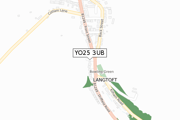
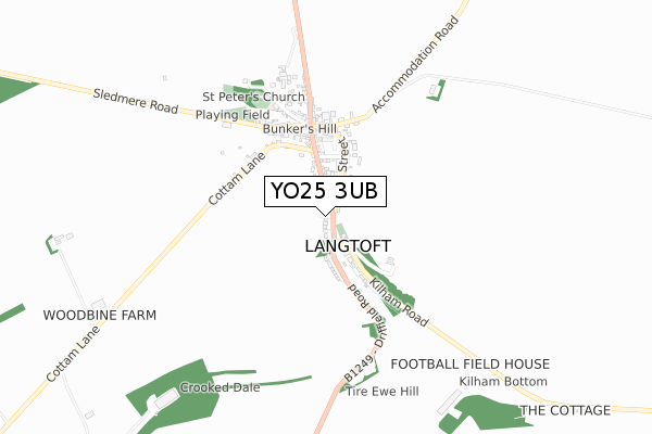
YO25 3UB is located in the East Wolds and Coastal electoral ward, within the unitary authority of East Riding of Yorkshire and the English Parliamentary constituency of East Yorkshire. The Sub Integrated Care Board (ICB) Location is NHS Humber and North Yorkshire ICB - 02Y and the police force is Humberside. This postcode has been in use since October 2019.


GetTheData
Source: OS Open Zoomstack (Ordnance Survey)
Licence: Open Government Licence (requires attribution)
Attribution: Contains OS data © Crown copyright and database right 2024
Source: Open Postcode Geo
Licence: Open Government Licence (requires attribution)
Attribution: Contains OS data © Crown copyright and database right 2024; Contains Royal Mail data © Royal Mail copyright and database right 2024; Source: Office for National Statistics licensed under the Open Government Licence v.3.0
| Easting | 501064 |
| Northing | 466553 |
| Latitude | 54.085000 |
| Longitude | -0.456549 |
GetTheData
Source: Open Postcode Geo
Licence: Open Government Licence
| Country | England |
| Postcode District | YO25 |
| ➜ YO25 open data dashboard ➜ See where YO25 is on a map ➜ Where is Langtoft? | |
GetTheData
Source: Land Registry Price Paid Data
Licence: Open Government Licence
| Ward | East Wolds And Coastal |
| Constituency | East Yorkshire |
GetTheData
Source: ONS Postcode Database
Licence: Open Government Licence
| June 2022 | Violence and sexual offences | On or near Hillside Gardens | 55m |
| June 2022 | Burglary | On or near Chapel Lane | 161m |
| June 2022 | Violence and sexual offences | On or near Green Lane | 237m |
| ➜ Get more crime data in our Crime section | |||
GetTheData
Source: data.police.uk
Licence: Open Government Licence
| Langtoft Kilham Road (Kilham Road) | Langtoft | 110m |
| Langtoft Front Street (Front Street) | Langtoft | 313m |
| Langtoft Back Street (Back Street) | Langtoft | 344m |
| Langtoft Front Street (Front Street) | Langtoft | 348m |
GetTheData
Source: NaPTAN
Licence: Open Government Licence
GetTheData
Source: ONS Postcode Database
Licence: Open Government Licence

➜ Get more ratings from the Food Standards Agency
GetTheData
Source: Food Standards Agency
Licence: FSA terms & conditions
| Last Collection | |||
|---|---|---|---|
| Location | Mon-Fri | Sat | Distance |
| Kilham Road Langtoft | 16:00 | 12:15 | 109m |
| Langtoft Village | 16:00 | 12:15 | 378m |
| Octon Village | 16:00 | 09:45 | 3,878m |
GetTheData
Source: Dracos
Licence: Creative Commons Attribution-ShareAlike
| Facility | Distance |
|---|---|
| Langtoft Primary School (Closed) Church Lane, Langtoft, Driffield Grass Pitches | 523m |
| Kilham Playing Field Northback Lane, Kilham, Driffield Grass Pitches, Outdoor Tennis Courts | 5.1km |
GetTheData
Source: Active Places
Licence: Open Government Licence
The below table lists the International Territorial Level (ITL) codes (formerly Nomenclature of Territorial Units for Statistics (NUTS) codes) and Local Administrative Units (LAU) codes for YO25 3UB:
| ITL 1 Code | Name |
|---|---|
| TLE | Yorkshire and The Humber |
| ITL 2 Code | Name |
| TLE1 | East Yorkshire and Northern Lincolnshire |
| ITL 3 Code | Name |
| TLE12 | East Riding of Yorkshire |
| LAU 1 Code | Name |
| E06000011 | East Riding of Yorkshire |
GetTheData
Source: ONS Postcode Directory
Licence: Open Government Licence
The below table lists the Census Output Area (OA), Lower Layer Super Output Area (LSOA), and Middle Layer Super Output Area (MSOA) for YO25 3UB:
| Code | Name | |
|---|---|---|
| OA | E00065527 | |
| LSOA | E01012991 | East Riding of Yorkshire 006C |
| MSOA | E02002689 | East Riding of Yorkshire 006 |
GetTheData
Source: ONS Postcode Directory
Licence: Open Government Licence
| YO25 3TA | The Dell | 49m |
| YO25 3TZ | Hillside Gardens | 53m |
| YO25 3TS | Front Street | 122m |
| YO25 3TB | West View | 135m |
| YO25 3TD | Back Street | 176m |
| YO25 3TE | Cattle Bank View | 200m |
| YO25 3UA | Green Lane | 220m |
| YO25 3TT | Driffield Road | 238m |
| YO25 3TU | Kilham Road | 285m |
| YO25 3TF | Front Street | 292m |
GetTheData
Source: Open Postcode Geo; Land Registry Price Paid Data
Licence: Open Government Licence